Click to visit the main New York Public Library Homepage
The New York Public Library
Digital Collections
About Digital Collections
Browse
Search only public domain materials
Items
Collections
Divisions
Home
Search
Browse
About
Search only public domain materials
Items
Collections
Divisions
Digital Collections
Using Images
Using Data
Search
Filtered keyword search
Show filters
Hide filters
Show Only Public Domain
topic
Nautical charts
44
Harbors
12
Coasts
8
Navigation
6
Rivers
4
More
Less
name
United States Coast Survey
42
Bache, A. D. (Alexander Dallas), 1806-1867
39
Maffitt, John Newland, 1819-1886
8
Mathiot, G
8
Palmer, W. R. (William R.), -1862
8
More
Less
collection
Maps of North America
45
Maps of New York City and State
1
place
Florida
10
Virginia
8
Atlantic Ocean
6
South Carolina
6
California
4
More
Less
genre
x
Bathymetric maps
Maps
46
Nautical charts
43
Topographic maps
1
publisher
U.S. Coast Survey
23
U.S. Coast Survey Office
11
United States Coast Survey
5
Coast Survey Office
2
Bureau of U.S. Topographical Engineers
1
More
Less
division
Map Division
46
type
x
cartographic
still image
1
Date Range
to
46 results found for:
x
A. C. W
Filtering on:
x
Genre
: Bathymetric maps
x
Type
: cartographic
Sort by:
Relevance
Title
Date created
Date digitized
Sequence
Preliminary chart of Calibogu…
parent:
b8e12
c
20-
c
52
a
-012f-11bb-3
c
075448cc4b
Albemarle Sound, N. Carolina,…
parent:
78423d90-3ff5-0135-e7
c
6-0d7
a
3815
a
372
St. Mary's River and Fernandi…
parent:
61bfcf90-16f7-0135-3cc2-00
c
15915f2
a
5
City and harbor of Portland, …
parent:
51
a
7ed50-
a
2ba-0134-1e57-00505686
a
51
c
Preliminary chart of St. John…
parent:
16
a
97970-1400-0135-97
c
3-21d5624210
a
3
Preliminary survey of Winyah …
parent:
b8e12
c
20-
c
52
a
-012f-11bb-3
c
075448cc4b
Preliminary chart of Cedar Ke…
parent:
b8e12
c
20-
c
52
a
-012f-11bb-3
c
075448cc4b
Preliminary chart of Bull's B…
parent:
b8e12
c
20-
c
52
a
-012f-11bb-3
c
075448cc4b
Reconnaissance of Doboy Bar a…
parent:
3b2ec720-b143-0132-959
c
-58d385
a
7bbd0
Preliminary chart of western …
parent:
b8e12
c
20-
c
52
a
-012f-11bb-3
c
075448cc4b
Reconnaissance of Olympia Har…
parent:
b8e12
c
20-
c
52
a
-012f-11bb-3
c
075448cc4b
Preliminary survey of Humbold…
parent:
b8e12
c
20-
c
52
a
-012f-11bb-3
c
075448cc4b
Preliminary chart of St. Andr…
parent:
b8e12
c
20-
c
52
a
-012f-11bb-3
c
075448cc4b
Eastern part of St. George's …
parent:
b8e12
c
20-
c
52
a
-012f-11bb-3
c
075448cc4b
Preliminary chart of Port Roy…
parent:
b8e12
c
20-
c
52
a
-012f-11bb-3
c
075448cc4b
Reconnaissance of Port Townsh…
parent:
b8e12
c
20-
c
52
a
-012f-11bb-3
c
075448cc4b
Preliminary chart of the sea …
parent:
52
a
622d0-b144-0132-78
c
9-58d385
a
7bbd0
Preliminary chart of the sea …
parent:
a
9e10440-7
c
69-0135-322d-275
c
13d6
a
8ee
Preliminary chart of Winyah B…
parent:
b8e12
c
20-
c
52
a
-012f-11bb-3
c
075448cc4b
Norfolk harbor, Virginia : fr…
parent:
b8e12
c
20-
c
52
a
-012f-11bb-3
c
075448cc4b
Rappahannock River, Virginia …
parent:
b8e12
c
20-
c
52
a
-012f-11bb-3
c
075448cc4b
Ocilla River, Florida
parent:
b8e12
c
20-
c
52
a
-012f-11bb-3
c
075448cc4b
Reconnaissance of Tampa Bay, …
parent:
b8e12
c
20-
c
52
a
-012f-11bb-3
c
075448cc4b
Preliminary chart of Beaufort…
parent:
52
a
622d0-b144-0132-78
c
9-58d385
a
7bbd0
Reconnaissance of Doboy Bar a…
parent:
3b2ec720-b143-0132-959
c
-58d385
a
7bbd0
Preliminary chart of St. John…
parent:
b8e12
c
20-
c
52
a
-012f-11bb-3
c
075448cc4b
Reconnaissance of Port Royal …
parent:
b8e12
c
20-
c
52
a
-012f-11bb-3
c
075448cc4b
Key West Harbor and its appro…
parent:
b8e12
c
20-
c
52
a
-012f-11bb-3
c
075448cc4b
Preliminary survey of Turtle …
parent:
b8e12
c
20-
c
52
a
-012f-11bb-3
c
075448cc4b
Grand Island Pass, Mississipp…
parent:
b8e12
c
20-
c
52
a
-012f-11bb-3
c
075448cc4b
Metomkin Inlet, Virginia : fr…
parent:
b8e12
c
20-
c
52
a
-012f-11bb-3
c
075448cc4b
Preliminary survey of San Ped…
parent:
b8e12
c
20-
c
52
a
-012f-11bb-3
c
075448cc4b
Preliminary chart of Stellwag…
parent:
edbf00f0-6bc9-0134-5033-00505686
a
51
c
Bass River Harbor, Massachuse…
parent:
c
7805100-5296-0134-ff89-00505686
a
51
c
Preliminary chart of Rappahan…
parent:
a
1
c
19060-6973-0135-5236-2de53f405eb2
Hydrographic reconnaissance o…
parent:
bbd95190-68ac-0135-720
c
-29
a
548262744
Rappahannock River, Virginia …
parent:
b8e12
c
20-
c
52
a
-012f-11bb-3
c
075448cc4b
Rappahannock River, Virginia …
parent:
b8e12
c
20-
c
52
a
-012f-11bb-3
c
075448cc4b
Map of Presqu'ile Bay or Erie…
parent:
b8e12
c
20-
c
52
a
-012f-11bb-3
c
075448cc4b
Reconnaissance of Trinidad Ba…
parent:
b8e12
c
20-
c
52
a
-012f-11bb-3
c
075448cc4b
Mare Island Straits, Californ…
parent:
b8e12
c
20-
c
52
a
-012f-11bb-3
c
075448cc4b
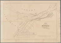
Map of the vicinity of Buffal…
parent:
851943e0-0bf1-0134-1366-00505686
a
51
c
Preliminary chart of Ossabaw …
parent:
a
0bdbbf0-01f1-0135-6e4b-29552
c
83177
a
Preliminary chart of part of …
parent:
b8e12
c
20-
c
52
a
-012f-11bb-3
c
075448cc4b
A map of the extremity of Cap…
parent:
b57bf580-5b26-0134-fa2
a
-00505686
a
51
c
Preliminary chart of Mount Ho…
parent:
c
88dc120-
c
54f-0134-e669-00505686
a
51
c
End of results
|
Top