Click to visit the main New York Public Library Homepage
The New York Public Library
Digital Collections
About Digital Collections
Browse
Search only public domain materials
Items
Collections
Divisions
Home
Search
Browse
About
Search only public domain materials
Items
Collections
Divisions
Digital Collections
Using Images
Using Data
Search
Filtered keyword search
Show filters
Hide filters
Show Only Public Domain
topic
x
Landowners
Real property
67
Administrative and political divisions
8
Cities and towns
8
Villages
4
More
Less
name
Bourquin, F. (Frederick), 1808-
7
Warner & Foote
6
Worley & Bracher
5
Bracher, Wm. (William)
4
H.F. Walling's Map Establishment
3
More
Less
collection
Maps of North America
48
Maps of New York City and State
23
place
New York (State)
23
Pennsylvania
8
California
6
Illinois
4
Massachusetts
4
More
Less
genre
x
Cadastral maps
Maps
71
Illustrations
7
Manuscript maps
4
Charts
1
More
Less
publisher
publisher not identified
12
Published by Warner & Foote
5
Dakin Pub. Co
2
Lith. of Jones & Newman
2
Stephens Brothers & Co
2
More
Less
division
Map Division
71
type
cartographic
71
still image
6
text
3
Date Range
to
71 results found for:
x
Land grants
Filtering on:
x
Genre
: Cadastral maps
x
Topic
: Landowners
Sort by:
Relevance
Title
Date created
Date digitized
Sequence
Map of French & English
grants
on Lake
note:
Mapping the Nation (NEH
grant
, 2015-2018)…
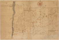
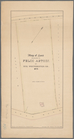
A plan of the Manor of Philip…
note:
Shows townships, roads,
land
tracts (some
Untitled manuscript map of Gr…
note:
Mapping the Nation (NEH
grant
, 2015-2018)…
m
Huguenot Park, Westchester Co…
note:
…"Officers of the Huguenot Park
Land
Land
given to the town of Quincy, [Mass
note:
Mapping the Nation (NEH
grant
, 2015-2018)…
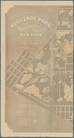
Map of Baker City, Oregon
note:
Mapping the Nation (NEH
grant
, 2015-2018)…
Private claims at Michilimack…
note:
Mapping the Nation (NEH
grant
, 2015-2018)…
m
Map of McLeod County, Minneso…
note:
Library of Congress.
Land
ownership maps
Map of Richland, Oswego Co. N…
note:
… (named), individual
land
Sketch of the claims to
land
note:
Mapping the Nation (NEH
grant
, 2015-2018)…
m
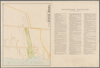
Upper Nyack
note:
… numbers, and
land
Map of
land
belonging to Felix Astoin
note:
Mapping the Nation (NEH
grant
, 2015-2018)…
Cattaraugus Reservation of th…
note:
Also shows roads, railroads, sections,
land
A plan of the
land
belonging to the Bedford
note:
Mapping the Nation (NEH
grant
, 2015-2018)…
Plan of the Country Club
Land
Association
note:
Mapping the Nation (NEH
grant
, 2015-2018)…
Map of the City of San Jose
note:
Mapping the Nation (NEH
grant
, 2015-2018)…
Map of Dobbs Ferry and Hastin…
note:
Mapping the Nation (NEH
grant
, 2015-2018) …
A map of the original allotments of
land
note:
Mapping the Nation (NEH
grant
, 2015-2018)…
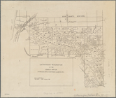
Map of the county of Herkimer
note:
…, churches,
land
parcels
Map of Woodbury County, Iowa …
note:
Library of Congress.
Land
ownership maps
The principal parts of Norwal…
note:
Relief shown by hachures, and
land
forms.
m
Map of Wright County, Iowa : …
note:
Library of Congress.
Land
ownership maps
Atherton, St. Lawrence County…
note:
Shows lot numbers, landowners,
land
condition
A map of the original allotments of
land
note:
Mapping the Nation (NEH
grant
, 2015-2018)…
Map of the city of Davenport …
note:
Mapping the Nation (NEH
grant
, 2015-2018)…
Plan of Danbury, Fairfield Co…
note:
Shows boundaries of
land
parcels
Map of Chicago and vicinity
note:
Compiled by Rees & Rucker,
land
agents
m
Map of Pettis County, Missour…
note:
Library of Congress.
Land
ownership maps
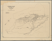
Tuxedo Park, Orange Co., New …
note:
Mapping the Nation (NEH
grant
, 2015-2018)…
The principal parts of Norwal…
note:
Relief shown by hachures, and
land
forms.
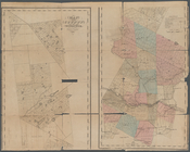
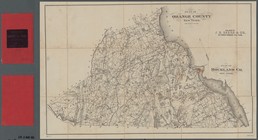
Plan of Orange County, New Yo…
note:
…, roads, railroads,
land
Crocker's guide map of the ci…
note:
Mapping the Nation (NEH
grant
, 2015-2018)…
m
Map of Dutchess Co., New York…
note:
Mapping the Nation (NEH
grant
, 2015-2018)…
m
Map of Stockton, Cal.
note:
Mapping the Nation (NEH
grant
, 2015-2018)…
m
Map of Meeker County, Minneso…
note:
Mapping the Nation (NEH
grant
, 2015-2018)…
m
Map of Mahoning County, Ohio …
note:
Variant of Library of Congress.
Land
ownership
The City of Stockton and vici…
note:
Mapping the Nation (NEH
grant
, 2015-2018)…
Map of the city of Topeka, Sh…
note:
Mapping the Nation (NEH
grant
, 2015-2018)…
Map of Northumberland County,…
note:
…
land
survey by Kimber
m
The City of Stockton and vici…
note:
Mapping the Nation (NEH
grant
, 2015-2018)…
m
Map of Columbiana County, Ohi…
note:
Library of Congress.
Land
ownership maps
Map of the city of Stockton
note:
Mapping the Nation (NEH
grant
, 2015-2018)…
m
Map of Monroe County, Wiscons…
note:
Library of Congress.
Land
ownership maps
m
Map of Kings and part of Quee…
note:
Mapping the Nation (NEH
grant
, 2015-2018)…
m
Map of Montgomery County, Ken…
note:
Library of Congress.
Land
ownership maps
m
Topographical map of the Coun…
note:
Indexed in: Library of Congress.
Land
ownership
m
Map of Vigo County, Indiana
note:
Library of Congress.
Land
ownership maps
m
Map of Trumbull County, Ohio
note:
Library of Congress.
Land
ownership maps
Map of Perry County, Ohio
note:
Library of Congress.
Land
ownership maps
m
Map of Harrison County, Ky. :…
note:
Library of Congress.
Land
ownership maps