Click to visit the main New York Public Library Homepage
The New York Public Library
Digital Collections
About Digital Collections
Browse
Search only public domain materials
Items
Collections
Divisions
Home
Search
Browse
About
Search only public domain materials
Items
Collections
Divisions
Digital Collections
Using Images
Using Data
Search
Filtered keyword search
Show filters
Hide filters
Show Only Public Domain
topic
Description and travel
24
African Americans
4
Angels
4
Animals
4
Antiquities
4
More
Less
name
Ogilby, John (1600-1676)
15
Faidherbe, Louis Léon César, 1818-1889
4
Norden, Frederik Ludvig, 1708-1742
4
Tuscher, Markus, 1705-1751
4
American Colonization Society
2
More
Less
collection
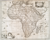
Africa: being an accurate description of the regions of Ægypt, Barbary, Lybia, and Billedulgerid, the land of Negroes, Guinee, Æthiopia, and the Abyssines, with all the adjacent islands ... collected and translated from most authentick authors ... by John Ogilby ..
15
Maps of North America
7
Relation universelle de l'Afrique, ancienne et moderne
5
Description de l'univers ..
4
George Grenfell and the Congo: a history and description of the Congo Independent State and adjoining districts of Congoland, Volume 1
4
More
Less
place
Africa
31
South Africa
16
Islands of the Atlantic
15
Islands of the Indian Ocean
15
Africa, West
7
More
Less
genre
x
Illustrations
Maps
44
Prints
23
Cadastral maps
2
Photographs
2
More
Less
publisher
T. Amaulry
5
D. Thierry
4
Hachette et cie
4
Hutchinson & Co
4
Printed for Lockyer Davis
4
More
Less
division
Schomburg Manuscripts, Archives and Rare Books Division
26
Schomburg Jean Blackwell Hutson Research and Reference Division
22
General Research Division
20
Map Division
7
Dorot Jewish Division
2
More
Less
type
x
cartographic
still image
10
text
2
Date Range
to
78 results found for:
x
B
Filtering on:
x
Genre
: Illustrations
x
Type
: cartographic
Sort by:
Relevance
Title
Date created
Date digitized
Sequence
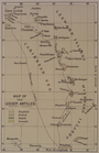
Map of the Lesser Antilles
parent:
4
b
8adfc0-c61f-012f-19c2-58d385a7bc34
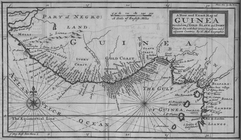
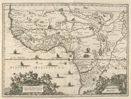
A New and Exact Map of Guinea…
Plan de l'Isle de Rodda, avec…
note:
… Nil,
b
. Grenier de
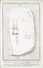
Plan des statues colossales, …
note:
… colossale,
b
. Statue d'une
…,
b
. Deux statues
parent:
3
b
43ae70-c6ba-012f-f083-58d385a7bc34
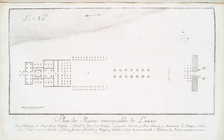
Plan des superbes edifices su…
note:
a. Plan de Temple de l'Epervier,
b
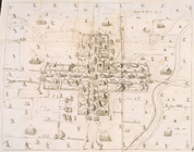
Plan of the city of Philadelp…
parent:
7
b
0a2650-c52
b
-012f-c914-3c075448cc4
b
Map of Cleveland and its envi…
parent:
75dd29e0-
b
144-0132-2130-58d385a7bbd0
m
Map of Trumbull County, Ohio
parent:
75dd29e0-
b
144-0132-2130-58d385a7bbd0
New and improved map of the c…
parent:
7
b
0a2650-c52
b
-012f-c914-3c075448cc4
b
Plan of the city of Philadelp…
parent:
7
b
0a2650-c52
b
-012f-c914-3c075448cc4
b
Reconnaissance of the western…
parent:
750639f0-0
b
7d-0136-3de2-0c3dfaad5f88
Colton's map of Oregon & Wash…
parent:
8517
b
870-
b
144-0132-5074-58d385a7bbd0
Map of the Western Coast of A…
A map of Palestine
Isle de Malthe
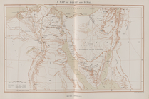
A map of Egypt and Sinai
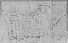
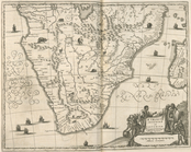
South Africa
parent:
2
b
37a200-c61e-012f-83f2-58d385a7bc34
Isles dv Cap Verd
I. Goree
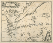
Le Ruyavme d Abyssinie ou lem…
parent:
ec3
b
8ee0-c6c0-012f-deac-58d385a7bc34
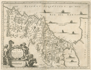
L"empire du Monomotapa et la …
Isle de Madagascar dite de St…
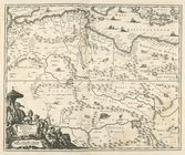
Afrique Ancienne
Afrique Moderne
parent:
74493520-c6be-012f-
b
51d-58d385a7bc34
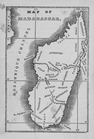
Map of Madagascar
parent:
757c7730-c622-012f-7e2
b
-58d385a7bc34
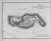
Plan of the Island of Goree
Partie Septentrionale de L'An…
parent:
74d698e0-c6be-012f-
b
1a2-58d385a7bc34
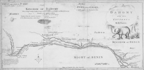
Dahomy and its environs by R.…
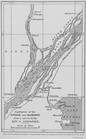
Confluence of the Congo and M…
parent:
b
959c110-c6dc-012f-abbc-3c075448cc4
b
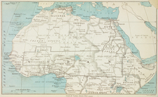
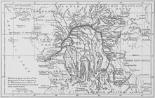
Map of the Sudan.
parent:
4
b
24f680-c6bf-012f-f527-58d385a7bc34
Uchenīe i khitrostʹ ratnago s…
first:
b
0
b
32
b
14-2535-3350-e040-e00a180602de
Aethiopia Inferior vel Exteri…
Stanley's general idea of the…
parent:
c62ae0a0-c6dc-012f-6ab4-3c075448cc4
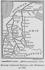
b
Routes through Indiana and Mi…
parent:
205503f0-c6
b
4-012f-8a4d-58d385a7bc34
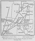
Network of routes through Gre…
parent:
205503f0-c6
b
4-012f-8a4d-58d385a7bc34
Map of free states, slave sta…
parent:
3
b
269030-c604-012f-a6c0-58d385a7bc34
Affairs of West Africa
parent:
4cd4ed80-c6
b
9-012f-
b
454-58d385a7bc34
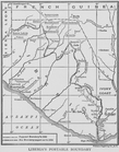
Liberia's portable boundary
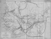
Carte de la Sénégambie et du …
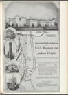
Jackson Heights, no. 8, p. 433
parent:
b
2042890-8721-0133-50d9-00505686a51c
The Political Division of Afr…
parent:
0c805680-c025-0132-
b
790-58d385a7bbd0
Nova Aegypti Tabula.
Barbaria Biledulgered o: Liby…
Fezzae et Marocchi Regna Afri…
Africae Accurata Tabula ex Of…
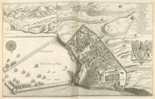
The Citty of Tanger.
Nigritarum Regio.
parent:
5
b
27e6c0-c6e7-012f-a55
b
-58d385a7bc34
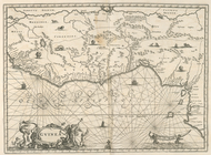
Gvinea.
parent:
5ca610
b
0-c6e7-012f-
b
837-58d385a7bc34
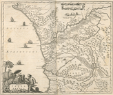
Regna Congo et Angola.