Click to visit the main New York Public Library Homepage
The New York Public Library
Digital Collections
About Digital Collections
Browse
Search only public domain materials
Items
Collections
Divisions
Home
Search
Browse
About
Search only public domain materials
Items
Collections
Divisions
Digital Collections
Using Images
Using Data
Search
Filtered keyword search
Show filters
Hide filters
Show Only Public Domain
topic
x
History
Fortification
9
Boundaries
6
Landowners
5
Indians of North America
4
More
Less
name
United States. Army. Corps of Topographical Engineers
11
United States. Army of the Potomac. Office of Surveys and Maps
7
American Civil War (1861-1865)
6
Barclay, Anthony, 1792-1877
5
Humphreys, A. A. (Andrew Atkinson), 1810-1883
5
More
Less
collection
Maps of North America
58
Maps of New York City and State
22
Lawrence H. Slaughter Collection of English maps, charts, globes, books and atlases
1
United States Sanitary Commission records. Condensed historical matter
1
place
United States
53
Virginia
22
New York (State)
19
Fredericksburg (Va.)
12
New York (N.Y.)
8
More
Less
genre
x
Maps
Manuscript maps
7
Bird's-eye views
2
Aerial views
1
Bathymetric maps
1
More
Less
publisher
publisher not identified
13
Corps of Topographical Engineers
10
Office of Surveys and Maps, Army of the Potomac
5
U.S. Light-House Board
5
C. Bohn
2
More
Less
division
Map Division
81
Manuscripts and Archives Division
1
type
cartographic
81
text
2
still image
1
Date Range
to
82 results found for:
x
Scales
Filtering on:
x
Genre
: Maps
x
Topic
: History
Sort by:
Relevance
Title
Date created
Date digitized
Sequence
… with sharp
scales
..."…
Boston with its environs in 1…
note:
Scale
based
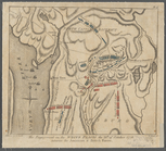
Map no. 16, Battlefield of Fo…
note:
… of fortifications, at
scale
of 60
Plan of the town of Newton in…
note:
Scale
approximately 1:19,800 (W 71°16ʹ15ʺ--W
Part of New Jersey : embracin…
note:
Bar
scale
and verbal statement of
scale
G. Woolworth Colton's map of …
note:
… a larger
scale
map
Plan of Amelia Island in East…
abstract:
… are at a larger
scale
than
m
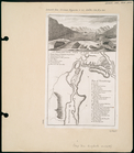
Thirty five miles around Rich…
abstract:
… ... 1866.
Scale
Map of Old Jan's land & the B…
note:
Scale
1:9,900. 50 rods to 1 inch. (W
A perspective view of Lake Ge…
note:
Scale
not given. Relief shown by hachures
Map of Cuba its provinces, ra…
note:
Scale
[ca. 1:2,450,000] (W 85°--W 74°/N
A perspective view of Lake Ge…
note:
Scale
not given. Relief shown by hachures
Map of Camp Chase. Drawn on a
scale
of 120
m
History of the United States:…
note:
Time
scale
10 years to the inch.
Map of Virginia, Fredericksbu…
note:
Scale
not given (W 78°17ʹ00ʺ--W 76°36ʹ00ʺ/N
Works at Stony Point and Verp…
note:
Scale
approximately 1:12,500 (W 73°58ʹ52ʺ--W
Western vicinity of Frederick…
note:
Scale
not given (W 77°41ʹ24ʺ--W 77°29ʹ37ʺ/N
Fredericksburg, Virginia and …
note:
Scale
not given (W 77°29ʹ51ʺ--W 77°07ʹ15ʺ/N
m
Map of the river Sainte Mary …
note:
Scale
approximately 1:85,000 (W 84.64°--W 84.05
Parts of Ohio & Pennsylvania …
note:
Scale
approximately 1:2,000,000 (W 85°--W 78°/N 43
Map of the country which was …
note:
Scale
[ca. 1:2,000,000] (W 74°00ʹ--W
m
Vicinity of the Rapidan and R…
note:
Scale
not given (W 78°00ʹ55ʺ--W 77°26ʹ49ʺ/N
A plan of New York Island, pa…
note:
Scale
approximately 1:85,000 (W 74°07ʹ40ʺ--W
Battle of Long Island: from S…
note:
Scale
approximately 1:125,000 (W 74°03ʹ58ʺ--W
Richmond, Virginia and vicini…
note:
Scale
approximately 1:80,000 (W 77°28ʹ25ʺ--W
Yorktown, armament of batteri…
note:
Scale
approximately 1:20,000 (W 76°34ʹ13ʺ--W
m
A sketch of the operations be…
note:
… "Charlestown Harbour,"
scale
m
The engagement on the White P…
note:
Scale
[ca. 1:170,000]
Plan of the position which th…
note:
Scale
approximately 1:10,800 (W 73°39ʹ28ʺ--W
Fortifications of Charleston …
abstract:
… sources. [
Scale
Map showing the approaches to…
note:
Scale
approximately 1:80,000 (W 77°42ʹ00ʺ--W
Map of the seat of war in Vir…
note:
Scale
not given (W 77°33ʹ41ʺ--W 75°55ʹ38ʺ/N
A map of the country which wa…
note:
Scale
[ca. 1:2,000,000] (W 74°00ʹ--W
m
Dec. 13th Positions of Humphr…
note:
Scale
approximately 1:7,050 (W 77°28ʹ46ʺ--W
Position de l'armée Américain…
note:
Scale
approximately 1:70,000 (W 73°53ʹ29ʺ--W
Additions & corrections for t…
note:
Scale
not given (W 77°35ʹ22ʺ--W 77°27ʹ17ʺ/N
Yorktown, armament of batteri…
note:
Scale
approximately 1:20,000 (W 76°34ʹ13ʺ--W
Map of Loudon [sic], Jefferso…
note:
Scale
approximately 1:120,000 (W 78°08ʹ46ʺ--W
To accompany Willard's histor…
note:
Scale
not given (W 83°05ʹ--W 78°14ʹ/N 36°07
Henrico County, Virginia: pre…
note:
Scale
approximately 1:75,000 (W 77°42ʹ46ʺ--W
Map of the battle field of Ge…
note:
Scale
approximately 1:63,360 (W 77°15ʹ50ʺ--W
Frederick County Maryland: pr…
note:
Scale
not given (W 77°40ʹ38ʺ--W 77°06ʹ24ʺ/N
A map of the eastern part of …
note:
….
Scale
1:3600.
A map of the eastern part of …
note:
….
Scale
1:3600.
A new and accurate map of eas…
note:
… and
scale
bar to the right
Map shewing position of 1st B…
note:
Scale
1:25,344. 2 1/2 inches per mile (W
Sketch exhibiting the positio…
note:
Scale
approximately 1:60,000 (W 76°33ʹ00ʺ--W
Grundriss des nördlichen Thei…
note:
Scale
not given (W 73°57ʹ49ʺ--W 73°54ʹ22ʺ/N
m
The position of Yorktown with…
note:
Scale
approximately 1:20,000 (W 76°31ʹ07ʺ--W
Plan of the French and Americ…
note:
Scale
not given (W 81°22ʹ13ʺ--W 81°01ʹ48ʺ/N