Click to visit the main New York Public Library Homepage
The New York Public Library
Digital Collections
About Digital Collections
Browse
Search only public domain materials
Items
Collections
Divisions
Home
Search
Browse
About
Search only public domain materials
Items
Collections
Divisions
Digital Collections
Using Images
Using Data
Search
Filtered keyword search
Show filters
Hide filters
Show Only Public Domain
topic
Real property
179
Fire insurance
52
Cities & towns
48
Administrative and political divisions
39
Zoning maps
36
More
Less
name
New York (N.Y.). Department of City Planning
87
Ashworth, Irving F
86
Ullitz, Hugo
54
E.B. Hyde & Co
50
Sanborn Map Company
49
More
Less
collection
Atlases of New York City
294
Maps of North America
155
Maps of New York City and State
59
Atlases of the United States
46
Bancker plans
30
More
Less
place
New York (State)
200
New York (N.Y.)
183
New York
106
Brooklyn (New York, N.Y.)
69
Maps
52
More
Less
genre
x
Maps
Atlases
45
Surveys
31
land surveys
29
Cadastral maps
25
More
Less
publisher
E. Belcher Hyde
51
Sanborn Map Company
50
New York (N.Y.). Dept. of City Planning
37
G.W. Bromley & Co
29
Julius Bien & Co
15
More
Less
division
Map Division
581
Manuscripts and Archives Division
31
General Research Division
9
Wallach Division: Print Collection
6
Rare Book Division
4
More
Less
type
x
cartographic
text
14
still image
7
Date Range
to
637 results found for:
x
27
Filtering on:
x
Genre
: Maps
x
Type
: cartographic
Sort by:
Relevance
Title
Date created
Date digitized
Sequence
….
27
, 28
…, Double Page Plate No.
27
; Part of Wards
27
& 28
Geological map showing the di…
Plate
27
: [Bounded by Bedford Avenue, Montgomery
Connecticut
m
Lot at Smith and Wall Street
note:
Block
27
.
m
Map of Haywood County, Tenn. …
note:
….,
27
South Sixth St
m
Map of Madison County, Tenn. …
parent:
5936ce00-4f91-0135-1a
27
-453cda723e47
Plan of Cambridge: [Massachus…
note:
… publishers,
27
School St
Plate
27
: Bounded by Withers Street, Kingsland
Use Zoning Map Section No.
27
Use Zoning Map Section No.
27
add
m
Van Der Spiegel's lot in Ston…
note:
Block
27
or 28.
m
Map of Maury Co., Tennessee :…
note:
….,
27
South Sixth St
Geographical, statistical, an…
Bounded by Flushing Avenue, M…
collection:
… &
27
. Land Map Sections, Nos. 18 &
27
. Volume
Sketch J showing the progress…
Height Zoning Map Section No.
27
Melite Insula vulgo Masia
parent:
491d5db0-c6ce-012f-aa
27
-58d385a7bc34
m
Greenwood cemetery.
Aethiopia Inferior vel Exteri…
parent:
491d5db0-c6ce-012f-aa
27
-58d385a7bc34
Insvla S. Lavrentii, vulgo Ma…
parent:
491d5db0-c6ce-012f-aa
27
-58d385a7bc34
Map or Plan of Section
27
. [Bounded
A geological and topographica…
…; Part of Wards 18 &
27
…; Part of Wards
27
& 28
Plan No. 3 : Milwaukee Harbor…
note:
…, map
27
A new map of North America fr…
Aethiopia Superior vel Interi…
parent:
491d5db0-c6ce-012f-aa
27
-58d385a7bc34
Bounded by Bedford Avenue, Ma…
collection:
Plate
27
Plate
27
: Map bounded by Schermerhorn
m
Plan No. 2 of Major Douglas's…
Bounded by Ocean Avenue, Emmo…
collection:
Plate
27
….
27
: [Bounded
note:
… County, N.Y. - Map No.
27
…, 18, 19,
27
& 28. City
…; Part of Ward
27
…; Part of Wards
27
& 28
United States of Nth. America…
note:
Lawrence H. Slaughter Collection ;
27
.
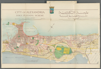
City of Alexandria Town Plann…
parent:
bc
27
f730-229a-0133-5a81-58d385a7b928
Carte de la Virginie et du Ma…
note:
…"Pl.
27
" printed in upper right corner.
Volcanic band of the Molucca,…
Height District Map Section No.
27
Use District Map Section No.
27
Lake George, Fort Ticonderoga…
Alexandria Municipality, 8th …
parent:
bc
27
f730-229a-0133-5a81-58d385a7b928
Map of the county of Herkimer
Plate
27
Mediterranean Sea. Lake Maryu…
parent:
bc
27
f730-229a-0133-5a81-58d385a7b928
Nouvelle carte itinéraire de …
Hudson County, V. 2, Double Page Plate No.
27
1
2
3
Previous
Next
1
2
3
Previous
Next