Click to visit the main New York Public Library Homepage
The New York Public Library
Digital Collections
About Digital Collections
Browse
Search only public domain materials
Items
Collections
Divisions
Home
Search
Browse
About
Search only public domain materials
Items
Collections
Divisions
Digital Collections
Using Images
Using Data
Search
Filtered keyword search
Show filters
Hide filters
Show Only Public Domain
topic
Real property
2518
Fire insurance
474
Administrative and political divisions
367
Cities & towns
342
Railroads
326
More
Less
name
G.W. Bromley & Co
1107
Bromley, George Washington
468
Bromley, Walter Scott
468
Sanborn Map Company
359
Perris, William
295
More
Less
collection
Atlases of New York City
2767
Maps of New York City and State
1303
Atlases of the United States
770
Maps of North America
528
Bancker plans
421
More
Less
place
New York (State)
3461
New York
2097
Manhattan (New York, N.Y.)
1389
New York (N.Y.)
1122
Brooklyn (New York, N.Y.)
506
More
Less
genre
x
Maps
Atlases
759
Surveys
433
land surveys
408
Cadastral maps
224
More
Less
publisher
G.W. Bromley & Co
986
Sanborn Map Company
345
E. Robinson Co
154
E. Belcher Hyde
146
William Perris
140
More
Less
division
Map Division
5632
Manuscripts and Archives Division
441
Wallach Division: Print Collection
41
Rare Book Division
17
General Research Division
16
More
Less
type
cartographic
6168
still image
177
text
108
Date Range
to
Looking for this collection?
Maps of New York City and State
2,059 items
6,315 results found for:
x
Bowery (New York, N.Y. : Street) -- 1900-1909
Filtering on:
x
Genre
: Maps
Sort by:
Relevance
Title
Date created
Date digitized
Sequence
Results 6251 - 6300
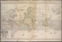
A
new
map of the world according
use:
… partner (e.g.,
New
York
… Morrisania) Melrose
Street
use:
… partner (e.g.,
New
York
A
new
chart of the vast Atlantic Ocean
use:
… partner (e.g.,
New
York
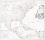
A
New
map of North America with the West
use:
… partner (e.g.,
New
York
A
new
map of North America with the West
use:
… partner (e.g.,
New
York
A
new
chart of the vast Atlantic Ocean
use:
… partner (e.g.,
New
York
…
Street
, Ferry
use:
… partner (e.g.,
New
York
m
… and East 177th
Street
use:
… partner (e.g.,
New
York
…, Prospect Ave,
York
Ave
use:
… partner (e.g.,
New
York
…, and East & West
New
Jersey
use:
… partner (e.g.,
New
York
Map of Jersey City,
New
Jersey, 1866
use:
… partner (e.g.,
New
York
… by Brighton Ave,
York
Ave
use:
… partner (e.g.,
New
York
….
New
in 18
use:
… partner (e.g.,
New
York
… 17th Ave.,
New
Utrech
use:
… partner (e.g.,
New
York
….,
New
Lots Ave.]
use:
… partner (e.g.,
New
York
….,
New
Lots Ave.]
use:
… partner (e.g.,
New
York
Map of
New
Netherland which was annexed
use:
… partner (e.g.,
New
York
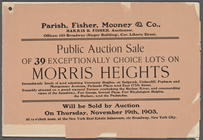
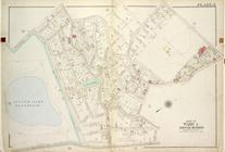
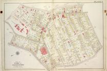
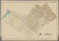
Plate 29: Map No. 274 [Bounde…
use:
… partner (e.g.,
New
York
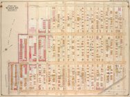
Brooklyn, Vol. 1, Double Page…
use:
… partner (e.g.,
New
York
… to Depot and
New
Town Road.]
use:
… partner (e.g.,
New
York
… Chester, Weir Creek,
New
use:
… partner (e.g.,
New
York
…, Scotland Ave,
New
Creek
use:
… partner (e.g.,
New
York
….,
New
Lots Ave
use:
… partner (e.g.,
New
York
….,
New
Lots Ave
use:
… partner (e.g.,
New
York
New
and correct map of the Great Rock Island route
use:
… partner (e.g.,
New
York
Brooklyn, Vol. 1, Double Page…
use:
… partner (e.g.,
New
York
New
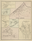
Ohio P.O., Colesville TP; Port Crane
use:
… partner (e.g.,
New
York
…, Locust Ave, 5th St,
New
use:
… partner (e.g.,
New
York
….; Including Williams Ave.,
New
use:
… partner (e.g.,
New
York
….; Including Williams Ave.,
New
use:
… partner (e.g.,
New
York
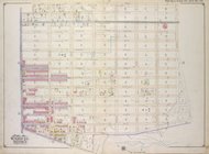
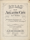
Atlas of Atlantic City,
New
Jersey
use:
… partner (e.g.,
New
York
… of
New
York
and Nassau …
use:
… partner (e.g.,
New
York
… of
New
York
; Including
use:
… partner (e.g.,
New
York
….; Including
New
Utrecht Ave
use:
… partner (e.g.,
New
York
… (Center),
York
Ave
use:
… partner (e.g.,
New
York
… St.; Including
New
York
Ave., Nottawa St
use:
… partner (e.g.,
New
York
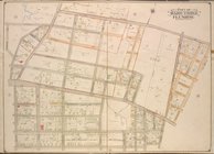
Queens, Vol. 2, Double Page N…
use:
… partner (e.g.,
New
York
Plate 8: [Bounded by Hillside…
use:
… partner (e.g.,
New
York
…., Milford St.,
New
Lots Ave
use:
… partner (e.g.,
New
York
Queens, Vol.2, Double Page Pl…
use:
… partner (e.g.,
New
York
….,
N
. Parsons Ave
use:
… partner (e.g.,
New
York
A
new
& exact map of the coast, countries
use:
… partner (e.g.,
New
York
….,
New
Utrecht Ave., 12th
use:
… partner (e.g.,
New
York
A
new
map of North America with the West
use:
… partner (e.g.,
New
York
Plate 10: Map No. 541 [Bounde…
use:
… partner (e.g.,
New
York
….,
New
Lane, Meadow Lane
use:
… partner (e.g.,
New
York
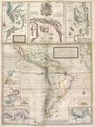
…'Amerique = The
new
sea map
use:
… partner (e.g.,
New
York
Brooklyn, Vol. 2, Double Page…
use:
… partner (e.g.,
New
York
…
New
Lots
use:
… partner (e.g.,
New
York
…
New
Lots
use:
… partner (e.g.,
New
York
1
2
…
17
18
19
20
21
22
23
24
25
26
Previous
Next
1
2
…
17
18
19
20
21
22
23
24
25
26
Previous
Next