Click to visit the main New York Public Library Homepage
The New York Public Library
Digital Collections
About Digital Collections
Browse
Search only public domain materials
Items
Collections
Divisions
Home
Search
Browse
About
Search only public domain materials
Items
Collections
Divisions
Digital Collections
Using Images
Using Data
Search
Filtered keyword search
Show filters
Hide filters
Show Only Public Domain
topic
Real property
147
Maps
36
Railroads
18
Rivers
12
Insurance
11
More
Less
name
Perris & Browne
141
Perris, William
141
M.B. Brown Printing and Binding Co
108
New York (N.Y.). Board of Estimate and Apportionment
108
A. Brown & Co
8
More
Less
collection
Atlases of New York City
307
Maps of North America
42
Maps of New York City and State
29
Atlases of the United States
10
Lawrence H. Slaughter Collection of English maps, charts, globes, books and atlases
4
More
Less
place
New York (State)
176
New York
160
Manhattan (New York, N.Y.)
134
New York (N.Y.)
114
Brooklyn (New York, N.Y.)
23
More
Less
genre
x
Maps
Atlases
10
Index maps
9
Cadastral maps
7
Title pages
7
More
Less
publisher
Perris & Browne
124
M.B. Brown Printing & Binding Co.,
108
Perris & Browne
38
A. Brown & Co
5
Advisory Board on Drainage
4
More
Less
division
Map Division
266
Manuscripts and Archives Division
4
Schomburg Manuscripts, Archives and Rare Books Division
3
Schomburg Jean Blackwell Hutson Research and Reference Division
2
General Research Division
1
More
Less
type
cartographic
407
text
11
still image
5
Date Range
to
407 results found for:
x
The Brownings
Filtering on:
x
Genre
: Maps
Sort by:
Relevance
Title
Date created
Date digitized
Sequence
Results 251 - 300
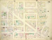
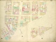
Height District Map Section N…
note:
…"
The
Amended area district map consists
Height District Map Section N…
note:
…"
The
Amended area district map consists
Height District Map Section N…
note:
…"
The
Amended area district map consists
Height District Map Section N…
note:
…"
The
Amended area district map consists
Height District Map Section N…
note:
…"
The
Amended area district map consists
Height District Map Section N…
note:
…"
The
Amended area district map consists
Height District Map Section N…
note:
…"
The
Amended area district map consists
Height District Map Section N…
note:
…"
The
Amended area district map consists
Height District Map Section N…
note:
…"
The
Amended area district map consists
Height District Map Section N…
note:
…"
The
Amended area district map consists
Height District Map Section N…
note:
…"
The
Amended area district map consists
Height District Map Section N…
note:
…"
The
Amended area district map consists
Height District Map Section N…
note:
…"
The
Amended area district map consists
Height District Map Section N…
note:
…"
The
Amended area district map consists
Height District Map Section N…
note:
…"
The
Amended area district map consists
Height District Map Section N…
note:
…"
The
Amended area district map consists
Height District Map Section N…
note:
…"
The
Amended area district map consists
m
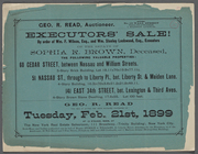
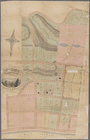
… of the Estate of Sophia R.
Brown
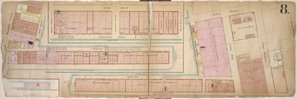
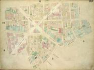
Double Page Plate No. 8; [Map…
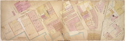
Double Page Plate No. 10; [Ma…
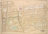
City of New York. Board of Es…
A plan of the town of Boston:…
Plate 14: Map bounded by Elm …
Plate 4: Map bounded by Maide…
Plate 1: Map bounded by Bowli…
Plate 5: Map bounded by Gold …
Plate 17: Map bounded by West…
Plate 18: Map bounded by Spri…
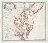
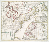
A new map of Virginia, Mary-l…
John W.
Brown
, Born
….,
Brown
Ave., Phraner Ave
Route through Mexico, Guatema…
Map no. 16, Battlefield of Fo…
note:
Photographed by
Brown
& Ogilvie.
Map of the Lower Comstock and…
m
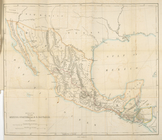
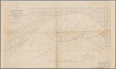
National map of the territory…
m
… of William R.
Browne
, …
collection:
… of William R.
Browne
Plate 13: Map bounded by Cana…
Plate 10: Map bounded by Jame…
m
Rand, McNally & Co.'s new ind…
note:
… &
brown
; [copy 2] colored
m
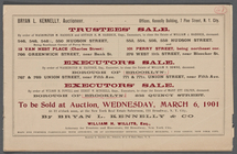
There will be Sold at Public …
note:
…, Garrison Sq.,
Brown
Ave.
Theatrum belli in America Sep…
note:
Brown
, L. Early maps of the Ohio Valley
Map of the seat of war in Vir…
note:
… underlined in
brown
, roads
…. Daniel
Brown
. ; Res. of Col. Daniel
Brown
United States of America, nor…
m
National map of the territory…
m
Fire Department map of the ci…
note:
… 1870 by Arthur
Brown
..."…
….
Brown
Esq.
A new map of the English empi…
Map of Dunkirk Harbor, showin…
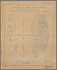
Location of North River Bridg…
note:
Center line of bridge is marked in
brown
1
2
Previous
Next
1
2
Previous
Next