Click to visit the main New York Public Library Homepage
The New York Public Library
Digital Collections
About Digital Collections
Browse
Search only public domain materials
Items
Collections
Divisions
Home
Search
Browse
About
Search only public domain materials
Items
Collections
Divisions
Digital Collections
Using Images
Using Data
Search
Filtered keyword search
Show filters
Hide filters
Show Only Public Domain
topic
Real property
1222
Administrative and political divisions
363
Fire insurance
349
Railroads
322
Cities & towns
316
More
Less
name
Sanborn Map Company
332
M.I.T. Press
157
New York (N.Y.). City Planning Commission
157
Everts, Ensign & Everts
151
G.W. Bromley & Co
151
More
Less
collection
Maps of New York City and State
1202
Atlases of New York City
1132
Atlases of the United States
758
Maps of North America
519
Lawrence H. Slaughter Collection of English maps, charts, globes, books and atlases
271
More
Less
place
New York (State)
2113
New York (N.Y.)
849
New York
777
Manhattan (New York, N.Y.)
384
New Jersey
294
More
Less
genre
x
Maps
Atlases
747
Cadastral maps
180
Manuscript maps
57
Topographic maps
54
More
Less
publisher
Sanborn Map Company
318
MIT Press
157
G.W. Bromley & Co
133
E. Belcher Hyde
107
publisher not identified
85
More
Less
division
Map Division
3983
Manuscripts and Archives Division
50
Wallach Division: Print Collection
41
Rare Book Division
17
General Research Division
16
More
Less
type
cartographic
3970
still image
210
text
86
Date Range
to
Looking for this collection?
Maps of New York City and State
2,059 items
4,146 results found for:
x
Winter Garden (Theater : New York, N.Y.: 1911-)
Filtering on:
x
Genre
: Maps
Sort by:
Relevance
Title
Date created
Date digitized
Sequence
Results 1251 - 1300
m
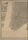
Bird's eye view of
New
York
City
use:
… partner (e.g.,
New
York
Hagstrom's map of lower
New
York
City …
use:
… partner (e.g.,
New
York
m
The Wanamaker diary map of
New
York
use:
… partner (e.g.,
New
York
Greater
New
York
's Census districts, 1920
use:
… partner (e.g.,
New
York
m
Financial district map of
New
York
City …
use:
… partner (e.g.,
New
York
Map of the borough of Brooklyn, City of
New
York
, …
use:
… partner (e.g.,
New
York
Map of the
New
York
world's fair
use:
… partner (e.g.,
New
York
A topographical map of Lewis Co.,
New
York
use:
… partner (e.g.,
New
York
m
Hammond's complete map of
New
York
City
use:
… partner (e.g.,
New
York
Hammond's complete map of
New
York
City
use:
… partner (e.g.,
New
York
Block sketch 1679,
New
York
City
use:
… partner (e.g.,
New
York
m
Hammond's complete map of
New
York
City
use:
… partner (e.g.,
New
York
m
Map of the borough of Brooklyn, City of
New
York
…
use:
… partner (e.g.,
New
York
New
York
and vicinity roads and rail
use:
… partner (e.g.,
New
York
… facilities in Greater
New
York
…
use:
… partner (e.g.,
New
York
A topographical map of Steuben Co.,
New
York
use:
… partner (e.g.,
New
York
… and
New
York
use:
… partner (e.g.,
New
York
Map, Copake (Columbia County,
New
York
)…
… of
New
York
use:
… partner (e.g.,
New
York
Height Zoning Map. City of
New
York
.
m
Map of the borough of the Bronx,
New
York
City
use:
… partner (e.g.,
New
York
Use Zoning Map. City of
New
York
.
m
Map of the borough of Brooklyn, City of
New
York
use:
… partner (e.g.,
New
York
… of
New
York
use:
… partner (e.g.,
New
York
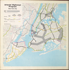
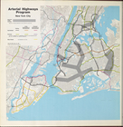
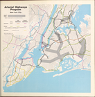
Arterial highways program
New
York
City
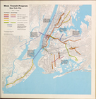
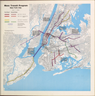
Mass Transit program
New
York
City
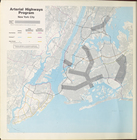
Arterial highways program
New
York
City
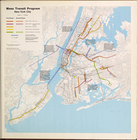
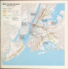
Mass Transit program
New
York
City
Arterial highways program
New
York
City
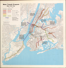
Mass Transit program
New
York
City
Mass Transit program
New
York
City
Arterial highways program
New
York
City
Mass Transit Program
New
York
City
Arterial Highways Program
New
York
City
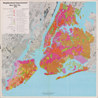
Neighborhood Improvement
New
York
City 1969
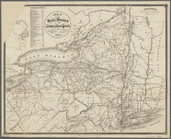
Map of the State of
New
York
use:
… partner (e.g.,
New
York
m
Gillette's map of Oneida Co.,
New
York
use:
… partner (e.g.,
New
York
Map of part of Orange County,
New
York
use:
… partner (e.g.,
New
York
m
Hotel Zone Map of
New
York
City
use:
… partner (e.g.,
New
York
m
Map of the City of
New
York
and its
use:
… partner (e.g.,
New
York
Colton's map of the
New
York
wilderness
use:
… partner (e.g.,
New
York
m
Hagstrom's map of Brooklyn (
New
York
City) …
use:
… partner (e.g.,
New
York
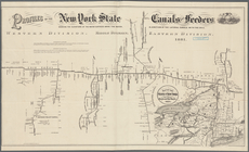
Profiles of the
New
York
State canals
use:
… partner (e.g.,
New
York
m
Post route map of the State of
New
York
use:
… partner (e.g.,
New
York
Map of the city of
New
York
, 1857-1858.
use:
… partner (e.g.,
New
York
Operations after the evacuation of
New
York
, 1776
use:
… partner (e.g.,
New
York
Map of the Borough of Queens, City of
New
York
.
use:
… partner (e.g.,
New
York
… of
New
York
use:
… partner (e.g.,
New
York
… of Northern
New
York
use:
… partner (e.g.,
New
York
…. (trunk line from
New
York
use:
… partner (e.g.,
New
York
1
2
3
4
5
6
7
8
9
10
…
16
17
Previous
Next
1
2
3
4
5
6
7
8
9
10
…
16
17
Previous
Next