Click to visit the main New York Public Library Homepage
The New York Public Library
Digital Collections
About Digital Collections
Browse
Search only public domain materials
Items
Collections
Divisions
Home
Search
Browse
About
Search only public domain materials
Items
Collections
Divisions
Digital Collections
Using Images
Using Data
Search
Filtered keyword search
Show filters
Hide filters
Show Only Public Domain
topic
Real property
207
Railroads
60
Fire insurance
51
Cities & towns
48
History
33
More
Less
name
E.B. Hyde & Co
83
Ullitz, Hugo
83
E. Belcher Hyde Map Company
65
Sanborn Map Company
49
G.W. Bromley & Co
47
More
Less
collection
Atlases of New York City
261
Maps of North America
161
Maps of New York City and State
111
Lawrence H. Slaughter Collection of English maps, charts, globes, books and atlases
48
Atlases of the United States
37
More
Less
place
New York (State)
298
New York
186
Brooklyn (New York, N.Y.)
121
New York (N.Y.)
104
Maps
75
More
Less
genre
x
Maps
Surveys
36
Atlases
35
land surveys
32
Cadastral maps
16
More
Less
publisher
E. Belcher Hyde
70
Sanborn Map Company
50
G.W. Bromley & Co
37
publisher not identified
23
E. Robinson Co
15
More
Less
division
Map Division
630
Manuscripts and Archives Division
39
Rare Book Division
17
Schomburg Jean Blackwell Hutson Research and Reference Division
7
Wallach Division: Print Collection
6
More
Less
type
cartographic
703
text
28
still image
17
Date Range
to
712 results found for:
x
20
Filtering on:
x
Genre
: Maps
Sort by:
Relevance
Title
Date created
Date digitized
Sequence
Geographical, statistical, an…
note:
Lawrence H. Slaughter Collection ;
20
.
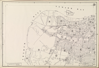
Bounded by Saratoga Avenue, C…
parent:
f415fc
20
-bc69-0132-4124-58d385a7bbd0
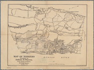
Map of Yonkers
parent:
61551f
20
-c5aa-012f-abc5-58d385a7bc34
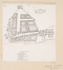
Albany
parent:
61551f
20
-c5aa-012f-abc5-58d385a7bc34
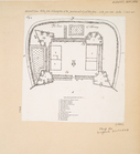
The Fort of Albany
parent:
61551f
20
-c5aa-012f-abc5-58d385a7bc34
Plate
20
: Bounded by E. 89th Street, East
Plate
20
: Bounded by S. 11th Street
parent:
f415fc
20
-bc69-0132-4124-58d385a7bbd0
Plate
20
: [Bounded by Saratoga Avenue, Chauncey
parent:
f415fc
20
-bc69-0132-4124-58d385a7bbd0
m
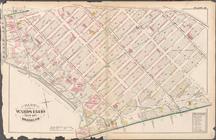
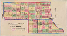
Maps of the 14, 15, 16, 17,
20
, 21
7th Senatorial District 18,
20
, 21 Wards
Plate 45: Map No.
20
[Bounded by Mill
note:
Map No.
20
: A map of land in Morrisania
m
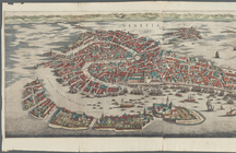
Venetia
m
New York world's fair by auto…
note:
Size: 14 3/4 X
20
3/4 inches.
Map or Plan of Section
20
. [Bounded
…; Part of Ward
20
parent:
f415fc
20
-bc69-0132-4124-58d385a7bbd0
…; Part of Wards
20
& 11
parent:
f415fc
20
-bc69-0132-4124-58d385a7bbd0
…; Part of Wards 7 &
20
parent:
f415fc
20
-bc69-0132-4124-58d385a7bbd0
… only, H. Qrs.
20
[th?] Corps, June
20
, 1864
parent:
b8e12c
20
-c52a-012f-11bb-3c075448cc4b
m
Map of tribal and place-names
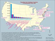
Population from Carrebean countries in
20
Bounded by Regent Place, Tild…
parent:
f415fc
20
-bc69-0132-4124-58d385a7bbd0
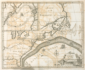
A chart of the Gulf Stream
…. Wards 7, 11,
20
, 21, 23
parent:
f415fc
20
-bc69-0132-4124-58d385a7bbd0
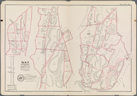
m
Tour book
m
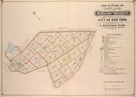
Brookland
note:
… and Stockholm ground, June
20
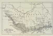
Sketch map of West Africa : s…
Plate
20
: Map bounded by Flushing Avenue
parent:
f415fc
20
-bc69-0132-4124-58d385a7bbd0
Height District Map Section No.
20
Use District Map Section No.
20
A new & correct map of Negrol…
m
Tour book
Topographical map of the stat…
parent:
b8e12c
20
-c52a-012f-11bb-3c075448cc4b
The territory of Alaska : -- …
parent:
b8e12c
20
-c52a-012f-11bb-3c075448cc4b
…; Part of Wards 11 &
20
parent:
f415fc
20
-bc69-0132-4124-58d385a7bbd0
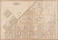
Brooklyn, Vol. 2, Double Page Plate No.
20
parent:
f415fc
20
-bc69-0132-4124-58d385a7bbd0
Cumberland coal region: shewi…
parent:
b8e12c
20
-c52a-012f-11bb-3c075448cc4b
m
Auction sale at Montrose Stat…
parent:
b8e12c
20
-c52a-012f-11bb-3c075448cc4b
Plate
20
first:
3a99db
20
-4349-0132-ca7e-58d385a7bbd0
Countries adjacent to the Med…
Plate
20
, Part of Section 2
Area Zoning Map Section No.
20
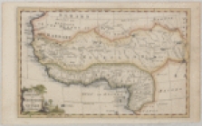
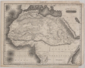
Northern and Central Africa
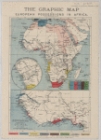
The Graphic map of European p…
note:
…"Supplement to the Graphic, December
20
, 1884."…
United States.
parent:
b8e12c
20
-c52a-012f-11bb-3c075448cc4b
An accurate map of the Britis…
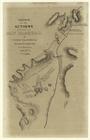
Sketch of the actions fought …
Sheet No.
20
. [Includes Lamberts Lane
parent:
20
a619e0-bc6a-0132-e989-58d385a7bbd0
Area District Map Section No.
20
Plate
20
: Map bounded by Sullivan Street
…; [Including Wards 7, 9,
20
, 22
parent:
f415fc
20
-bc69-0132-4124-58d385a7bbd0
1
2
3
Previous
Next
1
2
3
Previous
Next