Click to visit the main New York Public Library Homepage
The New York Public Library
Digital Collections
About Digital Collections
Browse
Search only public domain materials
Items
Collections
Divisions
Home
Search
Browse
About
Search only public domain materials
Items
Collections
Divisions
Digital Collections
Using Images
Using Data
Search
Filtered keyword search
Show filters
Hide filters
Show Only Public Domain
topic
Real property
285
Fire insurance
49
Cities & towns
46
Administrative and political divisions
28
Railroads
22
More
Less
name
Ullitz, Hugo
130
E.B. Hyde & Co
127
E. Belcher Hyde Map Company
100
J.B. Beers & Co
47
Sanborn Map Company
47
More
Less
collection
Atlases of New York City
249
Maps of North America
124
Atlases of the United States
76
Maps of New York City and State
74
Lawrence H. Slaughter Collection of English maps, charts, globes, books and atlases
21
More
Less
place
New York (State)
319
New York
183
Brooklyn (New York, N.Y.)
141
Maps
82
New York (N.Y.)
56
More
Less
genre
x
Maps
Atlases
76
Cadastral maps
20
Nautical charts
15
Bathymetric maps
13
More
Less
publisher
E. Belcher Hyde
103
Sanborn Map Company
48
G.W. Bromley & Co
29
publisher not identified
29
E.B. Hyde & Co
27
More
Less
division
Map Division
553
Manuscripts and Archives Division
4
General Research Division
3
Rare Book Division
2
Dorot Jewish Division
1
More
Less
type
cartographic
566
text
13
still image
4
Date Range
to
566 results found for:
x
32
Filtering on:
x
Genre
: Maps
Sort by:
Relevance
Title
Date created
Date digitized
Sequence
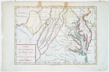
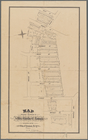
Carte de la Virginie, du Mary…
note:
Lawrence H. Slaughter Collection ;
32
.
Plate
32
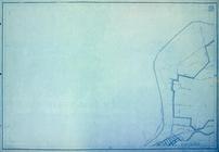
: [Bounded by (New York Bay & Piers
m
Auction sale at Montrose Stat…
note:
Designed to be folded to
32
x 20 cm
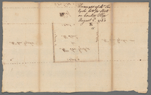
Map of property belonging to …
note:
… and surveyor, No
32
Liberty St
m
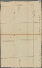
Lots on Coenties Slip
note:
Blocks 30 or
32
.
m
Little Dock or Water Street
note:
Block 30 or
32
.
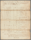
Plate
32
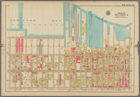
: Bounded by Greene Avenue, Bushvick
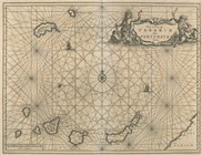
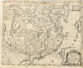
Insula Canariae alias Fortuna…
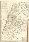
Carte de la Palestine selon l…
A new and accurate map of the…
…; Part of Wards 26 &
32
…; Part of Wards 26 &
32
… &
32
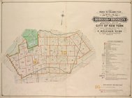
. City of New York
…; Part of Wards 26 &
32
… &
32
; Sections 12; …
…; Part of Wards 29 &
32
… &
32
, Section 16; …
…; Part of Wards 29 &
32
…; Part of Wards 29 &
32
…; Part of Wards 29 &
32
…; Part of Wards 29 &
32
…; Part of Wards 29 &
32
… and part of
32
. City of New
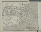
Massachusetts and Rhode Islan…
Bounded by (New York Bay) Sec…
collection:
Plate
32
Plate
32
: Map bounded by Degraw Street
m
New grant fronting Cruger's W…
note:
Blocks 30,
32
, 34.
m
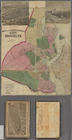
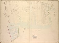
Map of Consolidated City Broo…
m
Brooklyn City Hall
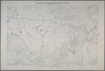
Map of Newtown Creek and vici…
m
Atlas eclipticalis 1950.0
… of Maps, Pages
32
note:
…, Page
32
: High Bridge
… &
32
, Section 12; [Map
…; Part of Wards 29 &
32
…, Double Page Plate No.
32
; Part of Ward
32
Geological plan of the Coast …
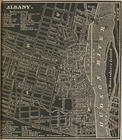
Albany.
Bounded by Avenue P., E. 31st…
collection:
Plate
32
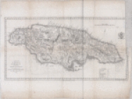
A map of the Island of Jamaic…
Height District Map Section No.
32
Use District Map Section No.
32
m
Draft of the New Road from No.
32
to No
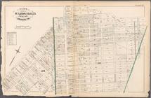
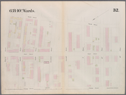
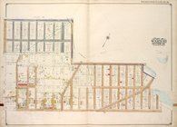
Brooklyn, Vol. 4, Double Page…
abstract:
… between Wards 26 &
32
Imperium Sinicum in XV Regna …
Santanoni, ed. of Mar. 1904, …
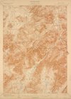
Mt. Marcy, ed. of June 1902, …
A New map of the province of …
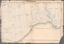
Part of Westfield
collection:
Section
32
Plate
32
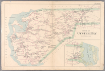
: Town of Oyster Bay.
Sheet No.
32
. [Includes Grymes Hill
1
2
3
Previous
Next
1
2
3
Previous
Next