Click to visit the main New York Public Library Homepage
The New York Public Library
Digital Collections
About Digital Collections
Browse
Search only public domain materials
Items
Collections
Divisions
Home
Search
Browse
About
Search only public domain materials
Items
Collections
Divisions
Digital Collections
Using Images
Using Data
Search
Filtered keyword search
Show filters
Hide filters
Show Only Public Domain
topic
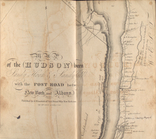
Post roads
14
Real property
8
Landowners
3
Water-supply
3
Charts, diagrams, etc
2
More
Less
name
Bridges
14
Goodrich, A. T. (Andrew Thompson), 1789-1845
14
Rollinson, William, 1762-1842
14
G.M. Hopkins & Co
4
New York (N.Y.). Aqueduct Commission
3
More
Less
collection
Atlases of the United States
16
Maps of New York City and State
11
Atlases of New York City
4
Maps of North America
4
place
New York (State)
31
New York (N.Y.)
20
Hudson River (N.Y. and N.J.) -- Maps
14
Hudson River Valley (N.Y. and N.J.) -- Maps
14
New Jersey
14
More
Less
genre
x
Maps
Atlases
16
Cadastral maps
3
Topographic maps
2
Military maps
1
publisher
Published by A.T. Goodrich, 124 Broad Way
14
G.M. Hopkins & Co
4
publisher not identified
3
Aqueduct Commission?
2
G.W. & C.B. Colton & Co
2
More
Less
division
Map Division
35
type
cartographic
35
Date Range
to
35 results found for:
x
Covered bridges
Filtering on:
x
Genre
: Maps
Sort by:
Relevance
Title
Date created
Date digitized
Sequence
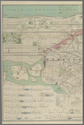
Map of the Harlem River and S…
use:
… exhibitions, on catalog
covers
m
Map of the Harlem River and S…
use:
… exhibitions, on catalog
covers
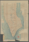
Map showing the relative posi…
use:
… exhibitions, on catalog
covers
Map of the proposed widening …
use:
… exhibitions, on catalog
covers
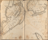
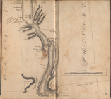
Map of the Hudson ... from Sa…
note:
… pasted inside back
cover
.
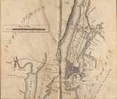
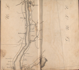
Map of the Hudson ... from Ne…
note:
… pasted inside back
cover
.
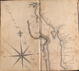
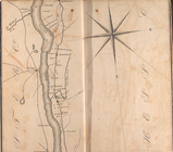
Map of the Hudson ... from Sp…
note:
… pasted inside back
cover
.
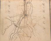
Map of the Hudson ... from Ta…
note:
… pasted inside back
cover
.
Map of the Hudson ... from Pe…
note:
… pasted inside back
cover
.
Map of the Hudson ... from Ne…
note:
… pasted inside back
cover
.
Map of the Hudson ... from Po…
note:
… pasted inside back
cover
.
Map of the Hudson ... from Ge…
note:
… pasted inside back
cover
.
Map of the Hudson ... from Co…
note:
… pasted inside back
cover
.
Map of the Hudson ... from Ca…
note:
… pasted inside back
cover
.
Map of the Hudson ... from La…
note:
… pasted inside back
cover
.
Map of the Hudson ... from Be…
note:
… pasted inside back
cover
.
Map of the Hudson ... from Ft…
note:
… pasted inside back
cover
.
Map of the Hudson ... from Rh…
note:
… pasted inside back
cover
.
m
Charleston District, South Ca…
use:
… exhibitions, on catalog
covers
Aqueduct Commissioners topogr…
use:
… exhibitions, on catalog
covers
Water shed of the Croton River
use:
… exhibitions, on catalog
covers
Aqueduct Commissioners topogr…
use:
… exhibitions, on catalog
covers
Military map of south-eastern…
use:
… exhibitions, on catalog
covers
… of the proposed
bridge
use:
… exhibitions, on catalog
covers
m
Map of Maine: constructed fro…
use:
… exhibitions, on catalog
covers
….,
Bridge
St., East River
use:
… exhibitions, on catalog
covers
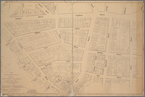
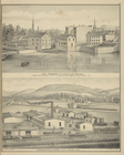
Plate 52: Wakefield, Town & C…
note:
Covers
Olinville and Williams
Bridge
.
… Suspension
Bridge
, Binghamton
note:
On
cover
: New historical atlas of Broome Co
Plan of land & water lots of …
use:
… exhibitions, on catalog
covers
m
New York City elevated railro…
use:
… exhibitions, on catalog
covers
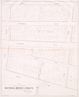
Map bound by East River,
Bridge
St., Sands
use:
… exhibitions, on catalog
covers
Map bound by Sands St., U.S. …
use:
… exhibitions, on catalog
covers
Map bound by Johnson St., Pea…
use:
… exhibitions, on catalog
covers
Map of the town of Niagara
use:
… exhibitions, on catalog
covers
Map of the route of the new C…
use:
… exhibitions, on catalog
covers
End of results
|
Top