Click to visit the main New York Public Library Homepage
The New York Public Library
Digital Collections
About Digital Collections
Browse
Search only public domain materials
Items
Collections
Divisions
Home
Search
Browse
About
Search only public domain materials
Items
Collections
Divisions
Digital Collections
Using Images
Using Data
Search
Filtered keyword search
Show filters
Hide filters
Show Only Public Domain
topic
Real property
22
Nautical charts
14
City planning
13
Geology
9
Harbors
9
More
Less
name
Geological Survey (U.S.)
19
United States Coast Survey
9
Walcott, Charles D. (Charles Doolittle), 1850-1927
7
Bache, A. D. (Alexander Dallas), 1806-1867
6
Gannett, Henry, 1846-1914
5
More
Less
collection
Maps of North America
76
Maps of New York City and State
58
Atlases of New York City
2
Atlases of the United States
1
H.M.S. Aeolus and H.M.S. Norwich logbooks
1
More
Less
place
New York (State)
48
New York (N.Y.)
26
Manhattan (New York, N.Y.)
24
New York
21
Brooklyn (New York, N.Y.)
10
More
Less
genre
x
Maps
Topographic maps
22
Cadastral maps
12
Nautical charts
12
Manuscript maps
10
More
Less
publisher
publisher not identified
11
U.S. Geological Survey
8
U.S. Coast Survey
6
M. Dripps
4
The Company
4
More
Less
division
Map Division
138
Manuscripts and Archives Division
3
type
cartographic
140
still image
10
text
3
Date Range
to
141 results found for:
x
Feet
Filtering on:
x
Genre
: Maps
Sort by:
Relevance
Title
Date created
Date digitized
Sequence
Chicago : with the school sec…
abstract:
…
feet
front and rear
…, " 134
feet
deep by 32
feet
wide. East Aurora
Whitesboro, Brown Co., W.T.
abstract:
… and a boat. "All lots 66
feet
…
feet
.
note:
Scale 1:969. 80 3/4
feet
to the inch. (W
Plan
note:
Size: 11 x 15 in. Scale: 100
feet
Map of the town of Huron, Mic…
Map of Buffalo Harbor, N.Y., …
note:
…"Sounding in
feet
Georgia, parish of St. John :…
abstract:
… is 70
feet
broad, & each
m
Map and profile of the New Yo…
abstract:
… 500
feet
to 1/10th of a foot; Vertical 100
feet
Map showing the location of t…
abstract:
…. Vertical scale 30
feet
Alaska route of military expe…
abstract:
… approximately 250
feet
, for insets, 500
feet
Topographical map of the stat…
note:
…, 20
feet
. Datum, mean
Manuscript map of corner of H…
note:
Scale 1:48. 4
feet
to 1 inch. (W 74°00ʹ22
m
Plans for the improvement of …
note:
…, 40
feet
to 1 in; vertical: 20
feet
to 1 in.
m
Borough of Manhattan, 300 foo…
note:
Scale 1:7,200; 1 inch = 300
feet
.
Map of water front from 61st …
note:
Scale 1:2,400. 1 inch 200
feet
(W 73°57ʹ…
m
Petersen's map of Brooklyn
note:
Scale 1:12,000; 1000
feet
to an inch.
m
Topographical map of the city…
note:
Scale [ca. 1:10,800]. 900
feet
to an inch.
m
Plan of property situate in t…
note:
Scale [ca. 1:2,400]. 200
feet
to an inch.
Plan of New York City between…
note:
Scale 1:600. 1 inch = 50
feet
. (W 74°01ʹ03
Preliminary chart of the sea …
abstract:
… are expressed in
feet
to 18
feet
Map of the Harlem River and S…
note:
Scale [1:12,000]. 1000
feet
= 1 in. (W
Map of the Harbor of New York…
note:
Depths shown by soundings in
feet
.
m
Plan of property situate in t…
note:
Scale [ca. 1:2,400]. 200
feet
to an inch.
Plan showing course of stream…
note:
Scale 1:1,200. 100
feet
to one inch. (W
m
Map of Connecticut
note:
Contour interval 100
feet
.
Plan of extension of Devonshi…
note:
… plan, 9,993
feet
."…
…
feet
to one inch
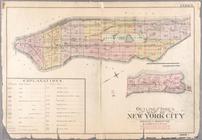
Index: Borough of Manhattan. Scale 1800
feet
East River from the Battery t…
note:
Scale 1:10,800. 900
feet
to one inch. (W
Railroad suburbs between Holl…
note:
Scale 1:9,600, 800 foot = 1
feet
; (W 73°46
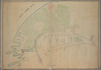
Map of Kissena Park, third wa…
note:
Scale 1:2,400; one inch = 200
feet
(W
m
Plan and profile showing the …
note:
…"Profile horizontal & vertical scale = 30
feet
m
Manuscript map of New York Ci…
note:
Scale 1:3,600. 1 inch = 300
feet
. (W
m
Map of Connecticut
note:
Contour interval 100
feet
.
Mines of the Kansas Ridge, Mo…
note:
Scale 1:2,400. 200
feet
to the inch (W
Map of the city of New York m…
note:
Scale 1:9,600. 800
feet
to 1 inch. (W
Map of West Street from Batte…
note:
Scale 1:3,600. 1 inch = 300
feet
. (W
Manuscript map of the section…
note:
Scale 1:240. 1/2 inch = 10
feet
. (W
m
Map showing part of the city …
note:
Typewritten text with information about "100
feet
m
Map of Connecticut
note:
Contour interval 100
feet
.
… Broadway. Scale 50
feet
Mobile, 1888
note:
Scale 1:14,400. 1200
feet
to the inch
m
Bureau of roads
abstract:
… approximately 1:4,800; 400
feet
m
Rand McNally commercial map o…
note:
Scale 1:7,200; 600
feet
= 1 inch (W 74°02ʹ…
m
Map of the borough of Brookly…
note:
Scale 1:24,000; 2000
feet
per inch.
m
Colton's street map of the Ci…
note:
Scale 1:19,200. 1600
feet
to one inch
m
Map of Cambridge in the vicin…
note:
…, on a scale of 209
feet
to 1
Sketch of the coast of North …
abstract:
…
feet
. …
Map of 272 lots in the 30th w…
note:
Scale approximately 1:720; 60
feet
per inch.