Click to visit the main New York Public Library Homepage
The New York Public Library
Digital Collections
About Digital Collections
Browse
Search only public domain materials
Items
Collections
Divisions
Home
Search
Browse
About
Search only public domain materials
Items
Collections
Divisions
Digital Collections
Using Images
Using Data
Search
Filtered keyword search
Show filters
Hide filters
Show Only Public Domain
topic
Administrative and political divisions
15
Railroads
12
Surveys
10
Geology
6
Mines and mineral resources
6
More
Less
name
United States. Surveyor General for Ohio, Indiana and Michigan
11
Colton, J. H. (Joseph Hutchins), 1800-1893
4
Cox, E. T. (Edward Travers), 1821-1907
4
Indiana. Geological Survey
4
Lyon, Lucius, 1800-1851
4
More
Less
collection
Maps of North America
63
Atlases of New York City
6
Atlases, gazetteers, guidebooks and other books
1
I. N. Phelps Stokes Collection of American Historical Prints
1
Lawrence H. Slaughter Collection of English maps, charts, globes, books and atlases
1
More
Less
place
Indiana
47
Michigan
17
Illinois
15
Ohio
13
United States
8
More
Less
genre
x
Maps
Cadastral maps
5
Geological maps
5
Bathymetric maps
2
Topographic maps
2
More
Less
publisher
publisher not identified
8
Surveyor General's Office?
5
Surveyor General's Office
4
G.W. Bromley & Co
3
General Land Office
3
More
Less
division
Map Division
71
Schomburg Jean Blackwell Hutson Research and Reference Division
1
Wallach Division: Print Collection
1
type
cartographic
73
Date Range
to
73 results found for:
x
Indiana
Filtering on:
x
Genre
: Maps
Sort by:
Relevance
Title
Date created
Date digitized
Sequence
… Counties,
Indiana
…
abstract:
… for Geological Survey of
Indiana
Rand, McNally & Co.'s
Indiana
abstract:
… and shippers' guide of
Indiana
Geological map of
Indiana
…
Map of the
Indiana
North and South Railway
Map of Vanderburgh County,
Indiana
…
Map of Pike and Dubois Counti…
abstract:
… for Geological Survey of
Indiana
Indiana
Map of Parke County,
Indiana
…
abstract:
… for Geological Survey of
Indiana
A sketch of the public surveys in
Indiana
…
m
Colton's map of the state of
Indiana
…
A sketch of the public surveys in
Indiana
Indiana
, 1820
Map of
Indiana
…
Map of
Indiana
…
Duncan's addition to Michigan…
collection:
Michigan City,
Indiana
… of
Indiana
…
abstract:
… of the state of
Indiana
m
A new map of
Indiana
…
Johnson's
Indiana
Survey of the mouth of Trail Creek,
Indiana
…
Indiana
…
Map of the State of
Indiana
…
Harbor of Michigan City,
Indiana
…
Map of Illinois with parts of
Indiana
The states of Ohio,
Indiana
& Illinois
note:
… for the states of Ohio,
Indiana
m
Map of the Grand Rapids and
Indiana
State of
Indiana
…
… of Illinois and
Indiana
] …
… of Ohio and
Indiana
m
Map of Vigo County,
Indiana
…
State of
Indiana
…
Transportation lines tributar…
collection:
Indiana
State of
Indiana
…
… Co.,
Indiana
m
Map of Ohio and
Indiana
…
Map of the states of
Indiana
and Ohio …
m
… and
Indiana
…
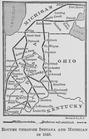
Routes through
Indiana
and Michigan
Western states
note:
Covers Kentucky, Ohio,
Indiana
, Illinois
Ohio,
Indiana
, and Michigan
Eastern United States, No. 5
abstract:
… of Illinois, and parts
Indiana
m
Map of the state of
Indiana
…
Guide through Ohio, Michigan,
Indiana
, Illinois
Map of the western states to …
note:
…, Illinois,
Indiana
, Ohio
Diagram of the state of Michi…
Sketch of the public surveys …
Fourteenth l.h. district
Sketch of the public surveys …
Sketch of the public surveys …
Map of the northern peninsula…
Diagram of part of the State …