Click to visit the main New York Public Library Homepage
The New York Public Library
Digital Collections
About Digital Collections
Browse
Search only public domain materials
Items
Collections
Divisions
Home
Search
Browse
About
Search only public domain materials
Items
Collections
Divisions
Digital Collections
Using Images
Using Data
Search
Filtered keyword search
Show filters
Hide filters
Show Only Public Domain
topic
City planning
948
Social conditions
942
Real property
289
Nautical charts
89
Administrative and political divisions
69
More
Less
name
M.I.T. Press
942
New York (N.Y.). City Planning Commission
942
G.M. Hopkins & Co
343
New York (N.Y.). Board of Estimate and Apportionment
109
M.B. Brown Printing and Binding Co
108
More
Less
collection
Atlases of New York City
1220
Atlases of the United States
550
Maps of North America
188
Maps of New York City and State
158
Lawrence H. Slaughter Collection of English maps, charts, globes, books and atlases
27
More
Less
place
New York (State)
1305
New York (N.Y.)
1128
New York
1098
Brooklyn (New York, N.Y.)
145
Jersey City (N.J.)
124
More
Less
genre
x
Maps
Atlases
517
Nautical charts
67
Topographic maps
41
Cadastral maps
38
More
Less
publisher
MIT Press
942
M.B. Brown Printing & Binding Co.,
108
G.M. Hopkins & Co
101
A.H. Mueller
95
G.M. Hopkins
83
More
Less
division
Map Division
2149
Rare Book Division
8
Manuscripts and Archives Division
3
Schomburg Jean Blackwell Hutson Research and Reference Division
3
General Research Division
2
More
Less
type
cartographic
1221
still image
950
text
19
Date Range
to
2,167 results found for:
x
M. N
Filtering on:
x
Genre
: Maps
Sort by:
Relevance
Title
Date created
Date digitized
Sequence
New York and vicinity
note:
… in the year 1862 by
M
. Dripps..."…
… lat. 40°15
N
., long
note:
…,
N
. York.
m
Map of New York City
note:
… 74°01ʹ21ʺ--W 73°54ʹ31ʺ/
N
40°52ʹ36ʺ--
N
40°42ʹ01ʺ)…
m
Topographical map of New York…
note:
… 73°34ʹ13ʺ/
N
40°57ʹ28ʺ--
N
Map of New York and vicinity / prepared by
M
note:
…ʹ00ʺ/
N
40°49ʹ11ʺ--
N
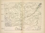
Karta srednei Evropy
N
. Kuzana, izd
m
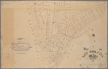
Map of the city of New York.
note:
… 73°54ʹ25ʺ/
N
40°52ʹ40ʺ--
N
Map of the cities of New York…
note:
Prepared by
M
. Dripps for Valentine
m
Map of New York City south of…
note:
… 73°55ʹ41ʺ/
N
40°49ʹ11ʺ--
N
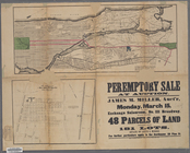
… at auction : James
M
. Miller
note:
… 73°58ʹ47ʺ--W 73°54ʹ30ʺ/
N
40°52ʹ42ʺ--
N
40°47ʹ41ʺ)…
…,
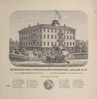
N
.Y. Rev. J. Dunbar Houghton, A.
M
., Principal
note:
by S.
N
. & D.G. Beers and assistants.
Farrar's map of northern Main…
note:
…ʹ/
N
46°42--
N
44°57ʹ).
m
… County,
N
.Y.
note:
…ʹ/
N
40°56ʹ--
N
40°47ʹ)…
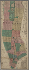
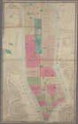
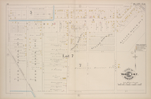
Part of Ward 5 & 7 [Plate
N
]
Map of the state of Wisconsin
note:
…ʹ--W 87°00ʹ/
N
47°00ʹ--
N
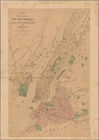
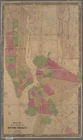
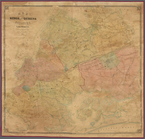
New-York City, County, and vi…
note:
… County,
N
.J., Bronx
m
Map of northern parts of the …
note:
…. & Geo.
N
. Tackabury 307
Map of the state of Wisconsin
note:
…ʹ--W 87°00ʹ/
N
47°00ʹ--
N
Map of the cities of New York…
note:
…] (W 74°01ʹ--W 73°53ʹ/
N
40°53ʹ--
N
40°38ʹ).
m
Topographical map of the City…
note:
… 74°00ʹ25ʺ--W 73°46ʹ45ʺ/
N
40°52ʹ15ʺ--
N
40°45ʹ36ʺ).
m
Sectional, Nebraska and Kansa…
note:
… 94°34ʹ/
N
43°00ʹ--
N
36°58
Map of Cincinnati and suburbs…
note:
… 84°25ʹ16ʺ/
N
39°10ʹ25ʺ--
N
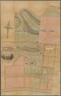
Map of property at New Bright…
note:
Scale not given (W 74°05ʹ35ʺ/
N
40°38ʹ32ʺ)…
A map of the Kingdoms of Koto…
note:
by
M
. D'Anville ; G. Child, sculpt.
… / prepared by
M
. Dripps
note:
…ʹ41ʺ/
N
40°49ʹ11ʺ--
N
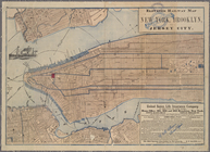
Elevated railway map of New Y…
note:
… 74°02ʹ55ʺ--W 73°56ʹ24ʺ/
N
40°47ʹ13ʺ--
N
40°41ʹ50ʺ)…
Diagram of the state of Misso…
note:
… 95°46ʹ--W 89°05ʹ/
N
40°36ʹ--
N
35°59ʹ).
Novi Belgii: Tabula ad N. J. …
m
Map of the state of Minnesota…
note:
…ʹ--W 89°30ʹ/
N
49°20ʹ--
N
State of Missouri
note:
…ʹ/
N
40°37ʹ--
N
36°00ʹ).
m
Map of New York City south of…
note:
…ʹ41ʺ/
N
40°49ʹ11ʺ--
N
m
Map shewing the old high wate…
note:
…ʹ20ʺ/
N
40°44ʹ30ʺ--
N
m
A chart of the discoveries of H.
M
.S. Hecla
note:
… 116°11ʹ--W 77°00ʹ/
N
76°32ʹ--
N
71°30ʹ).
Map of the Indian Territory
note:
… 98°22ʹ--W 94°07ʹ/
N
37°10ʹ--
N
33°30ʹ)…
…, Superintendent ; Chas.
M
. Mueller
note:
… 87°31ʹ25ʺ/
N
42°01ʹ23ʺ--
N
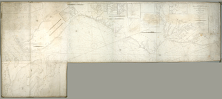
Sea Coast of Delaware, Maryla…
note:
… 75°35ʹ--W 74°32ʹ/
N
38°55ʹ--
N
37°43ʹ).
Philadelphia
note:
In lower left margin:
N
. Friend's lithc
…, Long Island,
N
.Y
Colton's railroad & township …
note:
… for the southern dist. of
N
. York."…
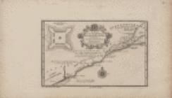
Carte reduite des costes de l…
note:
…ʹ/
N
33°30ʹ--
N
22°00ʹ).
Map of the state of Kansas
note:
… 102°03ʹ--W 94°35ʹ/
N
40°00ʹ--
N
37°00ʹ).
Colorado (Dolores County), Ri…
note:
…ʺ/
N
37°44ʹ39ʺ--
N
37°40
m
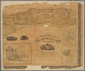
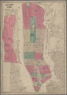
Map of the City of New York w…
note:
Drawn and engraved by John
M
. Atwood.
Colorado, Tenmile District sp…
note:
…ʺ/
N
39°30ʹ25ʺ--
N
39°22
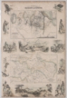
Countries in the northern tro…
m
Gold Ridge, Randolph Co., Ala…
note:
… 85°39ʹ14ʺ--W 85°13ʹ56ʺ/
N
33°30ʹ04ʺ--
N
33°06ʹ23ʺ).
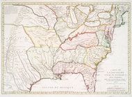
Carte de la Louisiane cours d…
note:
par
N
. Bellin ingenieur de la marine, 1744
Washington and vicinity, Mary…
note:
… 77°15ʹ--W 76°45ʹ/
N
39°00ʹ--
N
38°45ʹ)…
Part of United States west of…
note:
…. 1:5,000,000] (W 125°--W 84°/
N
49°--
N
31°).
… lat. 40º15{167}
N
note:
…,
N
. York.
1
2
3
4
5
6
7
8
9
Previous
Next
1
2
3
4
5
6
7
8
9
Previous
Next