Click to visit the main New York Public Library Homepage
The New York Public Library
Digital Collections
About Digital Collections
Browse
Search only public domain materials
Items
Collections
Divisions
Home
Search
Browse
About
Search only public domain materials
Items
Collections
Divisions
Digital Collections
Using Images
Using Data
Search
Filtered keyword search
Show filters
Hide filters
Show Only Public Domain
topic
Railroads
22
Real property
14
Canals
11
Administrative and political divisions
8
Indians of North America
5
More
Less
name
Burr, David H., 1803-1875
4
Cook, Frederick S
3
D.G. Beers & Co
3
New York, Ontario, and Western Railway Co
3
New York, West Shore & Buffalo Railroad
3
More
Less
collection
Maps of New York City and State
39
Maps of North America
25
Atlases of the United States
10
Atlases of New York City
2
John H. Levine Collection
1
More
Less
place
New York (State)
51
Ontario
16
United States
11
Connecticut
10
New Jersey
10
More
Less
genre
x
Maps
Atlases
10
Geological maps
4
Cadastral maps
3
Facsimiles
2
More
Less
publisher
publisher not identified
13
J.H. Toudy & Co
3
Published by James Eastburn & Co., at the Literary Rooms in Broadway
2
A. Lay
1
A. Lay?
1
More
Less
division
Map Division
78
type
cartographic
78
still image
2
Date Range
to
78 results found for:
x
Ontario
Filtering on:
x
Genre
: Maps
Sort by:
Relevance
Title
Date created
Date digitized
Sequence
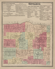
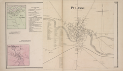
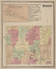
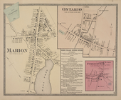
Village of Port
Ontario
, in the Town
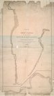
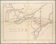
Map & profile of the Lake
Ontario
& Hudson
Ontario
(Village) Business Notices;
Ontario
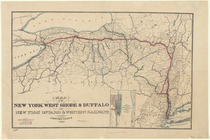
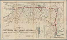
Map showing route of the New York,
Ontario
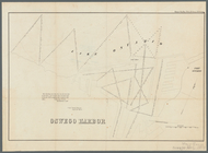
Oswego Harbor, 33d Congress, …
note:
Shows Fort
Ontario
m
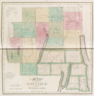
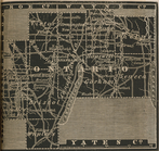
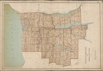
Map of
Ontario
County, New York
m
Map of Blackburn's addition to
Ontario
, San
abstract:
…'s addition to
Ontario
Map of the meetings constitut…
note:
… and
Ontario
.
… and New York
Ontario
note:
…
Ontario
, Canada.
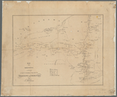
Chart of Lake
Ontario
… and New York
Ontario
note:
…
Ontario
, Canada.
… in the county of
Ontario
note:
…, Lake
Ontario
Rochester and
Ontario
beach quadrangles
note:
… and
Ontario
beach quadrangles
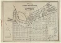
Port
Ontario
[Village]; Port
Ontario
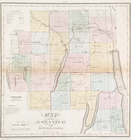
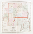
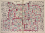
Map of the counties of
Ontario
& Yates
Map of the counties of
Ontario
& Yates
Map of the counties of
Ontario
& Yates
Map of the northern part of t…
note:
Shows part of Southern
Ontario
.
Ontario
County.
… and
Ontario
m
… the Lakes Erie &
Ontario
note:
…) on Lake
Ontario
through
m
Lloyd's new county map of the…
note:
For Canada, covers southern Quebec and
Ontario
.
Colton's new railroad & count…
note:
For Canada, covers southern
Ontario
, southern
… : from Lake
Ontario
Map of the routes through the…
Part of North America: showin…
note:
… for the government of
Ontario
Tenth l. h. district
Map of the routes through the…
Ontario
Center [Village]; Marion (Town
Ontario
[Village]; Furnaceville [Village]; Marion
… [Map of Wayne,
Ontario
… Superior,
Ontario
, Dominion
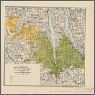
Geological map showing the di…
… Courtlandt Ave.,
Ontario
Ave.]
Map of the mouth of big Sandy…
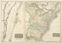
A new map of Upper & Lower Ca…
….,
Ontario
Ave.]
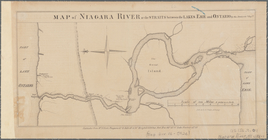
Map of Niagara Falls, suspens…
Ohio boundary, no. 111, south…
A new and accurate map of the…
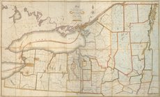
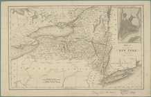
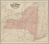
Map of the state of New York …
Monroe, Livingston, Allegany, Wayne,
Ontario
m
Map of Geneva,
Ontario
Co., N.Y.
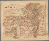
Map of New York
note:
… southern
Ontario
.
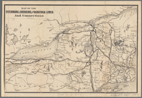
Map of the Fitchburg, Cheshir…
note:
… southern
Ontario
and Quebec
South West-Virginia mineral r…
abstract:
…
Ontario
and south to New
Revised map of the rail roads…
note:
… southern
Ontario
and Quebec.
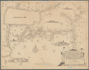
A mappe of Colonel Römers voy…
note:
… (i.e. Lake
Ontario
).
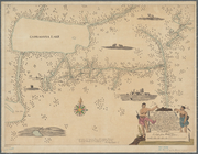
A mappe of Colonel Römers voy…
note:
… Lake (i.e. Lake
Ontario
).
Map of the state of New York:…
abstract:
… southern
Ontario
and Quebec