Click to visit the main New York Public Library Homepage
The New York Public Library
Digital Collections
About Digital Collections
Browse
Search only public domain materials
Items
Collections
Divisions
Home
Search
Browse
About
Search only public domain materials
Items
Collections
Divisions
Digital Collections
Using Images
Using Data
Search
Filtered keyword search
Show filters
Hide filters
Show Only Public Domain
topic
Nautical charts
156
Harbors
32
Coasts
26
Navigation
24
Discovery and exploration
9
More
Less
name
United States Coast Survey
150
Bache, A. D. (Alexander Dallas), 1806-1867
135
Mathiot, G
36
Alden, James, 1810-1877
31
Maffitt, John Newland, 1819-1886
23
More
Less
collection
Maps of North America
199
Lawrence H. Slaughter Collection of English maps, charts, globes, books and atlases
29
Maps of Europe
16
John H. Levine Collection
11
Terzo volvme delle navigationi et viaggi: nel qvale si contengono le nauigationi al mondo nuouo, alli antichi incognito, fatte da don Christoforo Colombo Genouese, che fu il primo à scoprirlo à i Re Catholici, detto hora le Indie occidentali, con gli acquisti fatti da lui, et accresciuti poi da Fernando Cortese, da Francesco Pizzarro, & altri valorosi capitani, in diuerse parti delle dette Indie, in nome della Ces. Maes
6
More
Less
place
North America
33
California
25
Virginia
25
Florida
24
North Carolina
20
More
Less
genre
x
Maps
Nautical charts
139
Bathymetric maps
72
Topographic maps
10
Prints
7
More
Less
publisher
U.S. Coast Survey
73
U.S. Coast Survey Office
48
United States Coast Survey
14
Nella stamperia de Givnti
6
Northern Transcontinental Survey?
6
More
Less
division
Map Division
265
Rare Book Division
10
Wallach Division: Print Collection
5
Schomburg Manuscripts, Archives and Rare Books Division
3
General Research Division
2
More
Less
type
cartographic
288
still image
10
text
10
Date Range
to
289 results found for:
x
Parties
Filtering on:
x
Genre
: Maps
Sort by:
Relevance
Title
Date created
Date digitized
Sequence
… principales
parties
:…
use:
Can be sold through 3rd
party
print
Dominii Veneti in Italia.
use:
Can be sold through 3rd
party
print
Nova Italiae Descriptio, in R…
use:
Can be sold through 3rd
party
print
… principales
parties
use:
Can be sold through 3rd
party
print
… principales
parties
, ou sont
use:
Can be sold through 3rd
party
print
Carte pour servir a l'itenera…
use:
Can be sold through 3rd
party
print
Carte de la Louisiane et du c…
use:
Can be sold through 3rd
party
print
… principales
parties
.
use:
Can be sold through 3rd
party
print
Carte des
Parties
Centrales Du Sahara et du
use:
Can be sold through 3rd
party
print
… principales
parties
.
use:
Can be sold through 3rd
party
print
… principale
parties
.
use:
Can be sold through 3rd
party
print
… principales
parties
.
use:
Can be sold through 3rd
party
print
… principales
parties
use:
Can be sold through 3rd
party
print
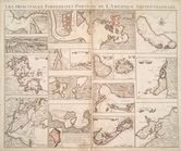
Les principales forteresses, …
use:
Can be sold through 3rd
party
print
… principales
parties
.
use:
Can be sold through 3rd
party
print
Congressional district vote m…
use:
Can be sold through 3rd
party
print
Le Canton de Basile et
parties
des
use:
Can be sold through 3rd
party
print
…
parties
use:
Can be sold through 3rd
party
print
L'Amérique septentrionale : d…
use:
Can be sold through 3rd
party
print
L'Amérique septentrionale : d…
use:
Can be sold through 3rd
party
print
Preliminary chart of the sea …
use:
Can be sold through 3rd
party
print
m
Le royaume d'Angleterre: divi…
use:
Can be sold through 3rd
party
print
Preliminary chart of Nantucke…
use:
Can be sold through 3rd
party
print
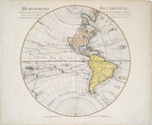
Hemisphere occidental dresse …
use:
Can be sold through 3rd
party
print
… et des
parties
use:
Can be sold through 3rd
party
print
Map of Crazy Mountains and vi…
use:
Can be sold through 3rd
party
print
m
Map of Judith Basin, Montana …
use:
Can be sold through 3rd
party
print
Terra nova, ac maris tractus …
use:
Can be sold through 3rd
party
print
Carte des états-unis indiquan…
use:
Can be sold through 3rd
party
print
… principales
parties
: ou sont
use:
Can be sold through 3rd
party
print
Stono Inlet, South Carolina
use:
Can be sold through 3rd
party
print
m
Preliminary chart of Port Roy…
use:
Can be sold through 3rd
party
print
[Photographic copy of a print…
use:
Can be sold through 3rd
party
print
Preliminary chart of Bull's B…
use:
Can be sold through 3rd
party
print
Map of Colville Region, Washi…
use:
Can be sold through 3rd
party
print
Sketch of Frying-Pan Shoals a…
use:
Can be sold through 3rd
party
print
Preliminary chart of Kennebec…
use:
Can be sold through 3rd
party
print
Preliminary chart of St. John…
use:
Can be sold through 3rd
party
print
Preliminary chart of Port Roy…
use:
Can be sold through 3rd
party
print
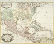
Carte du Mexique et de la Flo…
use:
Can be sold through 3rd
party
print
m
Rand, McNally & Co.'s new bus…
use:
Can be sold through 3rd
party
print
Bass River Harbor, Massachuse…
use:
Can be sold through 3rd
party
print
Preliminary chart of the Rigo…
use:
Can be sold through 3rd
party
print
Carte du Mexique et de la Flo…
use:
Can be sold through 3rd
party
print
Les principales forteresses, …
use:
Can be sold through 3rd
party
print
Preliminary survey of Winyah …
use:
Can be sold through 3rd
party
print
Map of Yakima Region, Washing…
use:
Can be sold through 3rd
party
print
Forest map of the Yakima Regi…
use:
Can be sold through 3rd
party
print
Preliminary chart of York Riv…
use:
Can be sold through 3rd
party
print
Explorations in Alaska, 1898 …
use:
Can be sold through 3rd
party
print
1
2
Previous
Next
1
2
Previous
Next