Click to visit the main New York Public Library Homepage
The New York Public Library
Digital Collections
About Digital Collections
Browse
Search only public domain materials
Items
Collections
Divisions
Home
Search
Browse
About
Search only public domain materials
Items
Collections
Divisions
Digital Collections
Using Images
Using Data
Search
Filtered keyword search
Show filters
Hide filters
Show Only Public Domain
topic
Nautical charts
10
Coasts
3
Harbors
3
Railroads
2
Administrative and political divisions
1
More
Less
name
Throop, John Peter Van Ness, 1794-approximately 1861
13
United States Coast Survey
10
Bache, A. D. (Alexander Dallas), 1806-1867
8
Mathiot, G
5
Alden, James, 1810-1877
3
More
Less
collection
Maps of North America
13
Maps of New York City and State
1
place
Massachusetts
3
North Carolina
3
Oregon
3
New England
2
New York (State)
2
More
Less
genre
x
Maps
Nautical charts
9
Bathymetric maps
2
Strip maps
1
coastal charts
1
publisher
U.S. Coast Survey
4
U.S. Coast Survey Office
4
Nathan Hale
2
U. S. Coast Survey Office
2
J.H. Lant
1
More
Less
division
Map Division
14
type
cartographic
14
Date Range
to
14 results found for:
x
Van Ness
Filtering on:
x
Genre
: Maps
Sort by:
Relevance
Title
Date created
Date digitized
Sequence
m
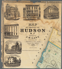
Map of the City of Hudson, N.…
note:
surveyed by Sherman
Van
Ness
; drawn
A map of the New England stat…
A map of the New England stat…
m
Plan of a survey for a rail-r…
Preliminary chart of Portland…
Preliminary chart of Monomoy …
Reconnaissance of the western…
Preliminary chart of lower pa…
Reconnaissance of the western…
Preliminary chart of entrance…
Preliminary chart of Frying P…
Preliminary survey of harbors…
Preliminary chart of Muskeget…
Preliminary chart of Beaufort…
End of results
|
Top