Click to visit the main New York Public Library Homepage
The New York Public Library
Digital Collections
About Digital Collections
Browse
Search only public domain materials
Items
Collections
Divisions
Home
Search
Browse
About
Search only public domain materials
Items
Collections
Divisions
Digital Collections
Using Images
Using Data
Search
Filtered keyword search
Show filters
Hide filters
Show Only Public Domain
topic
Boundaries
4
Indian land transfers
1
Indians of North America
1
Railroads
1
Rivers
1
More
Less
name
Connecticut. Commission on Boundary between the States of New York and Connecticut
4
New York (State), Commissioners on the New York and Connecticut Boundary
4
Stephenson, John L., 1821-1862
4
Wentz, C. W. (Charles Wesley), 1817-1884
4
New York (State). Legislature. Senate
3
More
Less
collection
Maps of New York City and State
4
Maps of North America
2
place
Connecticut
4
New York (State)
4
New York Region
2
Byram River (N.Y. and Conn.)
1
Indiana
1
More
Less
genre
x
Maps
Topographic maps
1
publisher
The Commissioners
4
Government Printing Office
1
The Survey
1
division
Map Division
6
type
cartographic
6
Date Range
to
6 results found for:
x
Wesley, Charles
Filtering on:
x
Genre
: Maps
Sort by:
Relevance
Title
Date created
Date digitized
Sequence
Map of the boundary between t…
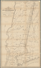
Map of the State of Indiana :…
Map of Utah territory: repres…
note:
Compiled and drawn by
Charles
Mahon [and others
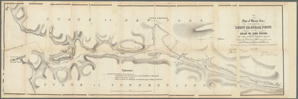
Map of Byram River from its m…
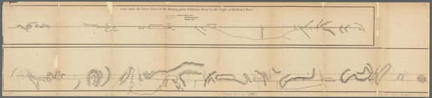
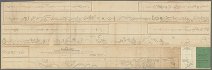
Diagrams of the New-York and …
m
Diagrams of the New-York and …