Click to visit the main New York Public Library Homepage
The New York Public Library
Digital Collections
About Digital Collections
Browse
Search only public domain materials
Items
Collections
Divisions
Home
Search
Browse
About
Search only public domain materials
Items
Collections
Divisions
Digital Collections
Using Images
Using Data
Search
Filtered keyword search
Show filters
Hide filters
Show Only Public Domain
topic
Nautical charts
11
Landowners
4
Real property
4
Administrative and political divisions
3
Buildings
3
More
Less
name
New York (N.Y.). Department of Parks. Topographical Division
29
Fisher, Joshua, 1707-1783
5
H.F. Walling's Map Establishment
3
Seller, John, active 1658-1698
3
Walling, Henry Francis, 1825-1888
3
More
Less
collection
Atlases of New York City
29
Maps of North America
14
Lawrence H. Slaughter Collection of English maps, charts, globes, books and atlases
10
Maps of New York City and State
3
Atlases of the United States
2
More
Less
place
Central Park (New York, N.Y.)
29
Maps
7
New Jersey
7
Delaware
6
Delaware Bay (Del. and N.J.)
6
More
Less
genre
x
Maps
Topographic maps
29
Cadastral maps
4
Pictorial works
4
Early works to 1800
3
More
Less
publisher
The Division
29
Published ... by Andrew Dury, Duke's Court, St. Martins Lane
2
Smith, Gallup & Co
2
... Sold by R. Eynon, behind the Royal Exchange,
1
... W. Hawkes (successor to T. Kitchin), No. 59, Holborn Hill
1
More
Less
division
Map Division
62
type
cartographic
61
still image
3
text
1
Date Range
to
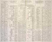
62 results found for:
x
Work tables
Filtering on:
x
Genre
: Maps
Sort by:
Relevance
Title
Date created
Date digitized
Sequence
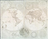
Tabula geographica universi t…
collection:
… the
work
is principally
A general map of the world, o…
note:
Includes text, diagrams, and
tables
.
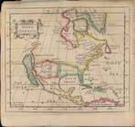
North America
collection:
… : with geographical
tables
, explaining
A new map of the whole contin…
note:
… & Hudsons bays,"
tables
m
Map of Pennsylvania
note:
…
works
and population
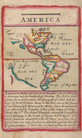
America.
note:
In this edition, the lunar
table
is dated
Map of water shed of Housaton…
note:
… of the consulting Engineers,
tables
Hydrographic map of Lake Beul…
note:
…. Smith, c.e. ; field
work
m
Topographical map of the coun…
note:
…"Field
work
under the direction of L.H. Eaton
Reconnaissance of the harbors…
note:
…. The sketch
work
of the shore
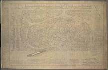
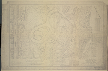
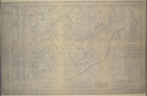
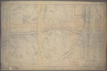
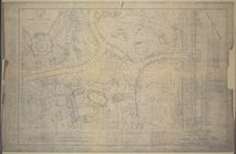
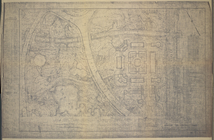
M-T-10-100: Index Map of Cent…
note:
Shows public
works
facilities, buildings, rock
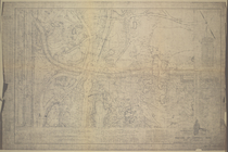
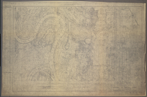
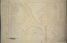
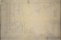
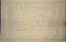
M-T-10-101: [Bounded by West …
note:
Shows public
works
facilities, buildings, rock
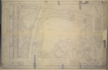
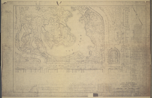
M-T-10-117: [Bounded by Centr…
note:
Shows public
works
facilities, buildings, rock
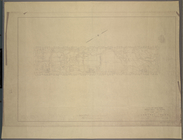
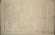
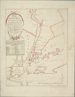
The Country twenty five miles…
note:
… "Chronological
table
of the most
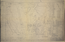
M-T-10-102: [Bounded by East …
note:
Shows public
works
facilities, buildings, rock
M-T-10-103: [Bounded by West …
note:
Shows public
works
facilities, buildings, rock
M-T-10-104: [Bounded by East …
note:
Shows public
works
facilities, buildings, rock
M-T-10-105: [Bounded by West …
note:
Shows public
works
facilities, buildings, rock
M-T-10-106: [Bounded by North…
note:
Shows public
works
facilities, buildings, rock
M-T-10-107: [Bounded by West …
note:
Shows public
works
facilities, buildings, rock
M-T-10-108: [Bounded by North…
note:
Shows public
works
facilities, buildings, rock
M-T-10-109: [Bounded by West …
note:
Shows public
works
facilities, buildings, rock
M-T-10-110: [Bounded by Bridl…
note:
Shows public
works
facilities, buildings, rock
M-T-10-111: [Bounded by West …
note:
Shows public
works
facilities, buildings, rock
M-T-10-112: [Bounded by Bridl…
note:
Shows public
works
facilities, buildings, rock
M-T-10-113: [Bounded by West …
note:
Shows public
works
facilities, buildings, rock
M-T-10-114: [Bounded by Bridl…
note:
Shows public
works
facilities, buildings, rock
M-T-10-115: [Bounded by West …
note:
Shows public
works
facilities, buildings, rock
M-T-10-116: [Bounded by East …
note:
Shows public
works
facilities, buildings, rock
M-T-10-118: [Bounded by East …
note:
Shows public
works
facilities, buildings, rock
M-T-10-119: [Bounded by West …
note:
Shows public
works
facilities, buildings, rock
M-T-10-120: [Bounded by (The …
note:
Shows public
works
facilities, buildings, rock
M-T-10-121: [Bounded by West …
note:
Shows public
works
facilities, buildings, rock
M-T-10-122: [Bounded by (The …
note:
Shows public
works
facilities, buildings, rock
M-T-10-123: [Bounded by West …
note:
Shows public
works
facilities, buildings, rock
M-T-10-124: [Bounded by (The …
note:
Shows public
works
facilities, buildings, rock
M-T-10-125: [Bounded by West …
note:
Shows public
works
facilities, buildings, rock
M-T-10-126: [Bounded by (The …
note:
Shows public
works
facilities, buildings, rock
M-T-10-127: [Bounded by Colum…
note:
Shows public
works
facilities, buildings, rock
M-T-10-128: [Bounded by (The …
note:
Shows public
works
facilities, buildings, rock
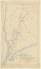
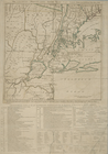
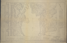
A chart of Delaware Bay and R…
note:
Includes tide-
table
and list of pilots
A chart of Delaware Bay and R…
note:
Includes tide-
table
and list of pilots
An accurate map of Staten Isl…
note:
Includes distance
table
.
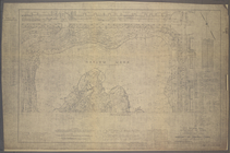
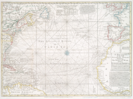
A new chart of the vast Atlan…
note:
Includes text, notes, and "A
table
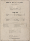
Table
of Contents.
topic:
Pictorial
works
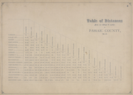
Table
of Distances from one Village
topic:
Pictorial
works
A chart of Delaware Bay and R…
note:
Includes list of subscribers and "Tide
table
."…
A chart of Delaware Bay and R…
note:
Includes list of subscribers and "Tide
table
."…
A new chart of the vast Atlan…
note:
Includes notes and "A
table
comparing
A chart of Delaware Bay and R…
note:
Includes text and "Tide
table
."…