Click to visit the main New York Public Library Homepage
The New York Public Library
Digital Collections
About Digital Collections
Browse
Search only public domain materials
Items
Collections
Divisions
Home
Search
Browse
About
Search only public domain materials
Items
Collections
Divisions
Digital Collections
Using Images
Using Data
Search
Filtered keyword search
Show filters
Hide filters
Show Only Public Domain
topic
Real property
78
Fire insurance
66
Cities & towns
65
City planning
7
Discovery and exploration
1
More
Less
name
Sanborn Map Company
66
New York (N.Y.). Common Council
7
G.W. Bromley & Co
6
Ullitz, Hugo
4
E. Belcher Hyde Map Company
3
More
Less
collection
Atlases of New York City
84
Maps of New York City and State
9
Atlases of the United States
2
Lawrence H. Slaughter Collection of English maps, charts, globes, books and atlases
2
Maps of North America
2
More
Less
place
New York (State)
80
New York
12
New York (N.Y.)
11
Central Park (New York, N.Y.)
9
Manhattan (New York, N.Y.)
6
More
Less
genre
x
Maps
Topographic maps
3
Atlases
2
Manuscript maps
1
publisher
Sanborn Map Company
66
G.W. Bromley & Co
6
E. Belcher Hyde
2
E. Robinson Co
2
The Division
2
More
Less
division
Map Division
99
General Research Division
1
type
cartographic
99
still image
1
Date Range
to
100 results found for:
x
sel_id:61
Filtering on:
x
Genre
: Maps
Sort by:
Relevance
Title
Date created
Date digitized
Sequence
Plate
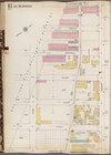
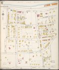
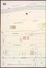
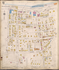
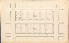
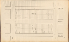
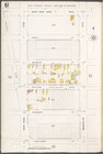
61
m
Ide
's map of Montana …
Gazetteer of New York [
61
]
Plate
61
, Part of Section 3
From Philadelphia (
61
) to Annapolis, Md.
Plate
61
, Part of Section 3
Plate
61
, Part of Section 3
… 1860-
61
… of the surveyor general 1860-
61
Double Page Plate No.
61
, Part of Ward
Richmond, Plate No.
61
[Map bounded
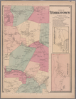
Plate
61
: Town of Yorktown, Westerchester Co
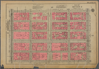
Manhattan, V. 11, Plate No.
61
[Map
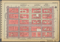
Manhattan, V. 5, Plate No.
61
[Map
Queens V. 5, Plate No.
61
[Map bounded
Map of water front from 61st …
collection:
Map of water front from
61
st to 92nd
m
Plates
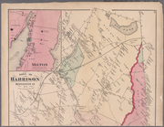
61
& 62: Town of Harrison
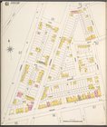
Brooklyn Plate No.
61
[Map bounded
Queens V. 3, Plate No.
61
[Map bounded
Staten Island, V. 1, Plate No.
61
[Map
Manhattan, V. 7, Plate No.
61
[Map
Staten Island, V. 1, Plate No.
61
[Map
Brooklyn Vol. A Plate No.
61
[Map
Brooklyn V. 7, Plate No.
61
[Map
Brooklyn V. 3, Plate No.
61
[Map
Brooklyn V. 4, Plate No.
61
[Map
Brooklyn V. 8, Plate No.
61
[Map
first:
7b040661-6842-
61
e2-e040-e00a1806661d
Brooklyn V. 9, Plate No.
61
[Map
Brooklyn V. 12, Plate No. 98 …
collection:
… bounded by Bay Parkway,
61
Queens V. 2, Plate No.
61
[Map bounded
Queens V. 3, Plate No.
61
[Map bounded
Queens V. 10, Plate No.
61
[Map bounded
Manhattan, V. 1, Plate No.
61
[Map
Bronx, V. 18, Plate No.
61
[Map bounded
Bronx, V. A, Plate No.
61
[Map bounded
Brooklyn V. 2, Plate No.
61
[Map
Brooklyn V. 3, Plate No.
61
[Map
Queens V. 4, Plate No.
61
[Map bounded
Brooklyn V. 3, Double Page Plate No.
61
Bronx, V. A, Plate No.
61
[Map bounded
Central Park Planning Map No.…
parent:
fffe1a40-0f
61
-0132-15fa-58d385a7bbd0
Central Park Planning Map No.…
collection:
… by
61
st Street, 6th
Central Park Planning Map No.…
collection:
… Avenue,
61
st Street and 8
Central Park Planning Map No.…
collection:
th Avenue,
61
st
Brooklyn V. 10, Plate No.
61
[Map
Brooklyn V. 12, Plate No. 99 …
collection:
… bounded by
61
st St., Bay
Central Park Planning Map No.…
collection:
… by
61
st Street, 5th
Queens V. 8, Plate No.
61
[Map bounded
Bronx, V. 9, Plate No.
61
[Map bounded
Manhattan V. 7, Plate No.
61
[Map