Click to visit the main New York Public Library Homepage
The New York Public Library
Digital Collections
About Digital Collections
Browse
Search only public domain materials
Items
Collections
Divisions
Home
Search
Browse
About
Search only public domain materials
Items
Collections
Divisions
Digital Collections
Using Images
Using Data
Search
Filtered keyword search
Show filters
Hide filters
Show Only Public Domain
topic
Real property
15
Business enterprises
10
Topographic maps
7
Antiquities
1
Asylums
1
More
Less
name
Wm. Stewart, Publisher
7
Jomard, M. (Edme-François), 1777-1862
5
Napoleon I, Emperor of the French, 1769-1821
5
Stone & Stewart
4
Stone, C. K
4
More
Less
collection
Atlases of the United States
16
Description de l'Égypte: ou, Recueil des observations et des recherches qui ont été faites en Égypte pendant l'expédition de l'armée française
5
I. N. Phelps Stokes Collection of American Historical Prints
3
Abydos; description des fouilles exécutées sur l'emplacement de cette ville ..
1
Plates illustrative of the researches and operations of G. Belzoni in Egypt and Nubia
1
More
Less
place
New York (State)
17
Egypt
8
Chautauqua County
7
Chautauqua County (N.Y.)
7
Oswego County
4
More
Less
genre
x
Prints
Atlases
16
Illustrations
7
Maps
5
Topographic maps
1
publisher
Impr. impériale
5
C. K. Stone
4
Stone & Stewart
3
Apresso Stefano Scolari a S. Zul. Marco Sadeler
1
Faden, William
1
More
Less
division
Map Division
16
Rare Book Division
6
General Research Division
3
Wallach Division: Print Collection
3
Wallach Division: Picture Collection
1
type
cartographic
21
still image
10
text
1
Date Range
to
29 results found for:
x
Topographic maps
Filtering on:
x
Genre
: Prints
Sort by:
Relevance
Title
Date created
Date digitized
Sequence
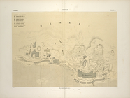
Abydos. Plan topographique de…
topic:
Topographic
maps
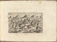
View of Jerusalem
Environs de Soueys [Suez]. 1.…
topic:
Topographic
maps
Antinoë [Antinoöpolis]. 1. Pl…
topic:
Topographic
maps
Babylone. Plan, vue et détail…
topic:
Topographic
maps
Alexandrie [Alexandria]. Plan…
topic:
Topographic
maps
Topographical
map
of the valley of Biban el Malook
topic:
Topographic
maps
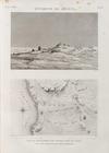
Isthme de Soueys [Isthmus of …
topic:
Topographic
maps
Topographical
map
of the city and county of New
collection:
Topographical
map
of the city and county
A
topographical
map
of the northn. part of New York
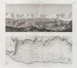
Fort Bridger, Black's Fork of…
note:
… of
Topographical
Engineers, 1852
Topographical
map
of the northern part of New York
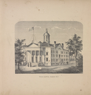
State Capitol, Albany N.Y.
collection:
New
topographical
atlas of the counties
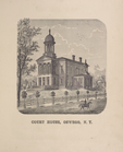
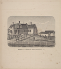
Court House, Oswego, N.Y.
collection:
New
topographical
atlas of Oswego County
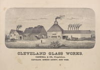
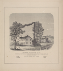
Cleveland Glass Works. Caswel…
collection:
New
topographical
atlas of Oswego County
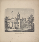
State Capitol, Albany, N.Y.
collection:
New
topographical
atlas of Schoharie Co
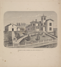
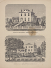
Residence of A. Burdick, Esq.…
collection:
New
topographical
atlas of Oswego County
Union Glass Company. Establis…
collection:
New
topographical
atlas of Oswego County
Residence of James Carrigan, …
collection:
New
topographical
atlas of Saratoga Co
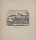
Residence of S.W. Mason, Esq.…
collection:
New
topographical
atlas of Chautauqua
Residence of George W. Holt, …
collection:
New
topographical
atlas of Chautauqua
Residence of John R. Robertso…
collection:
New
topographical
atlas of Chautauqua
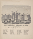
New York State Inebriate Asyl…
collection:
New
topographical
atlas of Tompkins County
Residence of Benson Buck, Esq…
collection:
New
topographical
atlas of Tompkins County
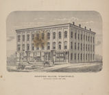
Brewer Block, Westfield, Chau…
collection:
New
topographical
atlas of Chautauqua
Residence Of John H. Milton, …
collection:
New
topographical
atlas of Chautauqua
Residence of N.N. Whitaker, E…
collection:
New
topographical
atlas of Chautauqua
Howes, Babcock & Co. Foundry …
collection:
New
topographical
atlas of Chautauqua
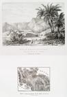
Site et ruines de Feiran (pre…
collection:
… of Feiran; [
Topographical
map
of Wadi Feiran].
End of results
|
Top