Click to visit the main New York Public Library Homepage
The New York Public Library
Digital Collections
About Digital Collections
Browse
Search only public domain materials
Items
Collections
Divisions
Home
Search
Browse
About
Search only public domain materials
Items
Collections
Divisions
Digital Collections
Using Images
Using Data
Search
Filtered search
Show filters
Hide filters
Show Only Public Domain
topic
Real property
228
Educational facilities
124
Elevated railroads
120
Public schools
93
Parks
74
More
Less
name
Sperr, Percy Loomis, 1890-1964
330
G.W. Bromley & Co
151
E. Belcher Hyde Map Company
67
Ullitz, Hugo
67
Bromley, George Washington
63
More
Less
collection
Photographic views of New York City, 1870's-1970's, from the collections of the New York Public Library
571
Atlases of New York City
219
Maps of New York City and State
63
Changing New York
44
Collection of photographs of New York City
19
More
Less
place
x
Bronx (New York, N.Y.)
New York
940
New York (State)
940
New York (N.Y.)
675
Manhattan (New York, N.Y.)
32
More
Less
genre
Photographs
646
Maps
277
Indexes
48
Postcards
5
Manuscript maps
4
More
Less
publisher
G.W. Bromley & Co
151
Hyde & Co
67
Topographical Bureau
6
publisher unknown
5
Museum of the American Indian, Heye Foundation
4
More
Less
division
Milstein Division
591
Map Division
283
Wallach Division: Photography Collection
45
Wallach Division: Picture Collection
9
NYPL Archives
2
More
Less
type
still image
658
cartographic
234
text
53
Date Range
to
940 results found
Filtering on:
x
Place
: Bronx (New York, N.Y.)
x
Place
: New York
Sort by:
Title
Date created
Date digitized
Sequence
The Evening Mail's complete m…
Map of the City of New York a…
Sketch map of the City of New…
Sketch map of the city of New…
Map of the Harlem River and S…
m
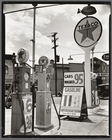
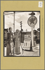
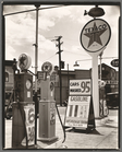
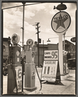
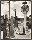
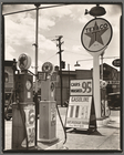
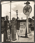
Gasoline station, Tremont Ave…
Williams' map of boroughs of …
Map of boroughs of Manhattan …
m
Hammond's new guide map of Ma…
m
Taunton new guide map and dir…
Map of the 23rd and 24th ward…
m
Robinson's map of New York Ci…
Map of the borough of Manhatt…
m
Street guide of Manhattan and…
Map of the borough of Manhatt…
Greater New York's Census dis…
m
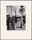
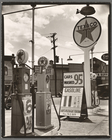
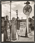
Gasoline station, Tremont Ave…
m
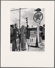
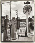
Gasoline station, Tremont Ave…
m
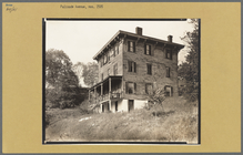
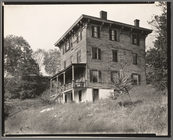
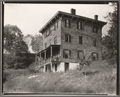
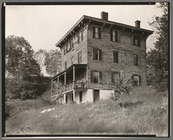
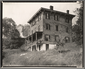
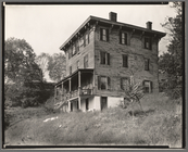
Palisade Avenue No. 2505, Spu…
m
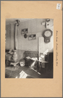
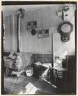
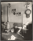
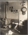
Country Store: interior, Ewen…
m
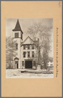
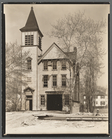
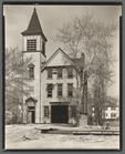
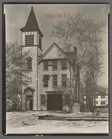
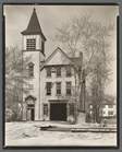
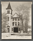
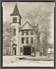
Firehouse #52, Spuyten Duyvil…
m
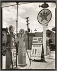
Gasoline station, Tremont Ave…
m
Firehouse #52, Spuyten Duyvil…
m
Firehouse #52, Spuyten Duyvil…
m
Firehouse #52, Spuyten Duyvil…
m
Firehouse #52, Spuyten Duyvil…
m
Firehouse #52, Spuyten Duyvil…
m
Firehouse #52, Spuyten Duyvil…
m
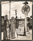
Gasoline station, Tremont Ave…
m
Gasoline station, Tremont Ave…
m
Gasoline station, Tremont Ave…
m
Gasoline station, Tremont Ave…
m
Gasoline station, Tremont Ave…
m
Gasoline station, Tremont Ave…
m
Gasoline station, Tremont Ave…
m
Gasoline station, Tremont Ave…
m
Gasoline station, Tremont Ave…
m
Country Store: interior, Ewen…
m
Gasoline station, Tremont Ave…
m
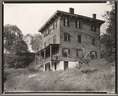
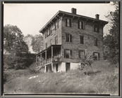
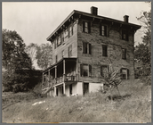
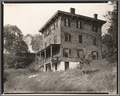
Palisade Avenue No. 2505, Spu…
m
Palisade Avenue No. 2505, Spu…
m
Palisade Avenue No. 2505, Spu…
m
Palisade Avenue No. 2505, Spu…
m
Palisade Avenue No. 2505, Spu…
m
Palisade Avenue No. 2505, Spu…
m
Palisade Avenue No. 2505, Spu…
m
Country Store: interior, Ewen…
m
Country Store: interior, Ewen…
m
Palisade Avenue No. 2505, Spu…
m
Palisade Avenue No. 2505, Spu…
1
2
3
4
Previous
Next
1
2
3
4
Previous
Next