Click to visit the main New York Public Library Homepage
The New York Public Library
Digital Collections
About Digital Collections
Browse
Search only public domain materials
Items
Collections
Divisions
Home
Search
Browse
About
Search only public domain materials
Items
Collections
Divisions
Digital Collections
Using Images
Using Data
Search
Filtered search
Show filters
Hide filters
Show Only Public Domain
topic
Atlases, British
1
name
Jansson, Jan, 1588-1664
2
Blaeu, Joan, 1596-1673
1
Blaeu, Willem Janszoon, 1571-1638
1
Cockerill, Thomas, active 1674-1702
1
Harrison, William, approximately 1750-1803
1
More
Less
collection
x
Lawrence H. Slaughter Collection of English maps, charts, globes, books and atlases
place
x
South Atlantic States -- Maps -- Early works to 1800
Florida -- Maps -- Early works to 1800
3
North Carolina
3
Virginia -- Maps -- Early works to 1800
3
Georgia -- Maps -- Early works to 1800
2
More
Less
genre
Maps
5
publisher
Ioannem Ianssonium?,
1
J. and C. Blaeu,
1
Printed by H. Hondius and J. Johnson,
1
Printed for Robert Morden and Thomas Cockeril, at the Atlas in Cornhill, and at the Three Legs in the Poultrey, over against the Stocks-Market
1
Publish'd by John Stockdale,
1
division
Map Division
5
type
cartographic
5
Date Range
to
5 results found
Filtering on:
x
Place
: South Atlantic States -- Maps -- Early works to 1800
x
Collection
: Lawrence H. Slaughter Collection of English maps, charts, globes, books and atlases
For more collection details, visit the
Lawrence H. Slaughter Collection of English maps, charts, globes, books and atlases collection page
.
Sort by:
Title
Date created
Date digitized
Sequence
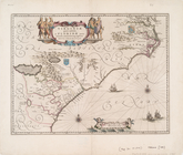
Virginiae partis australis, e…
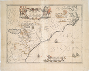
Virginiae partis australis et…
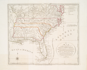
A map of the states of Virgin…
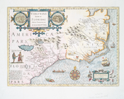
Virginiae item et Floridae Am…
Carolina, Virginia, Mary Land…