Click to visit the main New York Public Library Homepage
The New York Public Library
Digital Collections
About Digital Collections
Browse
Search only public domain materials
Items
Collections
Divisions
Home
Search
Browse
About
Search only public domain materials
Items
Collections
Divisions
Digital Collections
Using Images
Using Data
Search
Filtered keyword search
Show filters
Hide filters
Show Only Public Domain
topic
Real property
1826
Business enterprises
467
Description and travel
165
History
93
Geography
63
More
Less
name
Beers, F. W. (Frederick W.)
492
Everts, Ensign & Everts
231
Hyde, E. Belcher
175
Beers, D. G. (Daniel G.)
172
F.W. Beers & Co
168
More
Less
collection
Atlases of the United States
2915
Atlases of New York City
175
Maps of North America
73
Lawrence H. Slaughter Collection of English maps, charts, globes, books and atlases
71
Atlases, gazetteers, guidebooks and other books
23
More
Less
place
New York (State)
1902
Westchester County (N.Y.)
223
Erie County (N.Y.)
197
Suffolk County (N.Y.)
181
New Jersey
158
More
Less
genre
Maps
3071
Atlases
2907
Prints
71
Surveys
54
Plans
44
More
Less
publisher
F. W. Beers & Co
148
E. Belcher Hyde
119
E. Belcher-Hyde
112
Century Map Company
111
Everts, Ensign & Everts
99
More
Less
division
Map Division
3275
type
cartographic
3134
text
187
still image
12
Date Range
to
Looking for this collection?
Atlases of the United States
3,868 items
3,275 results found for:
x
county atlas
Filtering on:
x
Location
: Map Division
For more division details, visit the
Lionel Pincus and Princess Firyal Map Division division page
.
Sort by:
Relevance
Title
Date created
Date digitized
Sequence
Results 751 - 800
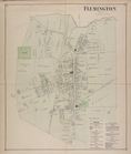
Flemington [Village]; Fleming…
collection:
Atlases
of the United States
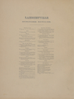
Lambertville Business Notices.
collection:
Atlases
of the United States
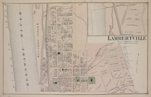
North Part of Lambertville [V…
collection:
Atlases
of the United States
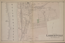
South Part of Lambertville [V…
collection:
Atlases
of the United States
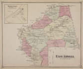
East Amwell [Township]; Werts…
collection:
Atlases
of the United States
Index
collection:
Atlases
of the United States
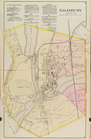
Salisbury, Wicomico Co.
collection:
Atlases
of the United States
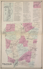
North Chatham [Village]; Chat…
collection:
Atlases
of the United States
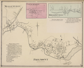
Hollowville [Village]; Hollow…
collection:
Atlases
of the United States
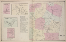
Charyville [Village]; Copake …
collection:
Atlases
of the United States
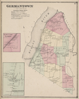
Germantown [Township]; German…
collection:
Atlases
of the United States
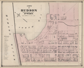
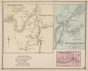
City of Hudson Built Up Porti…
collection:
Atlases
of the United States
Livington [Township]; Glenco …
collection:
Atlases
of the United States
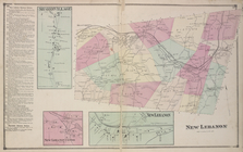
New Lebanon Business Notices;…
collection:
Atlases
of the United States
Columbianville & Stockport [V…
collection:
Atlases
of the United States
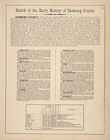
Sketch of the Early History of Chemung
County
collection:
Atlases
of the United States
Map of Saratoga
County
collection:
Atlases
of the United States
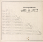
Table of Distances in Saratoga
County
collection:
Atlases
of the United States
…
County
, York Town, Hudson
collection:
Atlases
of the United States
…
County
, North Salem]
collection:
Atlases
of the United States
Union
County
, Double Page Plate No. 12
note:
from maps and data by Jacob L. Bauer,
County
Union
County
, Double Page Plate No. 16
note:
from maps and data by Jacob L. Bauer,
County
Union
County
, Double Page Plate No. 19
note:
from maps and data by Jacob L. Bauer,
County
Union
County
, Double Page Plate No. 23
note:
from maps and data by Jacob L. Bauer,
County
Union
County
, Double Page Plate No. 27
note:
from maps and data by Jacob L. Bauer,
County
Union
County
, Double Page Plate No. 29
note:
from maps and data by Jacob L. Bauer,
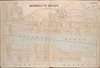
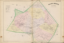
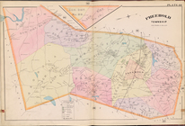
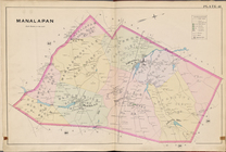
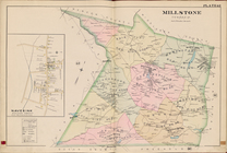
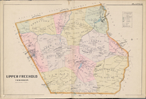
County
Monmouth
County
, Double Page Plate No. 5
collection:
Atlases
of the United States
Monmouth
County
, Double Page Plate No. 6
collection:
Atlases
of the United States
Monmouth
County
, Double Page Plate No. 7
collection:
Atlases
of the United States
Monmouth
County
, Double Page Plate No. 13
collection:
Atlases
of the United States
Monmouth
County
, Double Page Plate No. 26
collection:
Atlases
of the United States
Monmouth
County
, Double Page Plate No. 30
collection:
Atlases
of the United States
Monmouth
County
, Double Page Plate No. 32
collection:
Atlases
of the United States
Monmouth
County
, Double Page Plate No. 34
collection:
Atlases
of the United States
Monmouth
County
, Double Page Plate No. 35
collection:
Atlases
of the United States
Monmouth
County
, Double Page Plate No. 36
collection:
Atlases
of the United States
Monmouth
County
, Double Page Plate No. 37
collection:
Atlases
of the United States
Monmouth
County
, Double Page Plate No. 38
collection:
Atlases
of the United States
Monmouth
County
, Double Page Plate No. 39
collection:
Atlases
of the United States
Monmouth
County
, Double Page Plate No. 40
collection:
Atlases
of the United States
Monmouth
County
, Double Page Plate No. 41
collection:
Atlases
of the United States
Monmouth
County
, Double Page Plate No. 42
collection:
Atlases
of the United States
Monmouth
County
, Double Page Plate No. 43
collection:
Atlases
of the United States
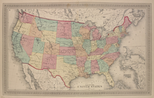
Map of The United States
collection:
Atlases
of the United States
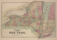
Plan of The State of New York
collection:
Atlases
of the United States
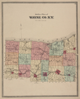
Outline Plan of Wayne Co., N.…
collection:
Atlases
of the United States
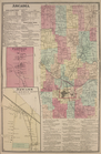
Arcadia [Township]; Arcadia B…
collection:
Atlases
of the United States
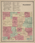
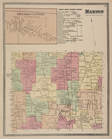
Macedon (Town) Business Notic…
collection:
Atlases
of the United States
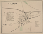
Macedon [Village]; Macedon (V…
collection:
Atlases
of the United States
Ontario Center [Village]; Mar…
collection:
Atlases
of the United States
1
2
3
4
5
6
7
8
9
10
…
13
14
Previous
Next
1
2
3
4
5
6
7
8
9
10
…
13
14
Previous
Next