Click to visit the main New York Public Library Homepage
The New York Public Library
Digital Collections
About Digital Collections
Browse
Search only public domain materials
Items
Collections
Divisions
Home
Search
Browse
About
Search only public domain materials
Items
Collections
Divisions
Digital Collections
Using Images
Using Data
Search
Filtered keyword search
Show filters
Hide filters
Show Only Public Domain
topic
Business enterprises
41
Real property
41
name
x
Bourquin, F. (Frederick), 1808-
D.G. Beers & Co
41
Worley & Bracher
41
collection
x
Atlases of the United States
place
Columbia County
41
Columbia County (N.Y.)
41
New York (State)
41
genre
Atlases
41
Maps
35
Title pages
1
publisher
D. G. Beers & Co
41
division
Map Division
41
type
cartographic
35
text
6
Date Range
to
41 results found for:
x
county atlas
Filtering on:
x
Name
: Bourquin, F. (Frederick), 1808-
x
Collection
: Atlases of the United States||2600a3f0-c5ec-012f-424e-58d385a7bc34
Sort by:
Relevance
Title
Date created
Date digitized
Sequence
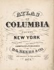
Atlas
of Columbia
County
, New York
collection:
Atlases
of the United States
Index
collection:
Atlases
of the United States
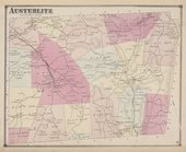
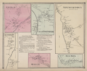
Austerlitz [Township]
collection:
Atlases
of the United States
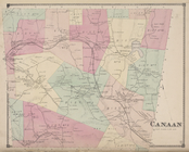
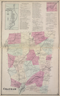
Canaan [Township]
collection:
Atlases
of the United States
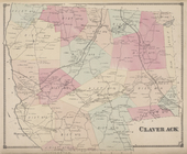
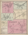
Claverack [Township]
collection:
Atlases
of the United States
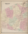
Ghent [Township]
collection:
Atlases
of the United States
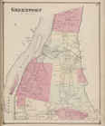
Greenport [Township]
collection:
Atlases
of the United States
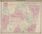
Hillsdale [Township]
collection:
Atlases
of the United States
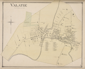
Valatie [Village]
collection:
Atlases
of the United States
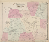
Taghkanic [Township]
collection:
Atlases
of the United States
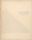
Table of Distances
collection:
Atlases
of the United States
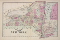
Plan of the State of New York
collection:
Atlases
of the United States
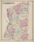
Columbia Co.
collection:
Atlases
of the United States
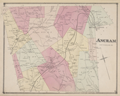
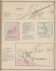
Ancram [Township]
collection:
Atlases
of the United States
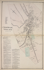
Chatham Village [Village]; Ch…
collection:
Atlases
of the United States
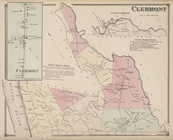
Clermont [Village]; Clermont …
collection:
Atlases
of the United States
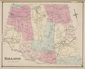
Gallatin [Township]
collection:
Atlases
of the United States
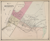
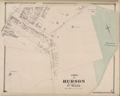
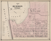
City of Hudson [Township]
collection:
Atlases
of the United States
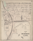
City of Hudson 1st Ward [Town…
collection:
Atlases
of the United States
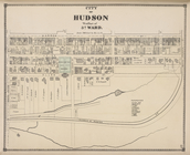
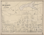
City of Hudson West Part of 3…
collection:
Atlases
of the United States
City of Hudson East Part of 3…
collection:
Atlases
of the United States
City of Hudson West Part of 4…
collection:
Atlases
of the United States
City of Hudson East Part of 4…
collection:
Atlases
of the United States
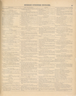
Hudson Business Notices
collection:
Atlases
of the United States
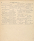
Hudson Business Notices [cont…
collection:
Atlases
of the United States
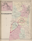
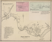
Niverville [Village]; Kinderh…
collection:
Atlases
of the United States
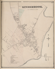
Kinderhook [Village]
collection:
Atlases
of the United States
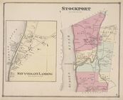
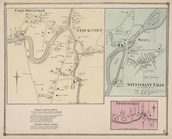
Stuyvesant Landing [Village];…
collection:
Atlases
of the United States
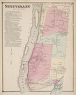
Stuyvesant [Township]; Stuyve…
collection:
Atlases
of the United States
North Chatham [Village]; Chat…
collection:
Atlases
of the United States
Hollowville [Village]; Hollow…
collection:
Atlases
of the United States
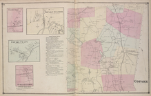
Charyville [Village]; Copake …
collection:
Atlases
of the United States
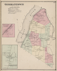
Germantown [Township]; German…
collection:
Atlases
of the United States
City of Hudson Built Up Porti…
collection:
Atlases
of the United States
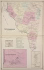
Livington [Township]; Glenco …
collection:
Atlases
of the United States
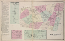
New Lebanon Business Notices;…
collection:
Atlases
of the United States
Columbianville & Stockport [V…
collection:
Atlases
of the United States
… Offices of Columbia
County
collection:
Atlases
of the United States
Malden Bridge [Village]; East…
collection:
Atlases
of the United States
Ghent [Village]; Harlemville …
collection:
Atlases
of the United States
Ancram [Village]; Canaan Four…
collection:
Atlases
of the United States
End of results
|
Top