Click to visit the main New York Public Library Homepage
The New York Public Library
Digital Collections
About Digital Collections
Browse
Search only public domain materials
Items
Collections
Divisions
Home
Search
Browse
About
Search only public domain materials
Items
Collections
Divisions
Digital Collections
Using Images
Using Data
Search
Filtered keyword search
Show filters
Hide filters
Show Only Public Domain
topic
Nautical charts
2
Canals
1
Landowners
1
Real property
1
name
x
Harrison, D. R
Blunt, Edmund, 1799-1866
2
E. & G.W. Blunt (Firm)
2
Hooker, William
2
Farley, John, 1802 or 1803-1874
1
More
Less
collection
Maps of New York City and State
2
Lawrence H. Slaughter Collection of English maps, charts, globes, books and atlases
1
Maps of North America
1
place
Long Island Sound (N.Y. and Conn.)
2
New York (N.Y.)
2
Chesapeake and Ohio Canal (Md. and Washington, D.C.) -- Altitudes -- Charts, diagrams etc
1
Chesapeake and Ohio Canal (Md. and Washington, D.C.) -- Maps
1
Connecticut
1
More
Less
genre
Maps
4
publisher
E. & G.W. Blunt
1
Published & sold by E. & G.W. Blunt, 179 Water Street, corner of Burling Slip,
1
s.n
1
s.n.,
1
division
Map Division
4
type
x
cartographic
Date Range
to
4 results found for:
x
Harrison, D. R
Filtering on:
x
Name
: Harrison, D. R.
x
Type
: cartographic
Sort by:
Relevance
Title
Date created
Date digitized
Sequence
Map of the country between Wa…
parent:
24ac8600-c52b-012f-
d
0a8-3c075448cc4b
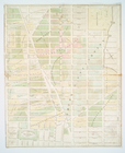
Map of the real estate in the…
parent:
e105fd20-c5aa-012f-ae29-58
d
385a7bc34
Long Island Sound from New Yo…
parent:
594da8c0-c5aa-012f-5dc3-58
d
385a7bc34
Long Island Sound from New Yo…
parent:
92586630-c5
d
5-012f-1c58-58
d
385a7bc34