Click to visit the main New York Public Library Homepage
The New York Public Library
Digital Collections
About Digital Collections
Browse
Search only public domain materials
Items
Collections
Divisions
Home
Search
Browse
About
Search only public domain materials
Items
Collections
Divisions
Digital Collections
Using Images
Using Data
Search
Filtered keyword search
Show filters
Hide filters
Show Only Public Domain
name
x
Thornton, Samuel
collection
Atlases, gazetteers, guidebooks and other books
16
place
English Channel
14
Brittany (France)
6
Normandy (France)
2
Atlantic Ocean
1
Channel Islands
1
More
Less
genre
Maps
16
Nautical charts
16
division
Map Division
16
type
cartographic
16
Date Range
to
16 results found for:
x
Channels
Filtering on:
x
Name
: Thornton, Samuel
Sort by:
Relevance
Title
Date created
Date digitized
Sequence
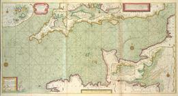
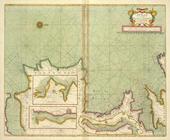
A new and correct draught of the
CHANNELL
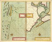
The coast of NORMANDIE from c…
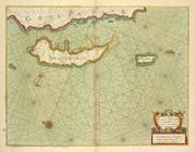
The
channell
of ABBO or UTTOY; A chart
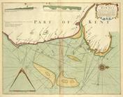
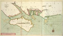
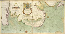
A Large Draught of the DOWNES
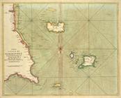
A large draught of the ISLE o…
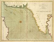
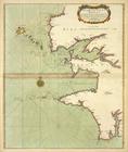
The sea-coasts of FRANCE from…
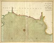
The sea-coast of FRANCE from …
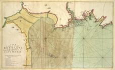
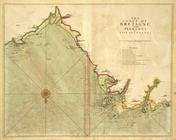
The coast of BRETAGNE from GR…
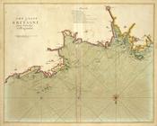
The coast of BRETAGNE from Pl…
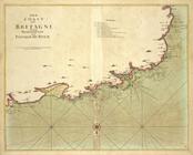
The coast of BRETAGNE from I …
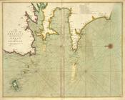
The coast of BRETAGNE from Pl…
The coast of BRETAGNE includi…
A chart of the sea coast from…
… and Antipachfu with
channel
A chart of the sands, shoals,…
A draught of the harbour of B…
End of results
|
Top