Click to visit the main New York Public Library Homepage
The New York Public Library
Digital Collections
About Digital Collections
Browse
Search only public domain materials
Items
Collections
Divisions
Home
Search
Browse
About
Search only public domain materials
Items
Collections
Divisions
Digital Collections
Using Images
Using Data
Search
Filtered search
Show filters
Hide filters
Show Only Public Domain
topic
City planning
944
Social conditions
942
Real property
10
Landowners
6
Fortification
3
More
Less
name
M.I.T. Press
942
New York (N.Y.). City Planning Commission
942
New York (N.Y.). Board of Estimate and Apportionment
2
Rodd, Thomas, 1763-1822
2
A.T. Goodrich & Co
1
More
Less
collection
Atlases of New York City
944
Maps of New York City and State
17
Atlases of the United States
2
Atlases, gazetteers, guidebooks and other books
1
Maps of North America
1
More
Less
place
x
New York (State)
New York
950
New York (N.Y.)
950
Bronx (New York, N.Y.)
2
Islip (N.Y. : Town) -- Maps
2
More
Less
genre
Maps
961
Cadastral maps
4
Prints
3
Atlases
2
Diagrams
2
More
Less
publisher
MIT Press
942
Thomas Rodd
2
A.R.Z. Dawson
1
A.T. Goodrich & Co., No. 124 Broad Way
1
Arbuckle Bros. Coffee Company
1
More
Less
division
Map Division
966
type
x
still image
cartographic
13
text
3
Date Range
to
966 results found
Filtering on:
x
Location
: Map Division
x
Place
: New York (State)
x
Type
: still image
For more division details, visit the
Lionel Pincus and Princess Firyal Map Division division page
.
Sort by:
Title
Date created
Date digitized
Sequence
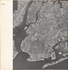
The Narrows tunnel : chart of…
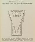
Setback principle
m
Map of Clinton Co., New York:…
m
Map of Dutchess Co., New York…
A map of New England & ye cou…
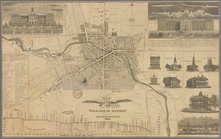
Map of the village of Auburn
m
Stony Point and Verplanck's P…
Town & village of Ovid, Senec…
m
Map of Ontario County, New Yo…
m
Plan and profile showing the …
A geological section of the c…
Map of the village of Hermann…
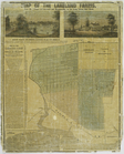
Map of the Lakeland farms, ne…
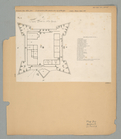
The Fort in New Yorke
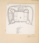
The Fort of Albany
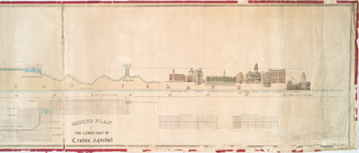
Profile of lower part of Crot…
m
Sketch showing the southern b…
m
Map of Staten Island, or Rich…
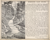
Ensenore Glenn House.; George…
Res. of E. W. Cook, Havana, N…
Reference Plate of Strips for…
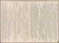
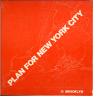
Plan for New york City. 1969.…
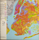
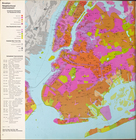
City planning commission
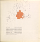
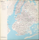
Key map
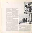
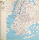
Brooklyn
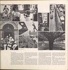
Brooklyn (cont.)
Brooklyn (cont.)
Brooklyn (cont.)
Brooklyn
Brooklyn land use policy
Brooklyn neighborhood improve…
Brooklyn public and publicly …
Brooklyn public schools
Brooklyn Hospitals and Health…
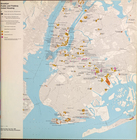
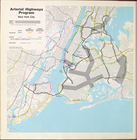
Arterial highways program New…
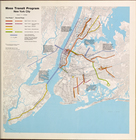
Mass Transit program New York…
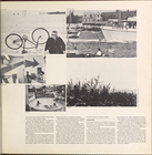
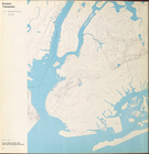
Brooklyn Topography
Cover Page
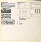
Brooklyn community planning D…
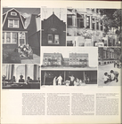
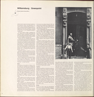
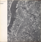
Williamsburg, Greenpoint.
Williamsburg, Greenpoint. (co…
Williamsburg, Greenpoint. (co…
Williamsburg, Greenpoint. (co…
Williamsburg, Greenpoint. (co…
Williamsburg, Greenpoint. (co…
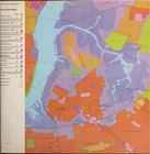
Land use policy
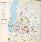
Community resources
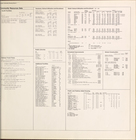
Community resources data
Scheduled new construction
Brooklyn community planning D…
1
2
3
4
Previous
Next
1
2
3
4
Previous
Next