Click to visit the main New York Public Library Homepage
The New York Public Library
Digital Collections
About Digital Collections
Browse
Search only public domain materials
Items
Collections
Divisions
Home
Search
Browse
About
Search only public domain materials
Items
Collections
Divisions
Digital Collections
Using Images
Using Data
Search
Filtered search
Show filters
Hide filters
Show Only Public Domain
topic
Real property
10889
Fire insurance
5305
Cities & towns
5007
City planning
1087
Social conditions
942
More
Less
name
Sanborn Map Company
5108
G.W. Bromley & Co
2551
New York (N.Y.). City Planning Commission
980
M.I.T. Press
942
Bromley, George Washington
857
More
Less
collection
Atlases of New York City
11592
Atlases of the United States
3839
Maps of North America
3345
Maps of New York City and State
2057
Lawrence H. Slaughter Collection of English maps, charts, globes, books and atlases
1248
More
Less
place
New York (State)
13151
New York
4862
New York (N.Y.)
3351
Manhattan (New York, N.Y.)
2239
Brooklyn (New York, N.Y.)
1212
More
Less
genre
Maps
23265
Atlases
3762
Topographic maps
1050
Cadastral maps
594
Nautical charts
394
More
Less
publisher
Sanborn Map Company
5145
G.W. Bromley & Co
2371
MIT Press
942
E. Belcher Hyde
807
K.u.K. Militargeographisches Institut
774
More
Less
division
Map Division
23798
type
cartographic
22270
still image
1222
text
755
Date Range
to
23,798 results found
Filtering on:
x
Location
: Map Division
For more division details, visit the
Lionel Pincus and Princess Firyal Map Division division page
.
Sort by:
Title
Date created
Date digitized
Sequence
Results 1001 - 1050
Our centennial--plan of the g…
Plat of a survey of land "for…
m
Missouri
m
Chicago
Chicago : correctly copied fr…
New and enlarged map of Balti…
Revised design for the improv…
Map showing the boulevards an…
New and enlarged map of Balti…
Map of Chicago and its wester…
Chicago harbor
Subdivision of Block 5 of the…
Map of Jackson Park : showing…
Chicago
The city of Chicago, Cook Co.…
Map of Chicago showing water …
Transportation lines tributar…
Map of the Indiana North and …
State of Indiana
Johnson's Indiana
A sketch of the public survey…
Map of Chicago : showing the …
City of Baltimore
Map of Texas and the countrie…
Bird's eye view of Philadelph…
Map of the territories of Mic…
Hunt's map of Philadelphia : …
Map of the city of Detroit, 1…
m
To the honourable House of Re…
This plan of the city of Phil…
Map of the survey of Wissahic…
Map of part of Marquette Coun…
Geological map of the distric…
Sketch of the public surveys …
m
Map of Michigan & part of Wis…
A.R. Roessler's latest map of…
m
Revised map of the state of T…
To the citizens of Philadelph…
Sketch I, showing the progres…
m
Map of Bates County, Missouri
m
Map of Johnson County, Missou…
m
Map of Pettis County, Missour…
m
Colton's new sectional map of…
m
Wright's map of Kansas City, …
m
Map of the city of St. Louis,…
m
Post route map of the state o…
Horatio Street, Hudson Street…
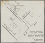
These lots will positively be…
Gansevoort Street, 9th Avenue…
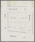
Jane Street, Eighth Avenue, T…
1
2
3
4
5
6
7
8
9
10
…
95
96
Previous
Next
1
2
3
4
5
6
7
8
9
10
…
95
96
Previous
Next