Click to visit the main New York Public Library Homepage
The New York Public Library
Digital Collections
About Digital Collections
Browse
Search only public domain materials
Items
Collections
Divisions
Home
Search
Browse
About
Search only public domain materials
Items
Collections
Divisions
Digital Collections
Using Images
Using Data
Search
Filtered keyword search
Show filters
Hide filters
Show Only Public Domain
topic
Nautical charts
39
Navigation
6
Coasts
4
Harbors
2
Bays
1
More
Less
name
United States Coast Survey
18
Bache, A. D. (Alexander Dallas), 1806-1867
16
Thornton, Samuel
14
Almy, John Jay, 1815-1895
3
Barnard, H. S
3
More
Less
collection
Maps of North America
20
Atlases, gazetteers, guidebooks and other books
14
Lawrence H. Slaughter Collection of English maps, charts, globes, books and atlases
13
Maps of the Oceans
5
Explanations and sailing directions to accompany the Wind and current charts,
1
More
Less
place
x
Atlantic Ocean
North Atlantic Ocean
7
Atlantic Ocean -- Maps -- Early works to 1800
6
Maps
6
Atlantic Coast
5
More
Less
genre
Maps
54
Nautical charts
35
Bathymetric maps
13
Prints
1
Surveys
1
publisher
U.S. Coast Survey
9
United States Coast Survey
5
U.S. Coast Survey Office
3
Anthony Iacobsz op t'Water inde Lootsman,
1
By Ier. Seller and Ch. Price, hydrographers to the Queen at the Hermitage staires,
1
More
Less
division
Map Division
53
General Research Division
1
Wallach Division: Print Collection
1
type
x
cartographic
still image
1
Date Range
to
55 results found for:
x
Nautical charts
Filtering on:
x
Place
: Atlantic Ocean
x
Type
: cartographic
Sort by:
Relevance
Title
Date created
Date digitized
Sequence
Preliminary
chart
of the sea coast of Virginia …
topic:
Nautical
charts
Preliminary
chart
of Stellwagen's Bank
topic:
Nautical
charts
Preliminary sketch of Chincot…
topic:
Nautical
charts
Harbor of Refuge, Dutch Islan…
topic:
Nautical
charts
Middle part of Long Island So…
abstract:
… by soundings. Includes
charts
Sketch of Ocracoke Inlet, Nor…
topic:
Nautical
charts
Reconnoissance of the entranc…
topic:
Nautical
charts
Chart
of Narraganset Bay …
abstract:
Subject:
Nautical
chart
showing the coast
Nantucket Sound: western part
topic:
Nautical
charts
…
chart
for the West
topic:
Nautical
charts
Preliminary
chart
of Port Royal entrance
abstract:
Detailed
nautical
chart
showing Hilton
Preliminary sketch showing th…
note:
Chart
includes Old South Shoal and New
A Generall
chart
topic:
Nautical
charts
Reconnaissance of New River a…
topic:
Nautical
charts
Preliminary sketch showing th…
topic:
Nautical
charts
…
chart
for the West
topic:
Nautical
charts
Ocean Atlantique, ou, Mer du …
topic:
Nautical
charts
Preliminary
chart
of Mount Hope Bay, Rhode
topic:
Nautical
charts
Preliminary
chart
of part of the sea coast
topic:
Nautical
charts
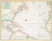
Chart
of the Atlantic Ocean
note:
Nautical
chart
of the North Atlantic Ocean
Ocean Atlantique, ou, Mer du …
topic:
Nautical
charts
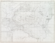
Basin of the North Atlantic O…
collection:
… and current
charts
,…
Bowles's new pocket map of th…
topic:
Nautical
charts
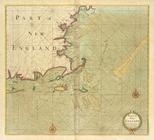
Part of NEW ENGLAND
Albemarle Sound, N. Carolina,…
abstract:
…: Coast
chart
no. 41.
…
chart
for the West
topic:
Nautical
charts
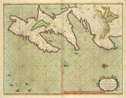
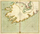
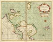
A new
chart
of the trading part of NEW FOUND
A generall
chart
from ENGLAND to cape
A
chart
of the NORTH-WEST coast
collection:
A
chart
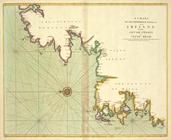
of the NORTH-WEST coast of IRELAND
The SOUTH-WEST coast of IRELA…
A
chart
of the sea coast from ENGLAND
A new draught of the coast of…
Carta general del Oceano Atla…
topic:
Nautical
charts
Albemarle Sound, N. Carolina,…
abstract:
…: Coast
chart
no. 40.
Part of New England, New York…
A new and correct
chart
from England
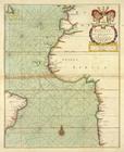
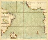
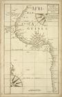
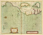
A draught of the coast of Afr…
A
chart
of the coast of BARBARIA
A Generall
chart
of the NORTHERN SEAS. Describing
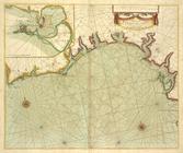
A
chart
of the sea coasts of ALGRAVE
Reconnaissance of Doboy Bar a…
topic:
Nautical
charts
A general
chart
of the West India's [sic]
topic:
Nautical
charts
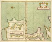
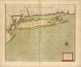
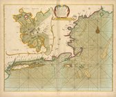
A large draught of New Englan…
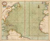
A Generall
chart
of the Western Ocean.
topic:
Nautical
charts
The Western Ocean.
note:
Chart
of the Atlantic Ocean with rhumb
Beaufort Harbour, North Carol…
abstract:
…, scale
chart
, text notes
m
A
chart
of the harbour of Rhode Island
note:
In: Des Barres, Joseph F.W.
Charts
Preliminary
chart
of Bass River Harbor
topic:
Nautical
charts
A
chart
of the Atlantic Ocean. I sheet.
topic:
Nautical
charts
Nieuwe wassende Graade Zee ka…
topic:
Nautical
charts