Click to visit the main New York Public Library Homepage
The New York Public Library
Digital Collections
About Digital Collections
Browse
Search only public domain materials
Items
Collections
Divisions
Home
Search
Browse
About
Search only public domain materials
Items
Collections
Divisions
Digital Collections
Using Images
Using Data
Search
Filtered keyword search
Show filters
Hide filters
Show Only Public Domain
topic
Indian reservations
7
Railroads
7
Indians of North America
5
Public lands
5
Administrative and political divisions
4
More
Less
name
United States. General Land Office
3
United States. Surveyor General of Kansas and Nebraska
3
Berthrong, I. P
2
Delahay, Mark W. (Mark William), 1818?-1879
2
Jewell, Marshall, 1825-1883
2
More
Less
collection
Maps of North America
11
Robert N. Dennis collection of stereoscopic views
1
place
x
Kansas
Nebraska
6
Missouri
2
Arkansas
1
Indian Territory
1
More
Less
genre
Maps
11
Photographs
1
Stereographs
1
publisher
Department of the Interior, General Land Office
3
Surveyor General's Office
3
Post Office Department
2
Published by A.J. Johnson
2
H.C. Townsend, general passenger and ticket agent, Mo. Pac. Ry
1
division
Map Division
11
Wallach Division: Photography Collection
1
type
cartographic
11
still image
1
Date Range
to
12 results found for:
x
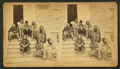
Kansa Indians
Filtering on:
x
Place
: Kansas
x
Rights
: Public Domain
Sort by:
Relevance
Title
Date created
Date digitized
Sequence
Johnson's Missouri and
Kansas
abstract:
… eastern third of
Kansas
.
m
Indians
who broke
topic:
Cheyenne
Indians
Johnson's
Kansas
and Nebraska
abstract:
… state of
Kansas
… surveys in
Kansas
note:
…,
Kansas
, 1861.
Map of
Kansas
and Nebraska …
note:
…,
Kansas
, September 2nd
… of
Kansas
and Nebraska …
abstract:
Shows township grid, existing towns,
Indian
State of
Kansas
…
abstract:
… and
Indian
reservations
Map of the state of
Kansas
…
abstract:
Shows county seats, Land offices,
Indian
State of
Kansas
…
abstract:
… and
Indian
reservations
m
… of
Kansas
and Nebraska …
m
Post route map of the states of
Kansas
A correct map of the Oklahoma…
abstract:
… Territory and
Indian
End of results
|
Top