Click to visit the main New York Public Library Homepage
The New York Public Library
Digital Collections
About Digital Collections
Browse
Search only public domain materials
Items
Collections
Divisions
Home
Search
Browse
About
Search only public domain materials
Items
Collections
Divisions
Digital Collections
Using Images
Using Data
Search
Filtered keyword search
Show filters
Hide filters
Show Only Public Domain
topic
Real property
7
Ferries
1
Piers
1
Railroads
1
Railroads, Elevated
1
More
Less
name
G.W. Bromley & Co
8
C.S. Hammond & Company
1
Pleasants Finder Map Company
1
collection
Atlases of New York City
8
Maps of New York City and State
1
place
x
Manhattan (New York, N.Y.)
New York (State)
9
New York
7
New York (N.Y.)
4
Bronx (New York, N.Y.)
1
More
Less
genre
Maps
9
publisher
G.W. Bromley & Co
8
C.S. Hammond and Co
1
division
Map Division
9
type
x
cartographic
Date Range
to
9 results found for:
x
Columbus Circle (New York, N.Y.)
Filtering on:
x
Place
: Manhattan (New York, N.Y.)
x
Type
: cartographic
Sort by:
Relevance
Title
Date created
Date digitized
Sequence
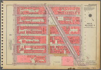
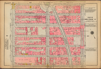
Plate 87, Part of Section 4: …
use:
… partner (e.g.,
New
York
…,
Columbus
Circle
, Central
use:
… partner (e.g.,
New
York
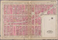
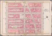
Plate 82, Part of Section 4: …
use:
… partner (e.g.,
New
York
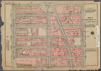
Plate 82, Part of Section 4: …
use:
… partner (e.g.,
New
York
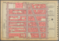
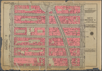
Plate 82: [Bounded by W. 59th…
use:
… partner (e.g.,
New
York
Bounded by W. 59th Street,
Columbus
Circle
use:
… partner (e.g.,
New
York
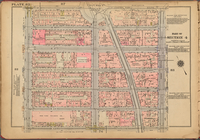
Bounded by W. 59th Street,
Columbus
Circle
use:
… partner (e.g.,
New
York
Plate 82, Part of Section 4: …
use:
… partner (e.g.,
New
York
m
Street guide of Manhattan and…
use:
… partner (e.g.,
New
York