Click to visit the main New York Public Library Homepage
The New York Public Library
Digital Collections
About Digital Collections
Browse
Search only public domain materials
Items
Collections
Divisions
Home
Search
Browse
About
Search only public domain materials
Items
Collections
Divisions
Digital Collections
Using Images
Using Data
Search
Filtered keyword search
Show filters
Hide filters
Show Only Public Domain
topic
Real property
115
Landowners
3
Canals
1
New England
1
name
Hyde, E. Belcher
112
Beers, F. W. (Frederick W.)
33
Burr, David H., 1803-1875
4
De Witt, Simeon, 1756-1834
4
Rawdon, Clark & Co
4
More
Less
collection
x
Atlases of the United States
place
x
Maps
New York (State)
116
Nassau County
112
Nassau County (N.Y.)
112
Hunterdon County (N.J.)
33
More
Less
genre
Atlases
150
Maps
150
publisher
E. Belcher-Hyde
112
D. H. Burr
2
Stone and Clark
2
Walker, Jewett & Miller
1
division
Map Division
150
type
cartographic
150
Date Range
to
150 results found for:
x
map
Filtering on:
x
Place
: Maps
x
Collection
: Atlases of the United States
For more collection details, visit the
Atlases of the United States collection page
.
Sort by:
Relevance
Title
Date created
Date digitized
Sequence
Topographical
Map
Map
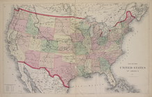
of the United States of America
Map
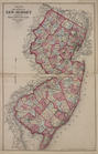
of the State of New Jersey
m
Outline
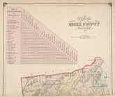
map
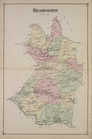
of Essex County, New York.
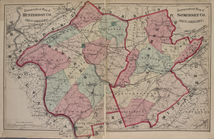
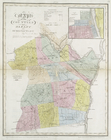
Atlas of Hunterdon County, Ne…
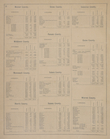
Table of Contents.
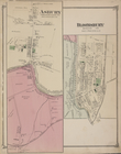
Asbury [Village]; Bloomsbury …
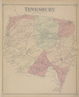
Tewksbury [Township]
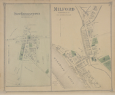
Milford [Village]; New German…
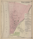
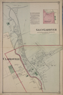
Frenchtown [Village]; Frencht…
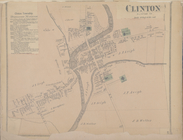
Clinton [Village]; Clinton Bu…
Annandale [Village]; Pittstow…
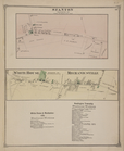
Readington [Township]
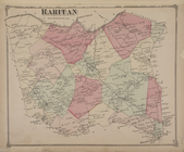
Raritan [Township]
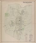
Flemington [Village]; Fleming…
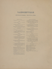
Lambertville Business Notices.
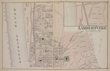
North Part of Lambertville [V…
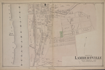
South Part of Lambertville [V…
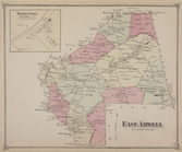
East Amwell [Township]; Werts…
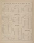
The Census of the State of Ne…
The Census of the State of Ne…
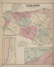
Lebanon Township Business Not…
Cokesburgh [Village]; Glen & …
Bethlehem [Township]; Bethleh…
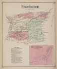
High Bridge [Township]; High …
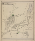
High Bridge [Village]; East H…
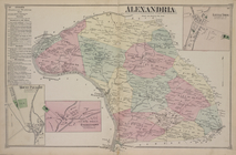
Alexandria Business Notices. …
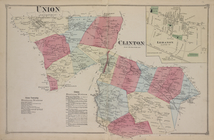
Union [Township]; Union Busin…
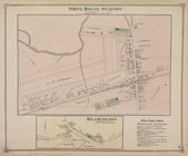
White House Station [Village]…
Station [Village]; White Hous…
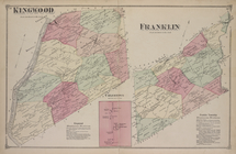
Kingwood [Township]; Kingwood…
West Amwell [Township]; West …
Stockton [Village]; Sergeants…
Map
of the counties of Ontario & Yates
note:
… to Early
Maps
of the Middle
Map
of the counties of Albany and Schenectady
note:
… to Early
Maps
of the Middle
Map
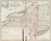
of the state of New-York
note:
… to Early
Maps
of the Middle
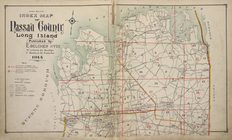
Upper section Index
Map
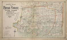
of Nassau County
Lower section Index
Map
of Nassau County
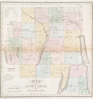
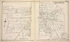
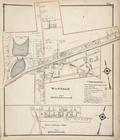
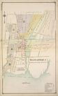
Hicksville
collection:
…. Based upon
maps
on file
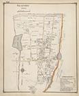
Seaford
collection:
…. Based upon
maps
on file
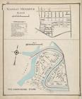
Nassau Heights; Meadowmere Pa…
collection:
…. Based upon
maps
on file
Wantagh; West Central Park
collection:
…. Based upon
maps
on file
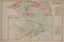
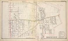
Roosevelt
collection:
…. Based upon
maps
on file
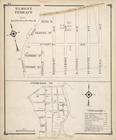
Elmont Terrace; Interurban Co.
collection:
…. Based upon
maps
on file
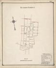
Manor Grove
collection:
…. Based upon
maps
on file
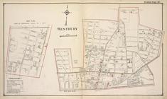
Sub Plan; Westbury
collection:
…. Based upon
maps
on file
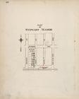
Part of Stewart Manor
collection:
…. Based upon
maps
on file
Massapequa
collection:
…. Based upon
maps
on file
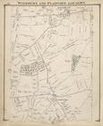
Woodbury and Plainview Locali…
collection:
…. Based upon
maps
on file
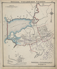
Inwood, Cedarhurst Vicinity
collection:
…. Based upon
maps
on file