Click to visit the main New York Public Library Homepage
The New York Public Library
Digital Collections
About Digital Collections
Browse
Search only public domain materials
Items
Collections
Divisions
Home
Search
Browse
About
Search only public domain materials
Items
Collections
Divisions
Digital Collections
Using Images
Using Data
Search
Filtered keyword search
Show filters
Hide filters
Show Only Public Domain
topic
x
Real property
Administrative and political divisions
3
Railroads
3
Landowners
2
Streets
2
More
Less
name
G.M. Hopkins & Co
108
G.W. Bromley & Co
4
Bromley, George Washington
3
Bromley, Walter Scott
3
G.W. & C.B. Colton & Co
3
More
Less
collection
Atlases of New York City
112
Maps of New York City and State
3
place
x
New York
New York (State)
115
Brooklyn (New York, N.Y.)
108
Manhattan (New York, N.Y.)
4
New York (N.Y.)
3
More
Less
genre
Maps
108
Title pages
5
Prospectuses
2
Cadastral maps
1
publisher
G.M. Hopkins & Co
108
G.W. Bromley & Co
4
G.W. & C.B. Colton & Co
3
South Side Railroad of Long Island
1
division
Map Division
115
type
cartographic
108
text
7
Date Range
to
115 results found for:
x
C. G
Filtering on:
x
Place
: New York
x
Topic
: Real property
Sort by:
Relevance
Title
Date created
Date digitized
Sequence
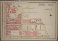
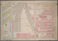
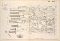
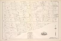
… Street, Avenue
C
. E. 16th
parent:
60786050-
c
5fa-012f-a9bc-58d385a7bc34
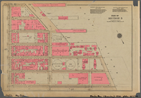
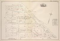
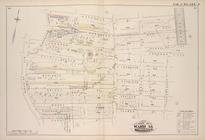
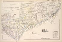
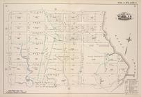
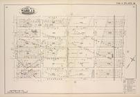
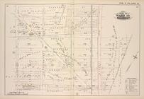
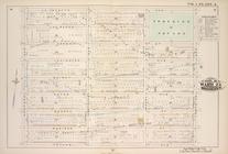
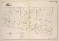
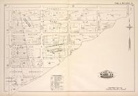
Plate 46, Part of Section 3: …
parent:
ed6
c
51e0-2177-0132-65cb-58d385a7b928
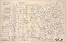
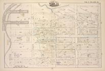
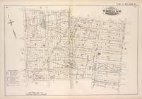
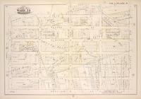
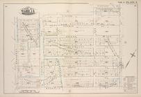
…. 20th Street, Avenue
C
parent:
80d8
c
040-
c
5f9-012f-ef2a-58d385a7bc34
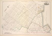
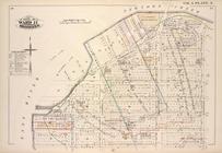
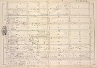
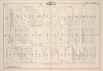
Map bounded by Madison St., B…
parent:
a988cad0-
c
5fa-012f-7245-58d385a7bc34
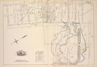
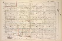
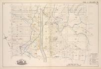
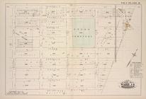
Map bound by Thirteenth St., …
parent:
b80bd4e0-
c
5fa-012f-513f-58d385a7bc34
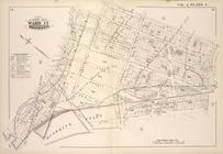
Map bound by Meserole St., Ca…
parent:
b0d60440-
c
5fa-012f-3765-58d385a7bc34
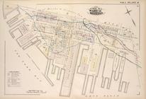
Map bounded by Lafayette Ave.…
parent:
a83eb0d0-
c
5fa-012f-ee70-58d385a7bc34
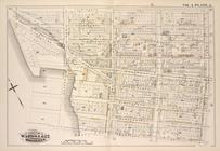
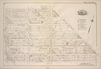
Map bound by Washington Park,…
parent:
bec18bf0-
c
5fa-012f-ba8e-58d385a7bc34
Map bound by Norman Ave. King…
parent:
c
667cc60-
c
5fa-012f-b7f3-58d385a7bc34
Map bound by Fifth Ave., Fift…
parent:
b6acdd40-
c
5fa-012f-955b-58d385a7bc34
Map bound by Manhattan Ave., …
parent:
c
4f05430-
c
5fa-012f-f2df-58d385a7bc34
Map bound by Division Pl., Ne…
parent:
af7baa20-
c
5fa-012f-367e-58d385a7bc34
Map bound by Poplar St., Sand…
parent:
bd62d650-
c
5fa-012f-04cb-58d385a7bc34
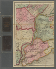
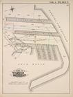
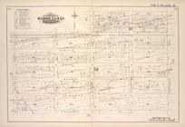
Detailed Estate and Old Farm …
parent:
c
43
c
2db0-
c
5fa-012f-0548-58d385a7bc34
… and (N.Y.
C
. & H.R.R.
C
.R
parent:
655bcac0-
c
5f9-012f-b446-58d385a7bc34
m
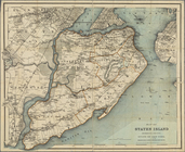
Map of Staten Island, Richmon…
parent:
fb72bd20-
c
5aa-012f-5141-58d385a7bc34
Map of Staten Island, Richmon…
parent:
ba76f0
c
0-1d48-0131-4345-58d385a7bbd0
… of the City of Brooklyn by
G
.M
parent:
a7013e90-
c
5fa-012f-3aa3-58d385a7bc34
Map of Long Island: showing t…
parent:
38021
c
90-cdb1-0133-53d2-00505686a51
c
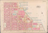
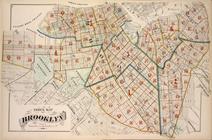
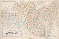
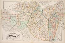
Index Map of Brooklyn
parent:
b5a78460-
c
5fa-012f-3e07-58d385a7bc34
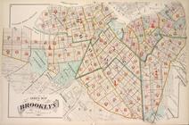
Index Map of Brooklyn
parent:
bc517d70-
c
5fa-012f-cd65-58d385a7bc34
Index Map of Brooklyn
parent:
c
3f49ad0-
c
5fa-012f-4124-58d385a7bc34
Index Map of Brooklyn
parent:
a7574430-
c
5fa-012f-4285-58d385a7bc34
Index Map of Brooklyn
parent:
ae686670-
c
5fa-012f-d1
c
1-58d385a7bc34
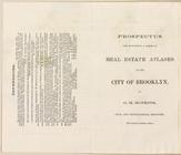
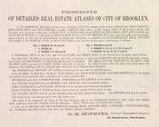
Prospectus of Detailed Real E…
parent:
a6
c
11880-
c
5fa-012f-e77
c
-58d385a7bc34
Map bound by Starr St., Wycko…
parent:
b2db5690-
c
5fa-012f-8327-58d385a7bc34
Map bound by Stanhope St., Wy…
parent:
b38abf10-
c
5fa-012f-
c
733-58d385a7bc34
Map bound by Fifth St., Sixth…
parent:
b70fd2d0-
c
5fa-012f-e297-58d385a7bc34
Map bound by First St., Ninth…
parent:
b75d8d70-
c
5fa-012f-
c
7dd-58d385a7bc34
Map bound by Tenth St., Ninth…
parent:
b7bc01
c
0-
c
5fa-012f-5a0f-58d385a7bc34
Map bound by Atlantic Ave., C…
parent:
bf165ef0-
c
5fa-012f-1b1
c
-58d385a7bc34
Map bound by Harrison St., Co…
parent:
c
06e3520-
c
5fa-012f-471e-58d385a7bc34
Map bound by Butler St., Four…
parent:
c
0ce3da0-
c
5fa-012f-96b7-58d385a7bc34
Map bound by Partition St., O…
parent:
c
285ffc0-
c
5fa-012f-a933-58d385a7bc34
Map bound by Henry St. Slip, …
parent:
c
34062a0-
c
5fa-012f-9da2-58d385a7bc34
Map bounded by Lafayette Ave.…
parent:
a7a518d0-
c
5fa-012f-d063-58d385a7bc34
Map bounded by Lafayette Ave.…
parent:
a7f95d30-
c
5fa-012f-8e73-58d385a7bc34
Map bounded by Putnam Ave., S…
parent:
a8e3fa40-
c
5fa-012f-410a-58d385a7bc34
Map bounded by Madison St., R…
parent:
a9452410-
c
5fa-012f-
c
53a-58d385a7bc34
Map bound by Atlantic Ave., N…
parent:
a9dcd9
c
0-
c
5fa-012f-bf0a-58d385a7bc34
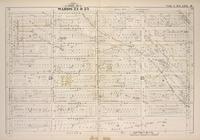
Map bound by Herkimer St., Tr…
parent:
aa29daa0-
c
5fa-012f-7828-58d385a7bc34
Map bound by Meeker Ave., New…
parent:
af19d1
c
0-
c
5fa-012f-
c
758-58d385a7bc34
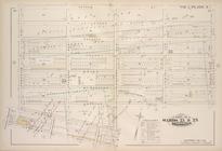
Map bound by Roges Ave., City…
parent:
ab84bf80-
c
5fa-012f-4130-58d385a7bc34
Map bound by Dean St., Pacifi…
parent:
ac6
c
7590-
c
5fa-012f-
c
19
c
-58d385a7bc34
Map bound by Douglass St., Bu…
parent:
acc88140-
c
5fa-012f-b581-58d385a7bc34
Map bound by Atlantic Ave., H…
parent:
ad11e0f0-
c
5fa-012f-2450-58d385a7bc34
Map bound by Prospect Pl., Ho…
parent:
ad74ad80-
c
5fa-012f-96be-58d385a7bc34
Map bound by La Fayette Ave.,…
parent:
b33b4e50-
c
5fa-012f-5685-58d385a7bc34
Map bound by Central Ave., Sc…
parent:
b3ef2090-
c
5fa-012f-e112-58d385a7bc34
Map bound by Magnolia St., Ci…
parent:
b45083
c
0-
c
5fa-012f-2ed4-58d385a7bc34