Click to visit the main New York Public Library Homepage
The New York Public Library
Digital Collections
About Digital Collections
Browse
Search only public domain materials
Items
Collections
Divisions
Home
Search
Browse
About
Search only public domain materials
Items
Collections
Divisions
Digital Collections
Using Images
Using Data
Search
Filtered keyword search
Show filters
Hide filters
Show Only Public Domain
topic
Real property
7
Landowners
1
Parks
1
Railroads
1
name
G.W. Bromley & Co
6
Bromley, George Washington
4
Bromley, Walter Scott
4
Perris & Browne
3
Perris, William
3
More
Less
collection
Atlases of New York City
9
Maps of New York City and State
3
place
x
New York
New York (State)
12
Manhattan (New York, N.Y.)
11
New York (N.Y.)
4
Brooklyn (New York, N.Y.)
2
More
Less
genre
Maps
12
Cadastral maps
1
publisher
G.W. Bromley & Co
6
Perris & Browne
3
Commission?
1
D.T. Valentine
1
Thomas W. Field
1
division
Map Division
9
type
x
cartographic
Date Range
to
12 results found for:
x
Thomas, W
Filtering on:
x
Place
: New York
x
Type
: cartographic
Sort by:
Relevance
Title
Date created
Date digitized
Sequence
m
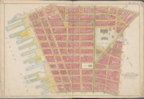
Map of the city of Williamsbu…
… Street,
Thomas
Street
…,
Thomas
Street, West
…, West Broadway,
Thomas
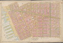
Map of the cities of New York…
abstract:
… to mile (
W
74°03ʹ21ʺ--
W
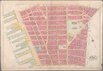
Map bounded by Jay St.,
Thomas
St
….,
Thomas
St., Jay St
Bounded by Jay Street,
Thomas
Street
…,
Thomas
Street, Hudson
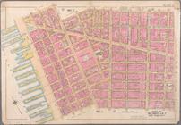
Sketch map of the city of New…
note:
…, Charles L. Tiffany, Geo.
W
… Street,
Thomas
Street
… Street,
Thomas
Street
End of results
|
Top