Click to visit the main New York Public Library Homepage
The New York Public Library
Digital Collections
About Digital Collections
Browse
Search only public domain materials
Items
Collections
Divisions
Home
Search
Browse
About
Search only public domain materials
Items
Collections
Divisions
Digital Collections
Using Images
Using Data
Search
Filtered keyword search
Show filters
Hide filters
Show Only Public Domain
topic
Railroads
11
Landowners
10
Real property
10
Administrative and political divisions
9
Canals
5
More
Less
name
Tanner, Vallance, Kearny & Co
4
Disturnell, John, 1801-1877
3
Eddy, John H. (John Hartshorne), 1783-1817
3
Maverick, Samuel, 1789-1845
3
Rand McNally and Company
3
More
Less
collection
x
Maps of New York City and State
place
x
New York (State)
Hudson River Valley (N.Y. and N.J.)
10
New York
7
New York (N.Y.)
7
Long Island (N.Y.)
4
More
Less
genre
Maps
47
Cadastral maps
6
Tourist maps
3
Manuscript maps
1
Road maps
1
publisher
publisher not identified
4
Ferdinand Andrews
2
Published by J. Disturnell, 102 Broadway
2
Published by James Eastburn & Co., at the Literary Rooms in Broadway
2
S.D.L. Taunton, 88 Warren St
2
More
Less
division
Map Division
47
type
cartographic
47
Date Range
to
47 results found for:
x
Valleys
Filtering on:
x
Place
: New York (State)
x
Collection
: Maps of New York City and State
For more collection details, visit the
Maps of New York City and State collection page
.
Sort by:
Relevance
Title
Date created
Date digitized
Sequence
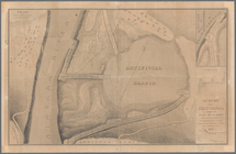
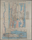
Map of the
valley
of the Bronx River
note:
…
Valley
Sewer
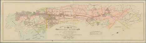
Map of the River Niagara and …
Map of the head waters of the…
m
Three maps of the property known as
Valley
Map of the head waters of the…
Map of the Genesee
Valley
Canal
Map of Niagara Falls, suspens…
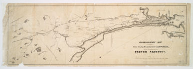
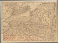
Hydrographic map of the count…
m
Map of Tioga County, New York…
note:
… -- Newark
Valley
-- Tioga
Map and profile showing sourc…
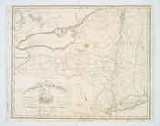
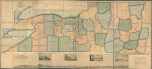
A map of the state of New Yor…
note:
Creek, A. Maps of the Genesee
Valley
& Finger
m
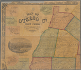
Map of Otsego Co., New York: …
note:
…: South
Valley
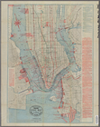
Upper Manhattan, comprising the Inwood
Valley
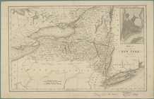
Map of the state of New York …
note:
Creek, A. Maps of the Genesee
Valley
& Finger
New York
note:
Creek, A. Maps of the Genesee
Valley
& Finger
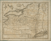
Communication between Albany …
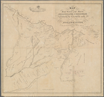
Operations on Hudson's River
Patroonships, manors and seig…
note:
…
Valley
area and Long
Attack on forts Clinton and M…
Operations on the Hudson River
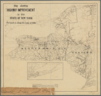
Map showing highway improveme…
note:
… and Lower Hudson
Valley
A map of the country between …
Rand, McNally & Co.'s New York
note:
…
Valley
regions, the City
State of New York, Jany. 1, 1…
note:
Creek, A. Maps of the Genesee
Valley
& Finger
Hudson River & vicinity
The state of New York : with …
note:
Creek, A. Maps of the Genesee
Valley
& Finger
Rand, McNally & Co.'s New York
note:
…
Valley
regions, the City
Map of the state of New York …
note:
Creek, A. Maps of the Genesee
Valley
& Finger
m
The state of New York : with …
note:
…
Valley
& Finger Lakes
m
Map of the western part of th…
note:
Creek, A. Maps of the Genesee
Valley
& Finger
Asher & Adams' new map of the…
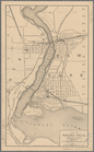
Map of the village of Rochest…
note:
…
Valley
."…
Map of the state of New York …
note:
Creek, A. Maps of the Genesee
Valley
& Finger
Map of the state of New York …
note:
Creek, A. Maps of the Genesee
Valley
& Finger
The state of New York : with …
note:
Creek, A. Maps of the Genesee
Valley
& Finger
Map of the New York and North…
Map showing location of propo…
note:
… and the Hudson
Valley
watersheds
Map of Sullivan County, New Y…
note:
…
Valley
-- North Branch
Survey for a ship canal aroun…
Map of the state of New York …
Map of the western part of th…
note:
…
Valley
& Finger Lakes
m
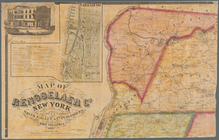
Map of Rensselaer Co., New Yo…
note:
…: Greenbush --
Valley
Falls
m
Map of Rockland County, New Y…
note:
…. Lane
Valley
Cottage
m
Map of Orange and Rockland Co…
note:
… -- Spring
Valley
-- Nyack
m
Taunton new guide map and dir…
m
Taunton new guide map and dir…
m
Taunton new guide map and dir…
End of results
|
Top