Click to visit the main New York Public Library Homepage
The New York Public Library
Digital Collections
About Digital Collections
Browse
Search only public domain materials
Items
Collections
Divisions
Home
Search
Browse
About
Search only public domain materials
Items
Collections
Divisions
Digital Collections
Using Images
Using Data
Search
Filtered keyword search
Show filters
Hide filters
Show Only Public Domain
topic
Charts, diagrams, etc
23
Exhibitions
22
Altitudes
17
Administrative and political divisions
14
Canals
10
More
Less
name
New York World's Fair (1939-1940 : New York, N.Y.)
22
Interborough Rapid Transit Company
10
Pease, Richard H., 1813-1869
4
Connecticut. Commission on Boundary between the States of New York and Connecticut
3
New York (State), Commissioners on the New York and Connecticut Boundary
3
More
Less
collection
Maps of New York City and State
39
New York World's Fair 1939 and 1940 Incorporated records
22
Interborough rapid transit: the New York subway, its construction and equipment
10
Apartment houses of the metropolis
3
Photographs, diagrams and documents relating to the New York port of embarkation in World War II
3
More
Less
place
x
New York (State)
New York
49
Erie Canal (N.Y.)
15
New York (N.Y.)
11
Manhattan (New York, N.Y.)
6
More
Less
genre
Maps
41
Photographs
19
Diagrams
17
Illustrations
5
Manuscript maps
4
More
Less
publisher
New York Interborough Rapid Transit Company
10
G.C. Hesselgren Pub. Co
3
Lith. of R.H. Pease
3
New York State Engineer and Surveyor?
3
The Commissioners
3
More
Less
division
Map Division
41
Manuscripts and Archives Division
23
Rare Book Division
10
Milstein Division
3
Wallach Division: Photography Collection
3
More
Less
type
still image
41
cartographic
40
text
12
Date Range
to
83 results found for:
x
Diagrams
Filtering on:
x
Place
: New York (State)
Sort by:
Relevance
Title
Date created
Date digitized
Sequence
Population - 1647; Gov. Stuyv…
topic:
Charts,
diagrams
, etc
Diagram
of arch panels between rotunda
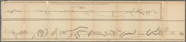
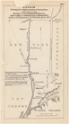
The Narrows tunnel : chart of…
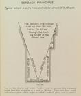
Setback principle
… Streets) ;
Diagram
… Avenue ;
Diagram
of lot
… Manhattan Street;
Diagram
m
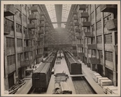
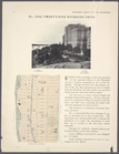
Brooklyn Army Terminal
collection:
Photographs,
diagrams
and documents
North River Terminal
collection:
Aerial views and
diagrams
Erie Canal enlargement, middl…
topic:
Charts,
diagrams
, etc
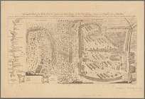
A prospective view of the bat…
abstract:
…
diagrams
: A plan of Lymans
m
Post route map of the states …
note:
…"The service on this
diagram
brought up to date
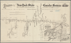
Statistical profile, Erie Can…
topic:
Charts,
diagrams
, etc
Map of the Hudson River near …
topic:
Charts,
diagrams
, etc
Chart of the Diocese of New Y…
topic:
Charts,
diagrams
, etc
Geological and land patent ma…
note:
Also includes a
diagram
of: "Comparative
A prospective view of the bat…
abstract:
…
diagrams
: A plan of Lymans
Diagram
showing the relative position
note:
… entitled: "
Diagrams
showing
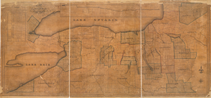
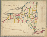
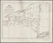
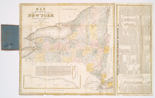
Map of the State of New York
topic:
Charts,
diagrams
, etc
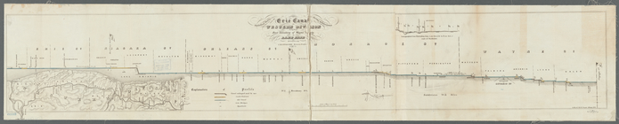
Profiles of the New York Stat…
topic:
Charts,
diagrams
, etc
m
Post route map of the State o…
note:
…"The service on this
diagram
brought up to date
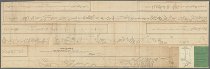
Statistical profile of Erie C…
topic:
Charts,
diagrams
, etc
Diagrams
of the New-York and Connecticut
note:
… entitled: "
Diagrams
showing
m
Diagrams
of the New-York and Connecticut
note:
… entitled: "
Diagrams
showing
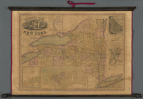
Map of the state of New York:…
topic:
Charts,
diagrams
, etc
Squire's map of the state of …
note:
… in the state [
diagram
] -- City
Distance map of the state of …
note:
… in the state [
diagram
and table
Female workers preparing army…
collection:
Photographs,
diagrams
and documents
Map of the State of New York …
topic:
Charts,
diagrams
, etc
Map of the western part of th…
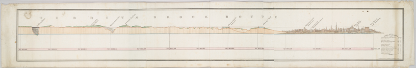
Tibbits Brook route.
The tourist's map of the stat…
topic:
Charts,
diagrams
, etc
Neueste Karte von New York : …
topic:
Charts,
diagrams
, etc
Map of the state of New York …
topic:
Charts,
diagrams
, etc
State of New York, Jany. 1, 1…
topic:
Charts,
diagrams
, etc
The state of New York from th…
topic:
Charts,
diagrams
, etc
Map of the state of New York …
topic:
Charts,
diagrams
, etc
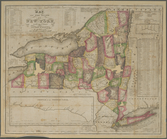
Map of the State of New York
topic:
Charts,
diagrams
, etc
Map of part of New York State…
m
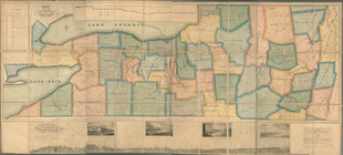
Map of the western part of th…
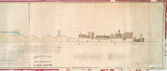
Profile of lower part of Crot…
Map of the State of New York
topic:
Charts,
diagrams
, etc
Map of the state of New York
topic:
Charts,
diagrams
, etc
m
Plan of the Harlem River Driv…
topic:
Charts,
diagrams
, etc
Diagram
showing location of undeground
m
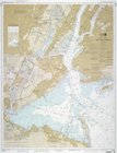
United States--east coast, Ne…
note:
…
diagram
, tables of channel
m
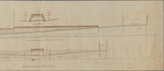
Profile of Riverside Drive fr…
topic:
Charts,
diagrams
, etc
m
Map of the Harlem River and S…
topic:
Charts,
diagrams
, etc
m
Geologic map and sections of …
topic:
Charts,
diagrams
, etc
m
… -
Diagram
of Perisphere