Click to visit the main New York Public Library Homepage
The New York Public Library
Digital Collections
About Digital Collections
Browse
Search only public domain materials
Items
Collections
Divisions
Home
Search
Browse
About
Search only public domain materials
Items
Collections
Divisions
Digital Collections
Using Images
Using Data
Search
Filtered keyword search
Show filters
Hide filters
Show Only Public Domain
topic
History
2
Boundaries
1
Distances, etc
1
Fortification
1
Military bases
1
More
Less
name
American Civil War (1861-1865)
2
Robert de Vaugondy, Gilles, 1688-1766
2
Colton, G. Woolworth (George Woolworth), 1827-1901
1
Hall, Henry Bryan, 1808-1884
1
Haussard, C
1
More
Less
collection
Maps of North America
7
Lawrence H. Slaughter Collection of English maps, charts, globes, books and atlases
1
place
x
United States
New York (State)
2
Ohio
2
Southern States
2
Atlantic Ocean
1
More
Less
genre
Maps
8
Cadastral maps
1
publisher
s.n.,
2
G. Woolworth Colton
1
H.P. Lathrop
1
Laurie & Whittle
1
New Jersey Boundary Commission?
1
More
Less
division
Map Division
8
type
x
cartographic
Date Range
to
8 results found for:
x
Ohio River
Filtering on:
x
Place
: United States
x
Type
: cartographic
Sort by:
Relevance
Title
Date created
Date digitized
Sequence
m
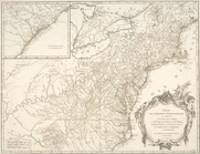
A map of Cabotia: comprehendi…
note:
… of the
river
St. Lawrence from
… de l'
Ohio
, la Nlle
note:
… to the Mississippi
River
. …
m
…
rivers
… comprend le cours de l'
Ohio
G. Woolworth Colton's map of …
note:
…, Kentucky, and
Ohio
Plan of the western seat of w…
note:
…, Indiana,
Ohio
, Virginia
Map of the boundary line betw…
Map of Port-Lawrence & Vistul…
abstract:
…
River
from its mouth