Click to visit the main New York Public Library Homepage
The New York Public Library
Digital Collections
About Digital Collections
Browse
Search only public domain materials
Items
Collections
Divisions
Home
Search
Browse
About
Search only public domain materials
Items
Collections
Divisions
Digital Collections
Using Images
Using Data
Search
Filtered keyword search
Show filters
Hide filters
Show Only Public Domain
topic
History
28
Railroads
11
Boundaries
9
Slavery
8
Lighthouses
3
More
Less
name
United States. Light-House Board
10
Barclay, Anthony, 1792-1877
7
Porter, Peter B. (Peter Buell), 1773-1844
7
G.W. & C.B. Colton & Co
6
Bird, William A., 1796-1878
5
More
Less
collection
Maps of North America
52
Lawrence H. Slaughter Collection of English maps, charts, globes, books and atlases
6
Maps of New York City and State
3
Atlases of the United States
2
Collection of broadside real estate maps announcing auctions of lots in early 19th century New York City
2
More
Less
place
x
United States
Canada
15
Virginia
9
North America
7
Mexico
4
More
Less
genre
Maps
74
Illustrations
4
Atlases
2
Cadastral maps
2
Military maps
2
More
Less
publisher
U.S. Light-House Board
10
Corps of Topographical Engineers
4
G.W. & C.B. Colton & Co
4
... Mathew Albert and George Frederick Lotter
2
Henry Tanner,
2
More
Less
division
Map Division
65
Schomburg Manuscripts, Archives and Rare Books Division
4
Schomburg Jean Blackwell Hutson Research and Reference Division
3
Manuscripts and Archives Division
1
Milstein Division
1
type
x
cartographic
Date Range
to
74 results found for:
x
B
Filtering on:
x
Place
: United States
x
Type
: cartographic
Sort by:
Relevance
Title
Date created
Date digitized
Sequence
Theatrum belli in America Sep…
parent:
851a6320-c52a-012f-1aed-3c075448cc4
b
Topographical sketch of the s…
parent:
b
7618bf0-165
b
-0136-3129-1760e1ebb24f
Map of the surveyed portions …
parent:
fa1aacf0-2a2a-0136-9331-43f7388
b
3241
Map of the United States and …
parent:
48113140-c6
b
9-012f-9d56-3c075448cc4
b
Congressional district vote m…
parent:
16
b
33120-30c5-0134-e5
b
7-00505686a51c
Map of The United States, and…
Sketch exhibiting the approac…
parent:
87229fd0-c52
b
-012f-390d-3c075448cc4
b
Map of the United States of A…
parent:
e020c190-c52a-012f-4124-3c075448cc4
b
Isothermal chart of the regio…
parent:
a5a90ca0-1141-0133-05cc-58d385a7
b
928
H4. Map (Scheme
B
) illustrating freight situation
parent:
aaf27ca0-6163-0138-cddd-5d5d9
b
244746
Lake St. Clair
parent:
c2e47e80-
b
143-0132-9cdd-58d385a7bbd0
m
Niagara 1819
note:
…"Peter
B
. Porter, Anthony Barclay
The second section of the sur…
first:
a4e9
b
8d0-c91a-0133-65
b
2-00505686a51c
…. Gen. Geo.
B
. McClellan
parent:
5983e540-14
b
0-0130-aac6-58d385a7
b
928
Loudon County, Virginia
parent:
87229fd0-c52
b
-012f-390d-3c075448cc4
b
Detroit 1820
parent:
efa89bd0-
b
822-0135-
b
1e4-1
b
66aabcd1c0
m
Map of the St. Clair River : …
parent:
8d2f1950-bcf4-0135-7a37-3
b
4a21986fa9
The United States of America
note:
B
. Tanner, sculpt.
Map of Virginia showing the d…
parent:
44897610-52
b
2-0135-f351-0c78552ba04
b
No. 3, map of Isle Royale in …
parent:
c94a9640-
b
825-0135-795a-2f50604
b
9373
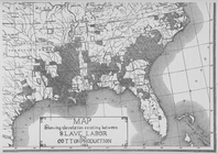
Map showing the relation exis…
parent:
0f060af0-c608-012f-
b
989-58d385a7bc34
m
51 lots to be sold by R.R. Mi…
parent:
1
b
7cd220-35bc-0136-3c98-2790efe6e89e
A map of the United States of…
parent:
c1cc5de0-c52a-012f-f999-3c075448cc4
b
Military map of Nebraska and …
parent:
90d69290-d1fd-0135-86
b
1-0d551a719cff
First l. h. district
parent:
e2fe61
b
0-8365-0134-9c85-00505686a51c
Plan of the siege of York Tow…
parent:
87229fd0-c52
b
-012f-390d-3c075448cc4
b
Map exhibiting the lines of m…
parent:
b
94d1370-c52a-012f-c874-3c075448cc4
b
United States light-house est…
parent:
b
94d1370-c52a-012f-c874-3c075448cc4
b
m
Map of the river Sainte Mary …
parent:
f72d15
b
0-bcf2-0135-004e-37ca8d37e0fc
A Map of Carolana and of the …
Second l. h. district
parent:
b
94d1370-c52a-012f-c874-3c075448cc4
b
m
… & George
B
. Smith, trustees
parent:
399
b
3d10-35bc-0136-9c73-67
b
4fd5bb7cf
Map of Loudon [sic], Jefferso…
parent:
5983e540-14
b
0-0130-aac6-58d385a7
b
928
Henrico County, Virginia: pre…
parent:
a2d7c250-dfb0-0132-4ed2-58d385a7
b
928
Carte du Mexique et des pays …
parent:
b
6a9aa20-c52a-012f-5bff-3c075448cc4
b
Sketch exhibiting the positio…
parent:
0605c320-e78
b
-0132-7806-58d385a7bbd0
Amerikanisch-Spanischer krieg…
parent:
7d109db0-c52a-012f-
b
115-3c075448cc4
b
Diagram
B
, Township no. 6 North of Range
parent:
f58affb0-c52a-012f-56dd-3c075448cc4
b
United States of America
parent:
e21406f0-c52a-012f-655
b
-3c075448cc4
b
m
The Chickahominy from Mechani…
parent:
5983e540-14
b
0-0130-aac6-58d385a7
b
928
m
The position of Yorktown with…
parent:
5983e540-14
b
0-0130-aac6-58d385a7
b
928
m
United States of America, 1834
parent:
dc6882
b
0-c52a-012f-f8ea-3c075448cc4
b
Map of the states of Ohio Ind…
parent:
f58affb0-c52a-012f-56dd-3c075448cc4
b
Carte generale des colonies a…
parent:
983815e0-c52
b
-012f-242f-3c075448cc4
b
A general map of the southern…
parent:
7d109db0-c52a-012f-
b
115-3c075448cc4
b
Entrance to Columbia River, O…
parent:
8517
b
870-
b
144-0132-5074-58d385a7bbd0
Die vereinigten Staaten von N…
m
Military map of Nebraska and …
parent:
0e5908
b
0-503
b
-0134-ac29-00505686a51c
m
Map of that portion of her ma…
parent:
7d109db0-c52a-012f-
b
115-3c075448cc4
b
m
Colton's map of the United St…
parent:
7cbd1cb0-c77
b
-0133-11e0-00505686a51c