Click to visit the main New York Public Library Homepage
The New York Public Library
Digital Collections
About Digital Collections
Browse
Search only public domain materials
Items
Collections
Divisions
Home
Search
Browse
About
Search only public domain materials
Items
Collections
Divisions
Digital Collections
Using Images
Using Data
Search
Filtered keyword search
Show filters
Hide filters
Show Only Public Domain
topic
History
18
Railroads
10
Indians of North America
8
Boundaries
7
Administrative and political divisions
5
More
Less
name
United States. General Land Office
10
Bien, Julius, 1826-1909
7
American Civil War (1861-1865)
5
Roeser, C. (Charles)
4
Warren, G. K. (Gouverneur Kemble), 1830-1882
4
More
Less
collection
Maps of North America
63
Lawrence H. Slaughter Collection of English maps, charts, globes, books and atlases
8
Jack Kerouac papers
2
Maps of New York City and State
2
The generall historie of Virginia, New-England, and the Summer Isles: with the names of the adventurers, planters, and governours from their first beginning, año: 1584. to this present 1626. With the proceedings of those severall colonies and the accidents that befell them in all their journyes and discoveries. Also the maps and descriptions of all those countryes, their commodities, people, government, customes, and religion yet knowne. Divided into sixe bookes
2
More
Less
place
x
United States
Virginia
11
Dakota Territory
5
Maps
5
Maryland
5
More
Less
genre
Maps
79
Military maps
5
Prints
3
Strip maps
3
Illustrations
2
More
Less
publisher
General Land Office
7
Department of the Interior, General Land Office
3
Chez Delamarche, géogr
2
Chez Jean Cóvens et Corneille Mortier, geographes
2
Department of the Interior
2
More
Less
division
Map Division
74
Berg Collection
2
Rare Book Division
2
Manuscripts and Archives Division
1
type
x
cartographic
text
3
still image
2
Date Range
to
79 results found for:
x
source_note_id%3A10486
Filtering on:
x
Place
: United States
x
Type
: cartographic
Sort by:
Relevance
Title
Date created
Date digitized
Sequence
Map of the United States and …
use:
Release
Source
File for Free (i.e., high-res
Map of the United States and …
use:
Release
Source
File for Free (i.e., high-res
Map of the United States and …
use:
Release
Source
File for Free (i.e., high-res
Map of the United States and …
use:
Release
Source
File for Free (i.e., high-res
m
Watson's new county and railr…
use:
Release
Source
File for Free (i.e., high-res
m
Johnson's new illustrated & e…
use:
Release
Source
File for Free (i.e., high-res
m
Map of the United States and …
use:
Release
Source
File for Free (i.e., high-res
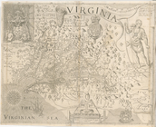
Virginia
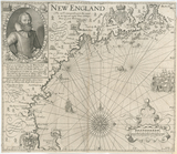
New England
Map illustrating the operatio…
note:
… notation, lost, Image
ID
m
Map of the United States show…
use:
Release
Source
File for Free (i.e., high-res
Map showing the location of t…
use:
Release
Source
File for Free (i.e., high-res
m
United States and territories…
use:
Release
Source
File for Free (i.e., high-res
Map of the U. S. and Territor…
use:
Release
Source
File for Free (i.e., high-res
Map of the U. S. and Territor…
use:
Release
Source
File for Free (i.e., high-res
m
… reliable & official
sources
use:
Release
Source
File for Free (i.e., high-res
m
Supervisors districts elevent…
use:
Release
Source
File for Free (i.e., high-res
m
Map of the United States and …
use:
Release
Source
File for Free (i.e., high-res
Colton's new topographical ma…
use:
Release
Source
File for Free (i.e., high-res
Military map refering to the …
use:
Release
Source
File for Free (i.e., high-res
Map of part of Virginia, Mary…
use:
Release
Source
File for Free (i.e., high-res
m
Map of part of Virginia, Mary…
use:
Release
Source
File for Free (i.e., high-res
Military map of south-eastern…
use:
Release
Source
File for Free (i.e., high-res
Military map of south-eastern…
use:
Release
Source
File for Free (i.e., high-res
Map and profile showing
sources
of
use:
Release
Source
File for Free (i.e., high-res
m
Johnson's new illustrated & e…
use:
Release
Source
File for Free (i.e., high-res
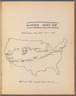
Hitch-hiking trip July - Oct.…
collection:
Holograph notebook "1947-1948 /
Notes
/ Journals"…
Operations on the Hudson River
use:
Release
Source
File for Free (i.e., high-res
Territory of Dakota
use:
Release
Source
File for Free (i.e., high-res
Territory of Dakota
use:
Release
Source
File for Free (i.e., high-res
Noua Terrae-Mariae tabula
use:
Release
Source
File for Free (i.e., high-res
Carte generale des colonies a…
use:
Release
Source
File for Free (i.e., high-res
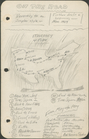
On the Road: map, itinerary, …
collection:
… and
notes
1949"…
Geographical & statistical ma…
use:
Release
Source
File for Free (i.e., high-res
m
Map of that portion of her ma…
use:
Release
Source
File for Free (i.e., high-res
A Map of Carolana and of the …
use:
Release
Source
File for Free (i.e., high-res
United States.
use:
Release
Source
File for Free (i.e., high-res
A map of the United States in…
use:
Release
Source
File for Free (i.e., high-res
Map of the Presbyterian Churc…
use:
Release
Source
File for Free (i.e., high-res
Isogonic chart of the United …
use:
Release
Source
File for Free (i.e., high-res
m
Map of the United States of N…
use:
Release
Source
File for Free (i.e., high-res
Partie orientale du Canada ou…
use:
Release
Source
File for Free (i.e., high-res
Map of the territory of the U…
use:
Release
Source
File for Free (i.e., high-res
Additions & corrections for t…
use:
Release
Source
File for Free (i.e., high-res
m
Map of the United States
use:
Release
Source
File for Free (i.e., high-res
A new and correct map of Nort…
use:
Release
Source
File for Free (i.e., high-res
Plan d'York en Virginie, avec…
use:
Release
Source
File for Free (i.e., high-res
Ètats-Unis de l'Amérique sept…
use:
Release
Source
File for Free (i.e., high-res
Phelps & Ensign's travellers'…
use:
Release
Source
File for Free (i.e., high-res
A map of Mexico, Louisiana, a…
use:
Release
Source
File for Free (i.e., high-res