Click to visit the main New York Public Library Homepage
The New York Public Library
Digital Collections
About Digital Collections
Browse
Search only public domain materials
Items
Collections
Divisions
Home
Search
Browse
About
Search only public domain materials
Items
Collections
Divisions
Digital Collections
Using Images
Using Data
Search
Filtered keyword search
Show filters
Hide filters
Show Only Public Domain
topic
Railroads
11
Indians of North America
3
Administrative and political divisions
2
Boundaries
2
Transportation
2
More
Less
name
Rand McNally and Company
4
G.W. & C.B. Colton & Co
2
G.W. & C.B. Colton & Co
2
Himberg, C. F
2
Barber, B. B
1
More
Less
collection
Maps of North America
27
I. N. Phelps Stokes Collection of American Historical Prints
3
Bref om de Forenta Staterna, föfattade under en resa till Amerika, åren 1818, 1819, 1820
1
Collection of book jackets
1
John H. Levine Collection
1
More
Less
place
x
Canada
United States
26
Québec (Province)
5
Maine
4
Mexico
4
More
Less
genre
Maps
32
Prints
4
Book jackets
1
Illustrations
1
Periodical illustrations
1
More
Less
publisher
G.W. & C.B. Colton & Co
2
Rand, McNally & Co
2
C. Müller
1
Department of the Interior
1
Ebenezer Hutchinson
1
More
Less
division
Map Division
28
Wallach Division: Print Collection
4
General Research Division
1
Rare Book Division
1
Wallach Division: Picture Collection
1
type
cartographic
32
still image
3
text
1
Date Range
to
35 results found for:
x
Yucatan (Mexico : State) -- History
Filtering on:
x
Place
: Canada
Sort by:
Relevance
Title
Date created
Date digitized
Sequence
m
… of the United
States
of America, the British provinces,
Mexico
…
States
, Canada and
Mexico
abstract:
… of the Atlantic coast
states
…
States
, Canada and
Mexico
abstract:
… of the Atlantic coast
states
…
States
of America
note:
… of the
states
and territories
Map of the
state
of Maine
m
The honourable company : a
history
m
Goldthwait's map of the United
States
& Canada
note:
… of the United
States
(by
state
…'s
History
of the Five Indian
… of
Mexico
note:
… of the United
States
.
m
Colton's railroad & township map of the
state
note:
… of the
state
of Maine for 1790 to 1850, and
state
Map of the United
States
and the Southern
note:
…, mountains and
state
lines.
m
…
States
and Canada
note:
Shows
states
Part of the United
States
, Lower Canada
note:
Shows boundaries claimed by United
States
Northern section of the United
States
including
Northern section of the United
States
, including
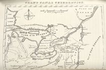
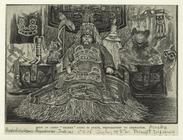
Body of Chief "Shakes" lying in
state
topic:
Lying in
state
m
…
States
and Canada
note:
…
States
showing
m
…
States
& Canada
note:
Covers United
States
as far west
…
States
and Canada
Lloyd's new map of the United
States
note:
from the United
States
Superintendent
Geological chart of the United
States
, east
… of the United
States
The United
States
of America with the British
… of the United
States
and Canada
The United
States
of America laid down from
A map of the United
States
and British
note:
…
States
, this map of the United
States
of America
The United
States
of North America
… & northern
states
note:
… the Northern and Middle
States
Map of the United
States
and Canada
m
…
States
of America
A new map of the United
States
, upon which
note:
….
states
and territories,
state
capitals, county
…
States
of North America
note:
… of the
state
of Connecticut.
…
States
: describing
note:
… with the United
States
of America
…
States
and the adjacent
… : with the adjacent
states
of New
note:
Shows boundaries of
states
.
End of results
|
Top