Click to visit the main New York Public Library Homepage
The New York Public Library
Digital Collections
About Digital Collections
Browse
Search only public domain materials
Items
Collections
Divisions
Home
Search
Browse
About
Search only public domain materials
Items
Collections
Divisions
Digital Collections
Using Images
Using Data
Search
Filtered keyword search
Show filters
Hide filters
Show Only Public Domain
topic
Nautical charts
14
Coasts
6
Atlases
3
Atlases, British
3
Cod fisheries
2
More
Less
name
L'Isle, Guillaume de, 1675-1726
9
Sayer, Robert, 1725-1794
8
Bellin, Jacques Nicolas, 1703-1772
5
Faden, William, 1749-1836
5
Fry, Joshua, approximately 1700-1754
5
More
Less
collection
Maps of North America
59
Lawrence H. Slaughter Collection of English maps, charts, globes, books and atlases
39
Maps of the Oceans
7
John H. Levine Collection
4
Maps of North and South America
2
More
Less
place
x
Early works to 1800
Maps
124
North America
33
America
18
Virginia
17
More
Less
genre
Maps
124
Prints
3
publisher
s.n
13
s.n.,
5
Printed by A. Godbid and J. Playford, for John Seller ...,
4
Printed for Tho. Basset ... and Ric. Chiswell ...,
2
Sold by H. Moll over against Deverux Court in ye Strand ...,
2
More
Less
division
Map Division
114
Schomburg Jean Blackwell Hutson Research and Reference Division
11
Wallach Division: Print Collection
1
type
cartographic
125
text
2
still image
1
Date Range
to
126 results found for:
x
map
Filtering on:
x
Place
: Early works to 1800
Sort by:
Relevance
Title
Date created
Date digitized
Sequence
New & accurate
map
of North America
note:
… to Early
Maps
of the Middle
… approved
maps
and charts
note:
… to Early
Maps
of the Middle
Maryland
note:
… to Early
Maps
of the Middle
Carta della Nuova Inghilterra…
note:
BM
maps
, X, 476
A new
map
or chart in Mercators projection
note:
Jolly, D.C.
Maps
of America in periodicals
A New and accurate
map
of the present
note:
… and accurate
map
of the present
The United States of America,…
note:
… to Early
Maps
of the Middle
Circuli Supe. Saxoniae Pars M…
image:
psnypl_
map
_308
Americæ nova descriptio
note:
… version of a
map
Map
of Spanish Louisiana and the American
note:
… to Early
Maps
of the Middle
L'Amérique septentrionale : d…
note:
… to Early
Maps
of the Middle
A new
map
of Virginia and Maryland
note:
… to Early
Maps
of the Middle
Map
of the northern provinces of the United
note:
… to Early
Maps
of the Middle
A new
map
of Virginia : from the best
note:
Jolly, D.C.
Maps
of America in periodicals
An exact
map
of North and South Carolina
note:
… to Early
Maps
of the Middle
A
map
of the world from the best
note:
… to Early
Maps
of the Middle
Carte générale des Etats Unis…
note:
… to Early
Maps
of the Middle
Carte des Etats-unis : provin…
note:
… to Early
Maps
of the Middle
Carte générale de l'Amérique …
note:
… of Popple's 1733
map
.
America.
note:
… to Early
Maps
of the Middle
Nouveau Mexique, Louisiane, C…
note:
1798 ed. of the
map
appears in Brion de la
L'Amerique septentrionale : d…
note:
…; and the first issue of this
map
North America, as divided amo…
note:
… to Early
Maps
of the Middle
New England, New York, New Je…
note:
… to Early
Maps
of the Middle
An accurate
map
of the English colonies in North
note:
… to Early
Maps
of the Middle
A New and accurate
map
of Virginia
note:
… to Early
Maps
of the Middle
A
map
of the United States of America
note:
… to Early
Maps
of the Middle
A new and correct
map
of North America
note:
… to Early
Maps
of the Middle
An Accurate
map
of the present seat of war
note:
… to Early
Maps
of the Middle
A New & accurate
map
of North America
note:
… to Early
Maps
of the Middle
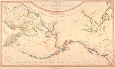
Chart of the Gulf Stream
note:
… to Early
Maps
of the Middle
A chart of the sea coasts of …
note:
… to Early
Maps
of the Middle
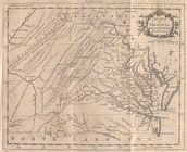
Virginia and Maryland
note:
… to Early
Maps
of the Middle
The United States of North Am…
note:
… to Early
Maps
of the Middle
L'Amerique septentrionale : d…
note:
… to Early
Maps
of the Middle
North America drawn from the …
note:
… to Early
Maps
of the Middle
Plan of the city of Washingto…
note:
… to Early
Maps
of the Middle
Carte d'Amerique : dressée po…
note:
… to Early
Maps
of the Middle
Carte de la Louisiane et des …
note:
… to Early
Maps
of the Middle
Chart of the N.W. coast of Am…
Belgii novi, angliae novae, e…
note:
… of
map
by Jan Jansson.
Pas caarte van Nieu Nederlandt
note:
Variant ed. of Burden, P.D.
Mapping
m
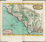
A chart of the West Indias fr…
note:
… to Early
Maps
of the Middle
Carolina newly discribed
note:
… to Early
Maps
of the Middle
m
A chart of the West Indias fr…
note:
… to Early
Maps
of the Middle
A
map
of New England and New York
note:
… to Early
Maps
of the Middle
A new
map
of Virginia from the best
note:
… to Early
Maps
of the Middle
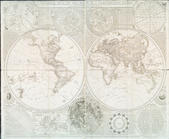
A general
map
of the world, or terraqueous
note:
… to Early
Maps
of the Middle
A chart of the Atlantic Ocean…
note:
… to Early
Maps
of the Middle
Amerique Septentrionale
note:
…
maps
of Michigan, p. 32