Click to visit the main New York Public Library Homepage
The New York Public Library
Digital Collections
About Digital Collections
Browse
Search only public domain materials
Items
Collections
Divisions
Home
Search
Browse
About
Search only public domain materials
Items
Collections
Divisions
Digital Collections
Using Images
Using Data
Search
Filtered keyword search
Show filters
Hide filters
Show Only Public Domain
topic
Historical geography
3
Bays
1
Ferries
1
Lighthouses
1
Nautical charts
1
More
Less
name
Norris Peters Co
6
Alexander, W. D. (William De Witt), 1833-1913
3
Geological Survey (U.S.)
3
Ourand, Charles H
3
Andrew B. Graham Co
1
More
Less
collection
Maps of North America
10
Reize naar de oost- en westkust van Zuid-Amerika en, van daar, naar de Sandwichs- en Philippijnsche eilanden, China enz, gedaan,in de jaren 1826, 1827, 1828 en 1829 ... Door J. Boelen, Joh. zoon ..
1
place
x
Hawaii
Honolulu (Hawaii)
3
Alaska
1
Canada
1
Hawaii Island (Hawaii)
1
More
Less
genre
Maps
11
Bathymetric maps
3
Topographic maps
3
Prints
1
publisher
Norris Peters Co
3
E.F. Woodward
1
Hydrographic Office, U.S. Navy
1
Norris Peters & Co
1
Rand, McNally & Co
1
More
Less
division
Map Division
10
General Research Division
1
type
x
cartographic
Date Range
to
11 results found for:
x
Hawaii
Filtering on:
x
Place
: Hawaii
x
Type
: cartographic
Sort by:
Relevance
Title
Date created
Date digitized
Sequence
Hawaii
abstract:
… of
Hawaii
-- Honolulu [Scale
Map of
Hawaii
…
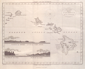
Hawaiian or Sandwich Islands
collection:
Hawaii
Oahu, Hawaiian Islands: repro…
collection:
Hawaii
Hawaiian Islands
collection:
Hawaii
General map of the island of …
collection:
Hawaii
Part of the city of Honolulu,…
collection:
Hawaii
Lighthouse chart of the West …
The Hawaiian Islands: compile…
abstract:
… on
Hawaii
Island. Includes
Kaart van de Sandwich Eilande…
Map of the western and middle…
End of results
|
Top