Click to visit the main New York Public Library Homepage
The New York Public Library
Digital Collections
About Digital Collections
Browse
Search only public domain materials
Items
Collections
Divisions
Home
Search
Browse
About
Search only public domain materials
Items
Collections
Divisions
Digital Collections
Using Images
Using Data
Search
Filtered keyword search
Show filters
Hide filters
Show Only Public Domain
topic
x
Fire insurance
Real property
105
name
Perris, William
105
Sanborn Map Company
1
collection
Atlases of New York City
105
Maps of New York City and State
1
place
x
Manhattan (New York, N.Y.)
New York
106
New York (State)
106
genre
Maps
106
Index maps
6
Title pages
6
publisher
William Perris
105
Sanborn Map Co
1
division
Map Division
106
type
cartographic
105
text
7
Date Range
to
106 results found for:
x
New York (State)
Filtering on:
x
Place
: Manhattan (New York, N.Y.)
x
Topic
: Fire insurance
Sort by:
Relevance
Title
Date created
Date digitized
Sequence
…, Whitehall Street,
State
use:
… partner (e.g.,
New
York
…,
New
York
City
use:
… partner (e.g.,
New
York
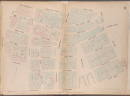
Map bounded by Vesey Street, …
use:
… partner (e.g.,
New
York
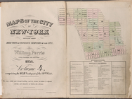
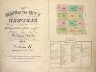
Maps of the city of
New
York
use:
… partner (e.g.,
New
York
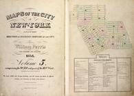
Maps of the city of
New
York
…
use:
… partner (e.g.,
New
York
… Maps of the city of
New
York
…
use:
… partner (e.g.,
New
York
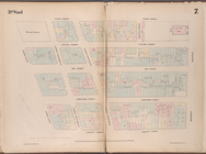
Map bounded by Liberty Street…
use:
… partner (e.g.,
New
York
Map bounded by Gold Street, F…
use:
… partner (e.g.,
New
York
Map bounded by Broadway, Park…
use:
… partner (e.g.,
New
York
Map bounded by West Street, R…
use:
… partner (e.g.,
New
York
Map bounded by Greenwich Stre…
use:
… partner (e.g.,
New
York
Map bounded by Chatham Street…
use:
… partner (e.g.,
New
York
Map bounded by Division Stree…
use:
… partner (e.g.,
New
York
Map bounded by Monroe Street,…
use:
… partner (e.g.,
New
York
Map bounded by Division Stree…
use:
… partner (e.g.,
New
York
Map bounded by Division Stree…
use:
… partner (e.g.,
New
York
Map bounded by Division Stree…
use:
… partner (e.g.,
New
York
Map bounded by Grand Street, …
use:
… partner (e.g.,
New
York
Map bounded by Rivington Stre…
use:
… partner (e.g.,
New
York
Map bounded by Rivington Stre…
use:
… partner (e.g.,
New
York
Map bounded by Rivington Stre…
use:
… partner (e.g.,
New
York
Map bounded by Grand Street, …
use:
… partner (e.g.,
New
York
Map bounded by Bowery, Grand …
use:
… partner (e.g.,
New
York
Map bounded by Bowery, Riving…
use:
… partner (e.g.,
New
York
Map bounded by Broome Street,…
use:
… partner (e.g.,
New
York
Map bounded by Houston Street…
use:
… partner (e.g.,
New
York
Map bounded by Leonard Street…
use:
… partner (e.g.,
New
York
Map bounded by Canal Street, …
use:
… partner (e.g.,
New
York
Map bounded by Spring Street,…
use:
… partner (e.g.,
New
York
Map bounded by Spring Street,…
use:
… partner (e.g.,
New
York
Map bounded by Houston Street…
use:
… partner (e.g.,
New
York
Map bounded by Franklin Stree…
use:
… partner (e.g.,
New
York
Map bounded by Vestry Street,…
use:
… partner (e.g.,
New
York
Map bounded by Hamersley Stre…
use:
… partner (e.g.,
New
York
Map bounded by Spring Street,…
use:
… partner (e.g.,
New
York
Map bounded by Hamersley Stre…
use:
… partner (e.g.,
New
York
Map bounded by Houston Street…
use:
… partner (e.g.,
New
York
Map bounded by Houston Street…
use:
… partner (e.g.,
New
York
Map bounded by Eighth Street,…
use:
… partner (e.g.,
New
York
Map bounded by Sixth Street, …
use:
… partner (e.g.,
New
York
Map bounded by Fifth Street, …
use:
… partner (e.g.,
New
York
Map bounded by Fifth Street, …
use:
… partner (e.g.,
New
York
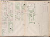
Map bounded by East 15th Stre…
use:
… partner (e.g.,
New
York
Map bounded by East 13th Stre…
use:
… partner (e.g.,
New
York
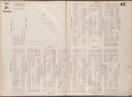
Map bounded by East 12th Stre…
use:
… partner (e.g.,
New
York
Map bounded by East 12th Stre…
use:
… partner (e.g.,
New
York
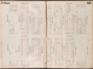
Map bounded by East 20th Stre…
use:
… partner (e.g.,
New
York
Map bounded by East 17th Stre…
use:
… partner (e.g.,
New
York
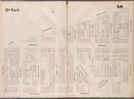
Map bounded by East 22nd Stre…
use:
… partner (e.g.,
New
York
Map bounded by East 22nd Stre…
use:
… partner (e.g.,
New
York