Click to visit the main New York Public Library Homepage
The New York Public Library
Digital Collections
About Digital Collections
Browse
Search only public domain materials
Items
Collections
Divisions
Home
Search
Browse
About
Search only public domain materials
Items
Collections
Divisions
Digital Collections
Using Images
Using Data
Search
Filtered keyword search
Show filters
Hide filters
Show Only Public Domain
topic
Real property
17
Buildings, structures, etc
6
Historic buildings
6
Local transit
6
Dwellings
4
More
Less
name
G.W. Bromley & Co
15
Bromley, George Washington
8
Bromley, Walter Scott
8
Wurts Bros. (New York, N.Y.)
6
Abbott, Berenice, 1898-1991
5
More
Less
collection
Maps of New York City and State
19
Atlases of New York City
17
Collection of photographs of New York City
6
Changing New York
4
Midtown; Lower Manhattan; On the Bowery
3
More
Less
place
x
Manhattan (New York, N.Y.)
New York (State)
43
New York (N.Y.)
38
New York
36
Greenwich Village (New York, N.Y.)
4
More
Less
genre
Maps
36
Photographs
17
Manuscript maps
2
Cadastral maps
1
Drawings
1
More
Less
publisher
G.W. Bromley & Co
14
J.N. Matthews Co
2
Trow City Directory Co
2
A.G. Hagstrom Co
1
A.J. Johnson
1
More
Less
division
Map Division
35
Milstein Division
9
Wallach Division: Photography Collection
7
Manuscripts and Archives Division
1
Spencer Collection
1
type
cartographic
36
still image
18
text
1
Date Range
to
54 results found for:
x
39
Filtering on:
x
Place
: Manhattan (New York, N.Y.)
Sort by:
Relevance
Title
Date created
Date digitized
Sequence
m
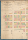
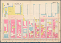
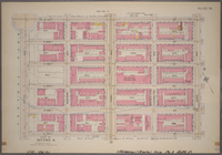
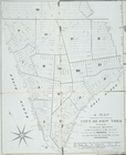
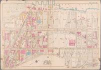
Lands of the Harlaem Canal Co…
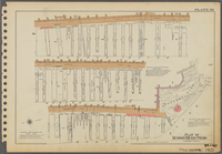
Plate
39
Plate
39
39
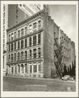
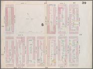
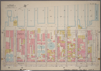
East 36th Street - Park Avenue
39
Bond Street
39
Bond Street
39
Broadway
39
Chambers Street - Elk Street
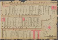
Plate
39
Plate
39
first:
39
c6ddf0-2179-0132-6824-58d385a7b928
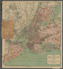
Map of New York City from 50t…
Broadway - West 45th Street
note:
3-Mar-
39
Producer's office, American P…
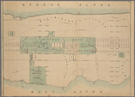
Plan showing course of stream…
m
Miguel: On the Bowery
Diagram showing location of u…
parent:
040be8c0-f
39
c-0130-0f3f-58d385a7b928
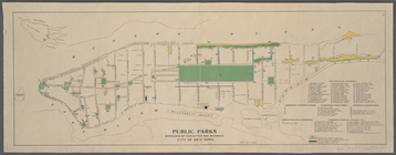
Public parks boroughs of Manh…
parent:
048b7d20-f
39
c-0130-2891-58d385a7b928
Plate
39
: Bounded by Twelfth Avenue (Hudson
Plate
39
, Part of Section 4: [Bounded
Plate
39
, Part of Section 6: [Bounded by E
Plate
39
, Part of Section 6: [Bounded by E
m
Map of New York City ("greate…
parent:
0423b840-f
39
c-0130-6f8e-58d385a7b928
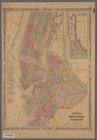
Map of the city of New-York
m
Center of New York, first cit…
parent:
04cd20b0-f
39
c-0130-40f9-58d385a7b928
Map of New-York City
Map of New-York City
Hagstrom's map of ... New Yor…
m
Proposed extension of Convent…
Johnson's New York and Brookl…
m
Plate
39
, Part of Section 4: [Bounded
Williams' map of boroughs of …
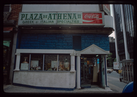
Storefront, Plaza de Athena II
note:
… order:
39
m
Hagstrom's map of upper New Y…
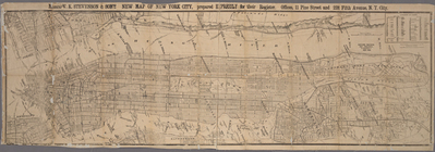
Messrs. V.K. Stevenson & Son'…
A Map of the city of New York…
Center of New York, first cit…
Hagstrom's New York house-num…
Map bounded by East 13th Stre…
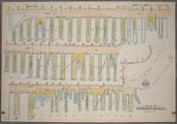
Plan of Hudson River Wharves,…
Bounded by Perry Street, West…
Map bounded by Houston Street…
Map bounded by Hudson River, …
Bounded by Hudson River [Twel…
Plan of Hudson River Wharves …
Bounded by Twelfth Avenue (Hu…
m
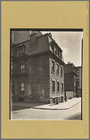
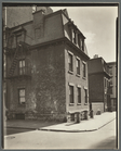
Commerce Street, no.
39
-41
m
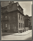
Commerce Street, no.
39
-41
m
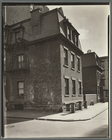
Commerce Street, no.
39
-41
m
Commerce Street, no.
39
-41
m
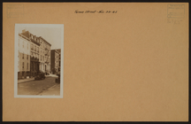
Manhattan: Grove Street - Ble…
collection:
[
39
-41 and 45 Grove Street ; Whittemore House.]