Click to visit the main New York Public Library Homepage
The New York Public Library
Digital Collections
About Digital Collections
Browse
Search only public domain materials
Items
Collections
Divisions
Home
Search
Browse
About
Search only public domain materials
Items
Collections
Divisions
Digital Collections
Using Images
Using Data
Search
Filtered keyword search
Show filters
Hide filters
Show Only Public Domain
topic
Nautical charts
3
Atlases
1
Canals
1
Historical geography
1
Ocean travel
1
More
Less
name
Holland, N., Captain
2
Laurie & Whittle
2
Brose, W
1
Burr, David H., 1803-1875
1
Clüver, Philipp, 1580-1622
1
More
Less
collection
Lawrence H. Slaughter Collection of English maps, charts, globes, books and atlases
4
Maps of North America
1
Maps of the World
1
place
x
Maps
Atlantic Coast (U.S.)
2
Altitudes
1
America
1
Atlantic Ocean
1
More
Less
genre
Maps
6
publisher
Rob[er]t Laurie & James Whittle, No. 53 Fleet Street
2
Printed by John Darby for the author, and are to be sold at his shop at the Hermitage in Wapping,
1
Published ... by W. Heather at the Navigation Warehouse, No. 157 Leadenhall Street,
1
Published by H.S. Tanner, No. 144 Chestnut St.,
1
Published by J. Haven, 86 State St
1
More
Less
division
Map Division
6
type
cartographic
6
Date Range
to
6 results found for:
x
Navigation
Filtering on:
x
Place
: Maps
Sort by:
Relevance
Title
Date created
Date digitized
Sequence
America.
…, for the
navigation
between
…, for the
navigation
between Cape Cod
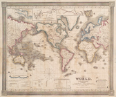
The world, on Mercator's proj…
note:
… of different
navigators
, route
The travellers pocket map of …
topic:
Steam-
navigation
A general chart of the West I…
collection:
… and experienced
navigators
of our