Click to visit the main New York Public Library Homepage
The New York Public Library
Digital Collections
About Digital Collections
Browse
Search only public domain materials
Items
Collections
Divisions
Home
Search
Browse
About
Search only public domain materials
Items
Collections
Divisions
Digital Collections
Using Images
Using Data
Search
Filtered keyword search
Show filters
Hide filters
Show Only Public Domain
topic
Administrative and political divisions
17
Floods
15
Mill River Disaster, 1874
14
Railroads
5
Steamboat lines
5
More
Less
name
Geo. H. Walker & Co
24
Geo. H. Ireland & Co
18
Appalachian Mountain Club
3
Knowlton Bros
3
Coolidge, George, 1817-1888
2
More
Less
collection
Maps of North America
34
Robert N. Dennis collection of stereoscopic views
24
Maps of New York City and State
2
Wallach Division Picture Collection
1
place
x
Massachusetts
Boston
20
Boston (Mass.)
19
Sawmill River (Mass.)
14
Boston Metropolitan Area (Mass.)
11
More
Less
genre
Maps
36
Photographs
24
Stereographs
24
Topographic maps
4
Cadastral maps
3
More
Less
publisher
Geo. H. Walker & Co
17
publisher not identified
4
Appalachian Mountain Club
3
Knowlton Brothers
3
Geo. Coolidge
2
More
Less
division
Map Division
36
Wallach Division: Photography Collection
24
Wallach Division: Picture Collection
1
type
cartographic
36
still image
25
Date Range
to
61 results found for:
x
Geo
Filtering on:
x
Place
: Massachusetts
Sort by:
Relevance
Title
Date created
Date digitized
Sequence
Map of Somerville, [Mass.]: p…
note:
…"Copyright 1895, by
Geo
. H. Walker & Co."…
New map of Boston, giving all…
note:
…"Copyrighted 1894 & 1897 by
Geo
. H. Walker
Map of Boston and vicinity
note:
Geo
. H. Walker & Co., engravers, Boston.
m
Map of Boston showing locatio…
note:
… copyright 1898 by
Geo
. H
Narragansett Bay and vicinity
note:
…"Copyright 1892 by
Geo
. H. Walker & Co."…
Map showing location and desi…
note:
Geo
. W. Stadly & Co., Boston.
Map of Berkshire County
Boston Harbor
Map of Berkshire hills, Massa…
Railroad and post office map …
The North Shore and part of M…
Boston and surroundings
Map of Cambridge and Somervil…
Indexed map of Boston
Map of Boston and vicinity: s…
Boston and surroundings
Map of the city of Malden
note:
…"Copyright by
Geo
. H. Walker & Co
Boston Harbor
m
Boston and surroundings
Plan of Springfield: [Massach…
note:
by
Geo
. Colton.
Sketch of the Battle of Bunke…
note:
…"Published by
Geo
. G. Smith, engraver
Map of the country about Bost…
note:
…, by
Geo
. W. Stadly and Co.
Plan of Boston and its vicini…
note:
… in the year 1869 by
Geo
Plan of Boston and its vicini…
note:
… in the year 1867 by
Geo
m
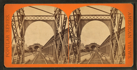
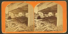
Depot from interior of bridge.
m
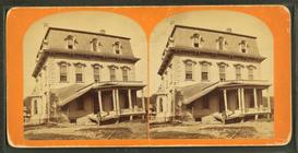
Mass. Mutual Life Insurance C…
m
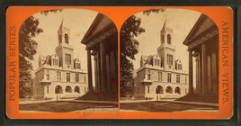
Court House.
m
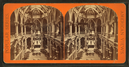
Public library interior.
m
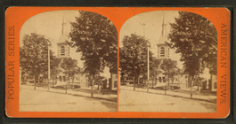
State at Methodist Church.
m
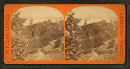
View from Long Hill, looking …
m
…, Ms., Dr.
Geo
. L
m
Down at water shops, seen thr…
m
Skinner's house, Skinnersvill…
m
Geo
. Cheney, gate keeper at Williamsburg
m
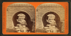
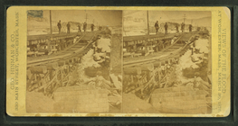
Arch bridge, Boston & Albany …
m
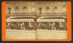
Geo
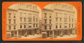
. A. Plummer Dry goods store showing men
m
Reservoir dam looking east, s…
m
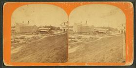
Mill St. looking south, Willi…
m
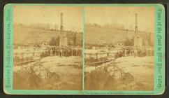
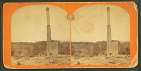
Haydenville, site of the iron…
m
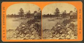
Cotton Mill Dam.
m
Geo
. Cheney, gate keeper at Williamsburg
m
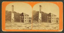
Ruins of
Geo
P. Warner's button factory
Map of Boston
A new plan of Boston: from ac…
m
Ruins of Hayden, Gere & Co.'s…
m
Main St. Leeds, looking throu…
m
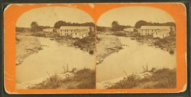
Nonotuck Silk Mill and ruins,…
m
Ruins of Warren's button shop…
m
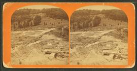
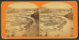
General view of Leeds, lookin…
m
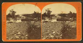
Site of iron bridges, Leeds.