Click to visit the main New York Public Library Homepage
The New York Public Library
Digital Collections
About Digital Collections
Browse
Search only public domain materials
Items
Collections
Divisions
Home
Search
Browse
About
Search only public domain materials
Items
Collections
Divisions
Digital Collections
Using Images
Using Data
Search
Filtered keyword search
Show filters
Hide filters
Show Only Public Domain
topic
Exhibitions
151
Real property
18
Railroads
13
Landowners
10
City planning
6
More
Less
name
New York World's Fair (1939-1940 : New York, N.Y.)
151
Ohman, August R
4
American Telephone and Telegraph Company
3
Webster, Joseph O. B
3
Boy Scouts of America
2
More
Less
collection
New York World's Fair 1939 and 1940 Incorporated records
151
Maps of New York City and State
44
William J. Wilgus papers
6
Robert Moses papers
4
Fred F. French Companies records
1
More
Less
place
x
New York
New York (State)
207
New York (N.Y.)
34
Manhattan (New York, N.Y.)
24
Brooklyn (New York, N.Y.)
12
More
Less
genre
Photographs
132
Maps
76
Manuscript maps
27
Plans
20
Cadastral maps
3
More
Less
publisher
producer not identified
9
publisher unknown
4
publisher not identified
3
Charles Francis Press
2
Department of Public Works
2
More
Less
division
Manuscripts and Archives Division
164
Map Division
42
No Division
1
Wallach Division: Picture Collection
1
type
still image
133
cartographic
76
text
7
Date Range
to
208 results found for:
x
Maps, Manuscript
Filtering on:
x
Place
: New York
Sort by:
Relevance
Title
Date created
Date digitized
Sequence
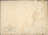
Map
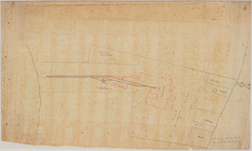
of Garret Nostrand's farm at Flushing
note:
… to Early
Maps
of the Middle
Block distribution of childre…
abstract:
Manuscript
map
showing number of children
m
…
manuscript
map
of New York
m
Map
showing steam, cable, and horse roads
Vingboons
map
of Manhattan, 1639
note:
Pictorial
map
showing buildings
Proposed Harlem River Drive f…
collection:
Maps
of New York City and State
m
Map
of part of New York City : area
note:
Manuscript
map
labeled "Population
map
no
Diagram showing location of u…
collection:
Maps
of New York City and State
m
1905 Library
map
of Manhattan, City of New York
abstract:
A black and white
Map
of Manhattan, City
m
1907 Library
map
of Manhattan, City of New York
abstract:
A black and white
Map
of Manhattan, City
Plan of streets etc. on the L…
note:
… catalog of the
Map
m
1906 Library
map
of Manhattan, City of New York
note:
A black and white
Map
of Manhattan, City
Map
of New York City between 135th
m
Plan of the Harlem River Driv…
collection:
Maps
of New York City and State
m
Map
showing part of the city bounded by West
collection:
Map
showing part of the city bounded by West 10
m
1907 Library
map
of Manhattan, City of New York
note:
A black and white
Map
of Manhattan, City
m
Population and school attendance
map
abstract:
Portion of black and white
map
showing
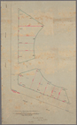
Map
of property belonging to the heirs
note:
… catalog of the
Map
Property in the towns of Cast…
note:
Map
is bound by Richmond Road (Victory Blvd
m
Profile of Riverside Drive fr…
note:
Sheet 2 shows
map
of area bounded by 97th
New-York and vicinity as prop…
topic:
Manuscript
maps
m
Map
and profile of the New York and Sea Beach
note:
… catalog of the
Map
m
Map
of the route of the New York and Sea Beach
note:
… catalog of the
Map
A plott of ye situations of t…
note:
Facsimile of
manuscript
map
.
m
27th assembly district
collection:
Maps
of New York City and State
m
Library
map
1908
abstract:
…
map
New York
Map
of property in the 19th ward of the city
m
Maps
of property in the city of New York
note:
… index,
map
of 277 Pearl Street),
map
leaves 1
Map
of the Eureka Basin, including about
note:
NYPL copy includes
manuscript
outlines
Map
of property owned by Francis Pidgeon
note:
NYPL copy includes
manuscript
notations in lead
Map
of property on Brooklyn Heights, or
note:
NYPL copy has
manuscript
note written
Operations on the Hudson River
note:
NYPL copy includes librarian
manuscript
note
m
New
map
of the borough of Richmond
note:
… and includes
manuscript
m
Map
of the 23rd ward, New York City
note:
NYPL copy includes
manuscript
notations in green
Map
of New York City between 110th
Map
of Bayside, third ward, borough
note:
NYPL copy includes
manuscript
notations in ink.
Location of North River Bridg…
note:
Manuscript
note on upper right corner
Map
of lands in the city of New York, lying
note:
NYPL copy has
manuscript
note in ink
Borough Park Company
note:
NYPL copy includes
manuscript
notations in lead
m
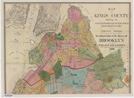
Map
of Kings County
note:
…
manuscript
notations
Opening Hell Gate at a cost o…
note:
Also inlcludes
manuscript
notation "N.Y
Map
of the real estate in the city of New
note:
NYPL copy has
manuscript
note in ink
Rand, McNally & Co.'s new handy
map
note:
NYPL copy includes
manuscript
notations
Key
map
m
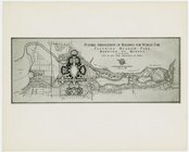
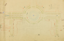
Fairgrounds -
Maps
and Plans - Possible
Lot Renting Plan, Section I
collection:
Maps
, Drawings, Plans
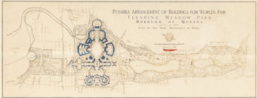
Possible arrangement of build…
collection:
Maps
, Drawings, Plans
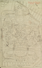
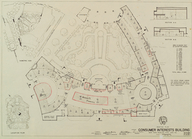
Renting Plan. Consumer Intere…
collection:
Maps
, Drawings, Plans
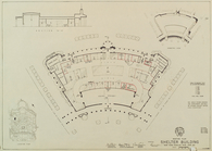
Renting Plan. Shelter Buildin…
collection:
Maps
, Drawings, Plans
Pocket
map
of greater New York ;
Map
abstract:
…
map
shows radial