Click to visit the main New York Public Library Homepage
The New York Public Library
Digital Collections
About Digital Collections
Browse
Search only public domain materials
Items
Collections
Divisions
Home
Search
Browse
About
Search only public domain materials
Items
Collections
Divisions
Digital Collections
Using Images
Using Data
Search
Filtered keyword search
Show filters
Hide filters
Show Only Public Domain
topic
City planning
7
Social conditions
6
Real property
2
Barges
1
Bays (Bodies of water)
1
More
Less
name
M.I.T. Press
6
New York (N.Y.). City Planning Commission
6
Sperr, Percy Loomis, 1890-1964
3
Dripps, M. (Matthew)
1
E. Robinson Co
1
More
Less
collection
Atlases of New York City
7
Photographic views of New York City, 1870's-1970's, from the collections of the New York Public Library
4
Maps of New York City and State
2
place
x
New York
New York (State)
13
New York (N.Y.)
12
Rikers Island (N.Y.)
5
East River (N.Y.)
2
More
Less
genre
Maps
9
Photographs
4
Cadastral maps
1
publisher
MIT Press
6
E. Robinson Co
1
M. Dripps
1
Norris Peters Co., Photo-litho
1
War Department
1
division
Map Division
9
Milstein Division
4
type
still image
10
cartographic
3
Date Range
to
13 results found for:
x
Rikers Island (N.Y.)
Filtering on:
x
Place
: New York
Sort by:
Relevance
Title
Date created
Date digitized
Sequence
m
Islands
-
Rikers
Island
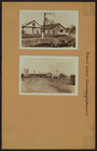
- Commissary
m
Islands
-
Rikers
Island
- Commissary
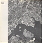
… around
Riker
's
Island
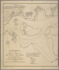
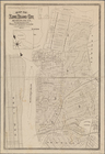
note:
Shows
Rikers
Island
and surrounding coasts.
m
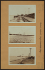
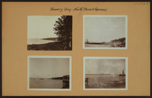
Bowery Bay - North Beach - Qu…
m
Bridges - Triborough and Hell…
Map of Long
Island
City, Queens Co.
N
.
Y
.
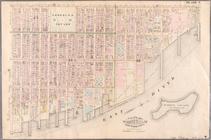
abstract:
… showing
Riker
's
Island
… (East River,
Rikers
Island
), Tompkins Street
Hounts Point, Longwood,
Riker
's
Island
.
Hounts Point, Longwood,
Riker
's
Island
.
… Point, Longwood,
Riker
's
Island
.
Hounts Point, Longwood,
Riker
's
Island
Hounts Point, Longwood,
Riker
's
Island
Hounts Point, Longwood,
Riker
's
Island
End of results
|
Top