Click to visit the main New York Public Library Homepage
The New York Public Library
Digital Collections
About Digital Collections
Browse
Search only public domain materials
Items
Collections
Divisions
Home
Search
Browse
About
Search only public domain materials
Items
Collections
Divisions
Digital Collections
Using Images
Using Data
Search
Filtered keyword search
Show filters
Hide filters
Show Only Public Domain
topic
Real property
86
Landowners
46
Administrative and political divisions
29
Post roads
14
History
11
More
Less
name
Burr, David H., 1803-1875
97
Rawdon, Clark & Co
79
Rawdon, Wright & Co
79
De Witt, Simeon, 1756-1834
55
New York (State). Surveyor General
48
More
Less
collection
Maps of New York City and State
127
Atlases of the United States
92
Lawrence H. Slaughter Collection of English maps, charts, globes, books and atlases
9
Maps of North America
6
I. N. Phelps Stokes Collection of American Historical Prints
5
More
Less
place
x
New York (N.Y.)
New York (State)
137
New York Metropolitan Area
45
New Jersey
39
Manhattan (New York, N.Y.) -- Maps
37
More
Less
genre
Maps
245
Atlases
92
Prints
4
Early works to 1800
2
Posters
1
publisher
Stone and Clark
27
D. H. Burr
26
Stone and Clark,
26
s.n
16
Published by A.T. Goodrich, 124 Broad Way
14
More
Less
division
Map Division
240
Wallach Division: Print Collection
5
type
cartographic
241
text
7
still image
5
Date Range
to
245 results found for:
x
Middle Atlantic States
Filtering on:
x
Place
: New York (N.Y.)
Sort by:
Relevance
Title
Date created
Date digitized
Sequence
Novi Belgii Novaeque Angliae …
note:
… to Early Maps of the
Middle
Atlantic
Seaboard.
A Map of the country round Ph…
note:
… to Early Maps of the
Middle
Atlantic
Seaboard.
Paskaerte van de zuydt en Noo…
Recens edita totius Novi Belg…
Belgii novi, angliae novae, e…
note:
Described by Campbell as third
state
A new map of New England, New…
A map of the
states
of Connecticut and Rho[de Islan]d
topic:
Middle
Atlantic
States
A map of New England, New Yor…
note:
… to Early Maps of the
Middle
Atlantic
Seaboard.
The figurative map of Corneli…
Carte de la Nouvelle Angleter…
note:
… to the
middle
of Lake Ontario.
New York and adjacent country.
note:
… to Early Maps of the
Middle
Atlantic
Seaboard.
Carta della Nuova Inghilterra…
note:
… to Early Maps of the
Middle
Atlantic
Seaboard.
… independent
states
of North
note:
… of the
Middle
British Colonies
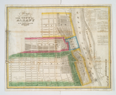
Map of the city of Albany
note:
… to Early Maps of the
Middle
Atlantic
Seaboard.
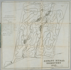
Albany Rural Cemetery
note:
… to Early Maps of the
Middle
Atlantic
Seaboard.
Map of Hudson's River, with t…
note:
… to Early Maps of the
Middle
Atlantic
Seaboard.
The Country twenty five miles…
note:
… to Early Maps of the
Middle
Atlantic
Seaboard.
A map of New England and New …
note:
… to Early Maps of the
Middle
Atlantic
Seaboard.
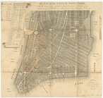
Plan of the city of New-York …
note:
… of the United
States
.
Map of the village of Peekski…
note:
… to Early Maps of the
Middle
Atlantic
Seaboard.
Map of 465 valuable building …
note:
… to Early Maps of the
Middle
Atlantic
Seaboard.
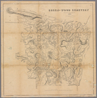
Green-wood cemetery
note:
… to Early Maps of the
Middle
Atlantic
Seaboard.
Little Falls in 1802.
note:
… of the
state
of New-York
Map of property on Brooklyn H…
note:
… to Early Maps of the
Middle
Atlantic
Seaboard.
Albany
note:
… to Early Maps of the
Middle
Atlantic
Seaboard.
Map of part of Kingston, N.Y.…
note:
… to Early Maps of the
Middle
Atlantic
Seaboard.
A map of the provinces of New…
note:
… to Early Maps of the
Middle
Atlantic
Seaboard.
A map of the country in which…
note:
… to Early Maps of the
Middle
Atlantic
Seaboard.
Map of the Hudson ... from Sa…
note:
… to Early Maps of the
Middle
Atlantic
Seaboard.
Map of the Hudson ... from Ne…
note:
… to Early Maps of the
Middle
Atlantic
Seaboard.
Map of the Hudson ... from Sp…
note:
… to Early Maps of the
Middle
Atlantic
Seaboard.
Map of the Hudson ... from Ta…
note:
… to Early Maps of the
Middle
Atlantic
Seaboard.
Map of the Hudson ... from Pe…
note:
… to Early Maps of the
Middle
Atlantic
Seaboard.
Map of the Hudson ... from Ne…
note:
… to Early Maps of the
Middle
Atlantic
Seaboard.
Map of the Hudson ... from Po…
note:
… to Early Maps of the
Middle
Atlantic
Seaboard.
Map of the Hudson ... from Rh…
note:
… to Early Maps of the
Middle
Atlantic
Seaboard.
Map of the Hudson ... from Ge…
note:
… to Early Maps of the
Middle
Atlantic
Seaboard.
Map of the Hudson ... from Co…
note:
… to Early Maps of the
Middle
Atlantic
Seaboard.
Map of the Hudson ... from Ca…
note:
… to Early Maps of the
Middle
Atlantic
Seaboard.
Map of the Hudson ... from La…
note:
… to Early Maps of the
Middle
Atlantic
Seaboard.
Map of the Hudson ... from Be…
note:
… to Early Maps of the
Middle
Atlantic
Seaboard.
Map of the Hudson ... from Ft…
note:
… to Early Maps of the
Middle
Atlantic
Seaboard.
Map of the counties of New Yo…
note:
… to Early Maps of the
Middle
Atlantic
Seaboard.
Map of the counties of New Yo…
note:
… to Early Maps of the
Middle
Atlantic
Seaboard.
Map of the
state
of New York
note:
… to Early Maps of the
Middle
Atlantic
Seaboard.
Map of the
state
of New York with part
note:
… to Early Maps of the
Middle
Atlantic
Seaboard.
Map of the Marine Hospital gr…
note:
… to Early Maps of the
Middle
Atlantic
Seaboard.
The Fort of Albany
note:
… to Early Maps of the
Middle
Atlantic
Seaboard.
Map of lots in the 5th ward o…
note:
… to Early Maps of the
Middle
Atlantic
Seaboard.
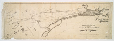
Hydrographic map of the count…
note:
… to Early Maps of the
Middle
Atlantic
Seaboard.